ISS035-E-7431
| NASA Photo ID | ISS035-E-7431 |
| Focal Length | 400mm |
| Date taken | 2013.03.22 |
| Time taken | 08:51:02 GMT |
Resolutions offered for this image:
1000 x 695 pixels 540 x 375 pixels 1440 x 960 pixels 720 x 480 pixels 4256 x 2832 pixels 640 x 426 pixels
1000 x 695 pixels 540 x 375 pixels 1440 x 960 pixels 720 x 480 pixels 4256 x 2832 pixels 640 x 426 pixels


Spacecraft nadir point: 40.2° N, 4.9° E
Photo center point: 39.0° N, 1.4° E
Photo center point by machine learning:
Photo center point: 39.0° N, 1.4° E
Photo center point by machine learning:
Nadir to Photo Center: West
Spacecraft Altitude: 217 nautical miles (402km)
Country or Geographic Name: | BALEARIC ISLANDS |
Features: | IBIZA ISLAND, SANT ANTONI DE PORTMANY, MEDITERRANEAN SEA |
| Features Found Using Machine Learning: | |
Cloud Cover Percentage: | 10 (1-10)% |
Sun Elevation Angle: | 34° |
Sun Azimuth: | 123° |
Camera: | Nikon D3S Electronic Still Camera |
Focal Length: | 400mm |
Camera Tilt: | 46 degrees |
Format: | 4256E: 4256 x 2832 pixel CMOS sensor, 36.0mm x 23.9mm, total pixels: 12.87 million, Nikon FX format |
Film Exposure: | |
| Additional Information | |
| Width | Height | Annotated | Cropped | Purpose | Links |
|---|---|---|---|---|---|
| 1000 pixels | 695 pixels | No | Yes | Earth From Space collection | Download Image |
| 540 pixels | 375 pixels | Yes | Yes | Earth From Space collection | Download Image |
| 1440 pixels | 960 pixels | No | Yes | NASA's Earth Observatory web site | Download Image |
| 720 pixels | 480 pixels | Yes | Yes | NASA's Earth Observatory web site | Download Image |
| 4256 pixels | 2832 pixels | No | No | Download Image | |
| 640 pixels | 426 pixels | No | No | Download Image |
Download Packaged File
Download a Google Earth KML for this Image
View photo footprint information
Download a GeoTIFF for this photo
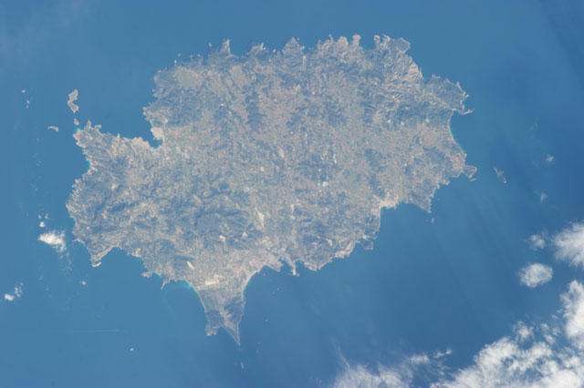
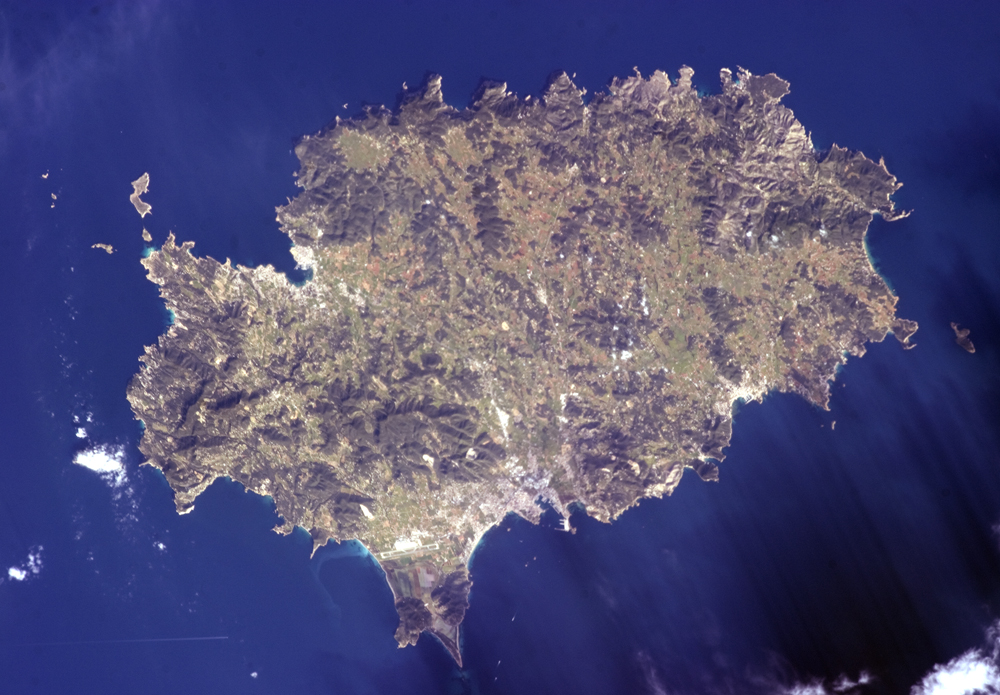
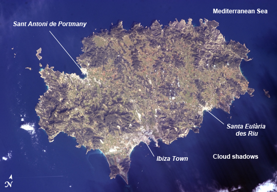
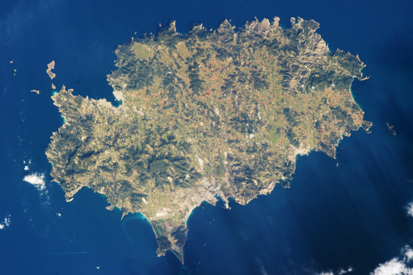
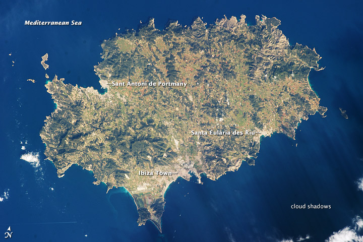
Image Caption: Island of Ibiza, Spain
The island of Ibiza (Eivissa in the native Catalan language) is located off of the southeastern coast of Spain, and is part of the Balearic archipelago. Together with the neighboring island of Formentera (not shown), it comprises the Pine Islands of the western archipelago. The largest cities on the island, Ibiza Town, Sant Antoni de Portmany, and Santa Eularia des Riu appear as white to pink regions near coastal embayments in this astronaut photograph from the International Space Station. Much of the lowland interior of the island is covered with green to light brown agricultural fields; some are still in active production for such crops as wheat, olives, and grapes but many fields are inactive and experiencing regrowth of native trees such as pine (Pinus halpensis) and savine (Juniperus phoenicea). The northern and southwestern coastlines are hilly (grey-brown regions), with the highest peak (Sa Talaia; 475 meters above sea level) located in the southwestern region.
Like many of the Balearic Islands, the major industry of Ibiza is European tourism, and it is particularly well known for the nightlife of Ibiza Town and Sant Antoni de Portmany. Ships near Ibiza Town and a ship wake off the southwestern coastline are visible at image lower left. Parts of the island are also designated as UNESCO World Heritage sites, and provide opportunities for rock climbing and ecotourism both on the island and underwater along the coastline. The island hosts a large variety of birds and lizards; however no large land fauna are present. Parts of Ibiza and Formentera wetlands are also identified by the Ramsar convention(also known as the Convention of Wetlands of International Importance) as habitat for nesting and migratory waterbirds.
The Mediterranean Sea to the southeast of the island appears dark in the image due to shadowing by clouds, just visible at the lower right corner of the image.
