ISS034-E-34806

| NASA Photo ID | ISS034-E-34806 |
| Focal Length | 400mm |
| Date taken | 2013.01.26 |
| Time taken | 14:16:53 GMT |
Cloud masks available for this image:
Spacecraft nadir point: 22.5° N, 87.6° W
Photo center point: 21.1° N, 86.8° W
Photo center point by machine learning:
Photo center point: 21.1° N, 86.8° W
Photo center point by machine learning:
Nadir to Photo Center: Southeast
Spacecraft Altitude: 217 nautical miles (402km)
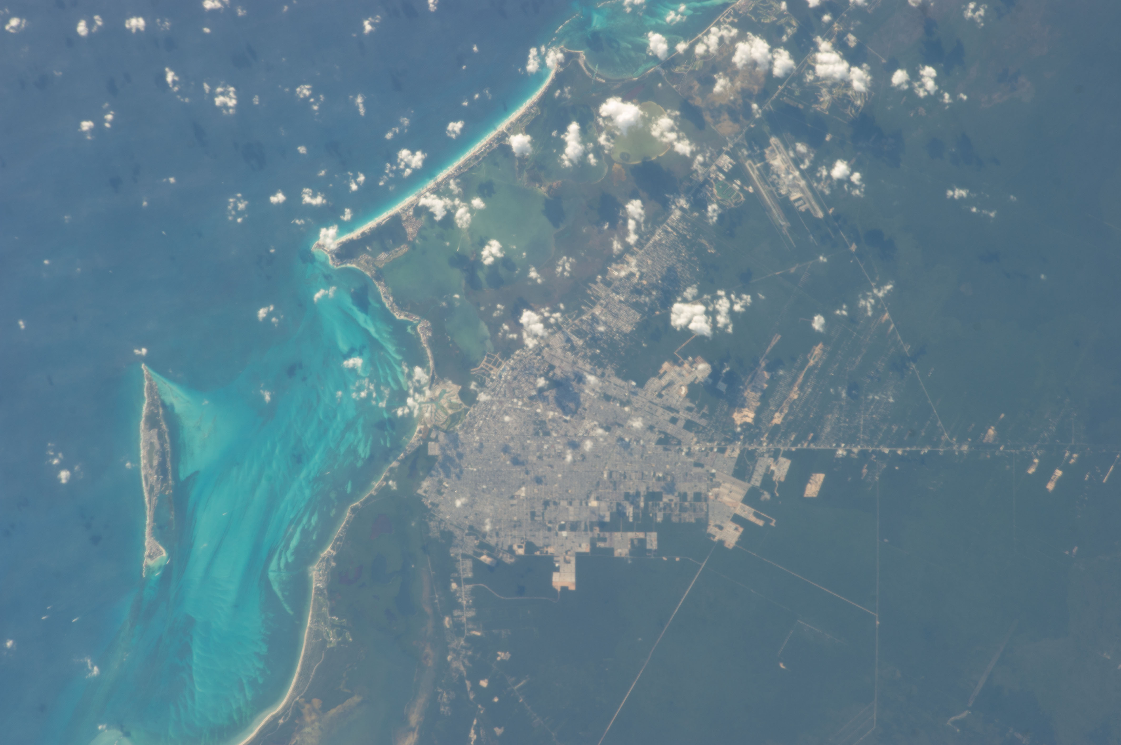
Country or Geographic Name: | MEXICO |
Features: | CANCUN, ISLA MUJERES, NICHUPTE LAG., CARIBBEAN S., YUCATAN PEN. |
| Features Found Using Machine Learning: | |
Cloud Cover Percentage: | 10 (1-10)% |
Sun Elevation Angle: | 21° |
Sun Azimuth: | 122° |
Camera: | Nikon D3S Electronic Still Camera |
Focal Length: | 400mm |
Camera Tilt: | 24 degrees |
Format: | 4256E: 4256 x 2832 pixel CMOS sensor, 36.0mm x 23.9mm, total pixels: 12.87 million, Nikon FX format |
Film Exposure: | |
| Additional Information | |
| Width | Height | Annotated | Cropped | Purpose | Links |
|---|---|---|---|---|---|
| 4256 pixels | 2832 pixels | No | No | Download Image | |
| 640 pixels | 426 pixels | No | No | Download Image |
Download Packaged File
Download a Google Earth KML for this Image
View photo footprint information
Download a GeoTIFF for this photo
Georeferenced by human interaction - exported 2016-08-16-231824-UTCGeoreferenced by human interaction - exported 2016-08-24-000723-UTC
Georeferenced by human interaction - exported 2018-01-16-145646-UTC
An explanation of the georeference file(s) above
Image Caption: none
