ISS033-E-14186
| NASA Photo ID | ISS033-E-14186 |
| Focal Length | 400mm |
| Date taken | 2012.10.16 |
| Time taken | 04:29:20 GMT |
Resolutions offered for this image:
1000 x 657 pixels 540 x 355 pixels 1440 x 960 pixels 720 x 480 pixels 4256 x 2832 pixels 640 x 426 pixels
1000 x 657 pixels 540 x 355 pixels 1440 x 960 pixels 720 x 480 pixels 4256 x 2832 pixels 640 x 426 pixels
Cloud masks available for this image:
Spacecraft nadir point: 40.2° N, 73.9° W
Photo center point: 39.3° N, 76.6° W
Photo center point by machine learning: 39.27° N, 76.60° W
Photo center point: 39.3° N, 76.6° W
Photo center point by machine learning: 39.27° N, 76.60° W
Nadir to Photo Center: West
Spacecraft Altitude: 216 nautical miles (400km)

Country or Geographic Name: | USA-MARYLAND |
Features: | BALTIMORE METRO AREA AT NIGHT, MIDDLE RIVER, CHESAPEAKE BAY |
| Features Found Using Machine Learning: | |
Cloud Cover Percentage: | 10 (1-10)% |
Sun Elevation Angle: | -59° |
Sun Azimuth: | 354° |
Camera: | Nikon D3S Electronic Still Camera |
Focal Length: | 400mm |
Camera Tilt: | 38 degrees |
Format: | 4256E: 4256 x 2832 pixel CMOS sensor, 36.0mm x 23.9mm, total pixels: 12.87 million, Nikon FX format |
Film Exposure: | |
| Additional Information | |
| Width | Height | Annotated | Cropped | Purpose | Links |
|---|---|---|---|---|---|
| 1000 pixels | 657 pixels | No | Yes | Earth From Space collection | Download Image |
| 540 pixels | 355 pixels | Yes | Yes | Earth From Space collection | Download Image |
| 1440 pixels | 960 pixels | No | Yes | NASA's Earth Observatory web site | Download Image |
| 720 pixels | 480 pixels | Yes | Yes | NASA's Earth Observatory web site | Download Image |
| 4256 pixels | 2832 pixels | No | No | Download Image | |
| 640 pixels | 426 pixels | No | No | Download Image |
Download Packaged File
Download a Google Earth KML for this Image
View photo footprint information
Download a GeoTIFF for this photo
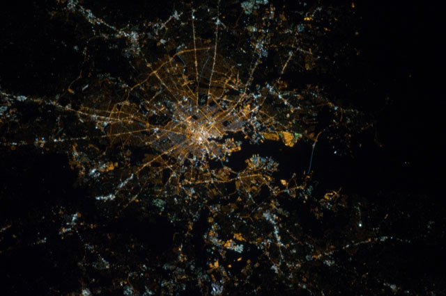
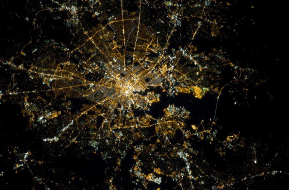
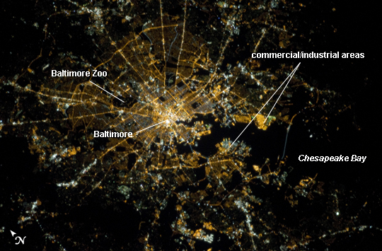
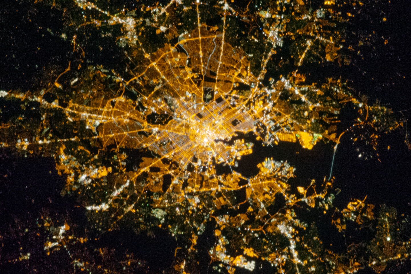
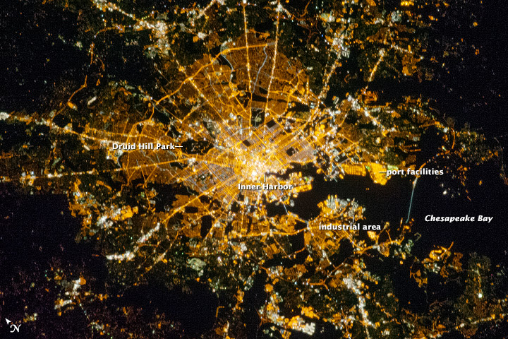
Image Caption: Baltimore, Maryland at Night
Baltimore, Maryland, is located on the US mid-Atlantic coastline along the terminus of the Patapsco River into Chesapeake Bay, and is the largest seaport along this part of the coast. This astronaut photograph, taken from the International Space Station, highlights the Baltimore area at night. Like many large US metropolitan areas, the most brightly lit area corresponds to the highest density of buildings and typically indicates the urban core - in this case, downtown Baltimore at image center.
Highways and large arterial streets appear as bright yellow-orange lines extending outwards from the downtown area into the surrounding suburban regions (light violet and reddish brown regions of diffuse lighting). Dark areas beyond the suburban zone are rural - or to the southeast, indicate the waters of Chesapeake Bay. Small dark patches within the metropolitan area are open space including parks, cemeteries, and the Baltimore Zoo (image top left). Two large, brightly-lit areas along Chesapeake Bay are commercial/industrial regions, and include the major port facilities for Baltimore.
The City of Baltimore was incorporated in 1796, after serving as the de facto capital of the nascent United States of America during the Second Continental Congress(from December 20, 1776 to March 4, 1777). Today, the Baltimore metropolitan area (as defined by the Baltimore Metropolitan Council includes over 2.5 million people and includes six Maryland counties (Anne Arundel, Baltimore, Carroll, Harford, and Howard) in addition to the City of Baltimore. The region is also a focus of urban ecological research through the Baltimore Ecosystem Study that is part of the National Science Foundation's Long Term Ecological Research network.
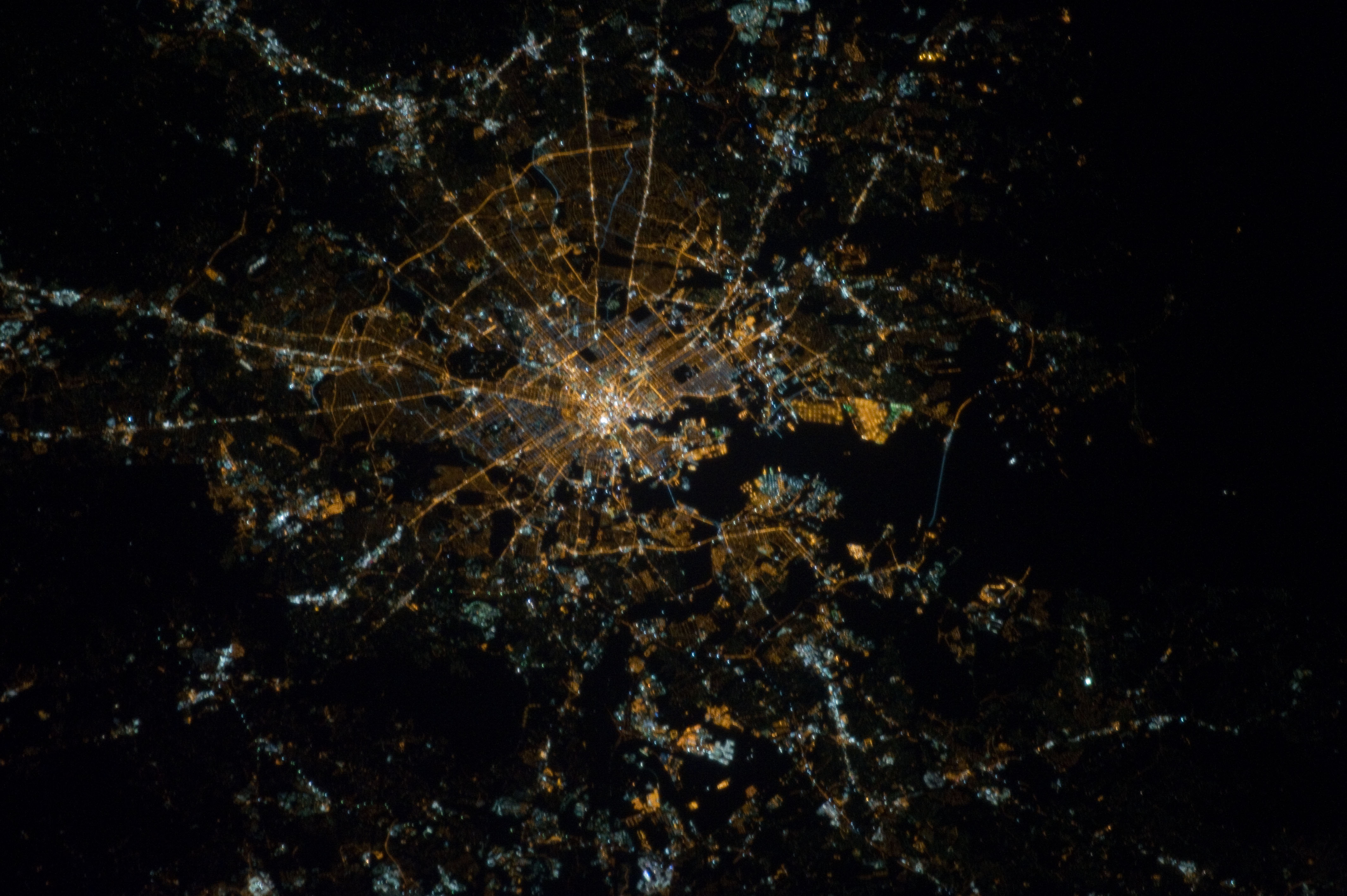
