ISS031-E-146341

| NASA Photo ID | ISS031-E-146341 |
| Focal Length | 16mm |
| Date taken | 2012.06.27 |
| Time taken | 20:41:46 GMT |


Spacecraft nadir point: 51.0° N, 81.6° W
Photo center point: 42.5° N, 109.5° W
Photo center point by machine learning:
Photo center point: 42.5° N, 109.5° W
Photo center point by machine learning:
Nadir to Photo Center: West
Spacecraft Altitude: 208 nautical miles (385km)
Country or Geographic Name: | USA-WYOMING |
Features: | PAN-ROCKY MTS., FONTANELLE FIRE, ISS |
| Features Found Using Machine Learning: | |
Cloud Cover Percentage: | 10 (1-10)% |
Sun Elevation Angle: | 44° |
Sun Azimuth: | 252° |
Camera: | Nikon D3S Electronic Still Camera |
Focal Length: | 16mm |
Camera Tilt: | High Oblique |
Format: | 4256E: 4256 x 2832 pixel CMOS sensor, 36.0mm x 23.9mm, total pixels: 12.87 million, Nikon FX format |
Film Exposure: | |
| Additional Information | |
| Width | Height | Annotated | Cropped | Purpose | Links |
|---|---|---|---|---|---|
| 4256 pixels | 2832 pixels | No | No | Download Image | |
| 640 pixels | 426 pixels | No | No | Download Image |
Download Packaged File
Download a Google Earth KML for this Image
View photo footprint information
Download a GeoTIFF for this photo
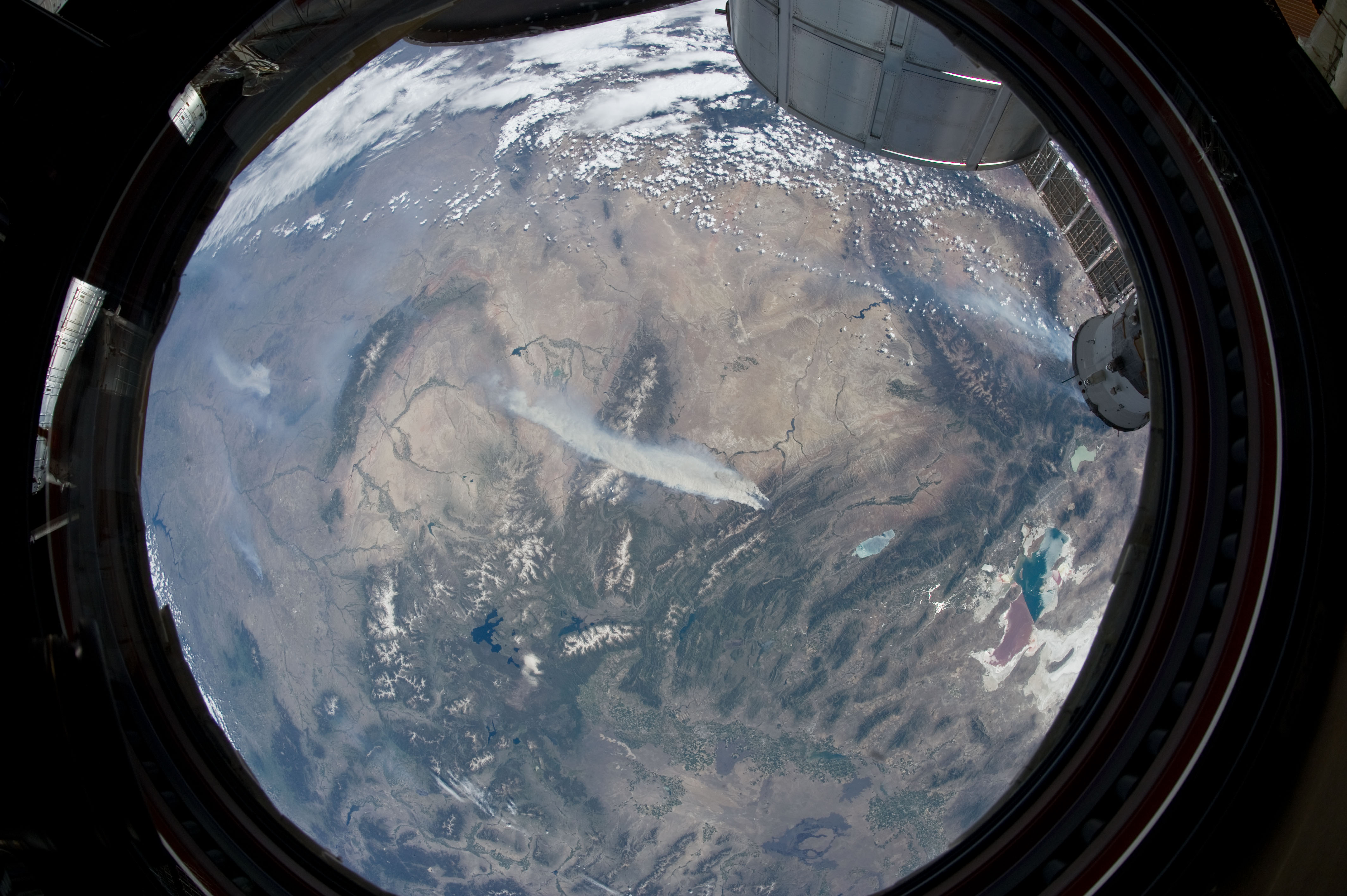
Image Caption: ISS031-E-146344 (27 June 2012) --- An Expedition 31 crew member aboard the International Space Station, flying approximately 240 miles above Earth, recorded a series of images of the current wild fires in the southwestern United States. For this particular image, taken from the station's Cupola, he used a 16mm lens, which gives this view a "fisheye" affect. The fires give rise to thick smoke plumes on the southernmost extremity of the Wyoming Range, which occupies the center of the image. Slopes of the central Salt River Range appear at left. Three helicopters and more than 100 personnel are fighting the fire, which is being managed by the Bridger-Teton National Forest.
