ISS030-E-31636
| NASA Photo ID | ISS030-E-31636 |
| Focal Length | 180mm |
| Date taken | 2012.01.08 |
| Time taken | 14:19:55 GMT |
Cloud masks available for this image:
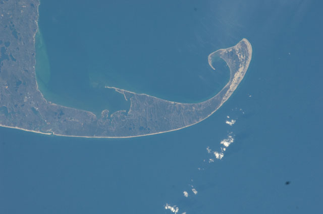
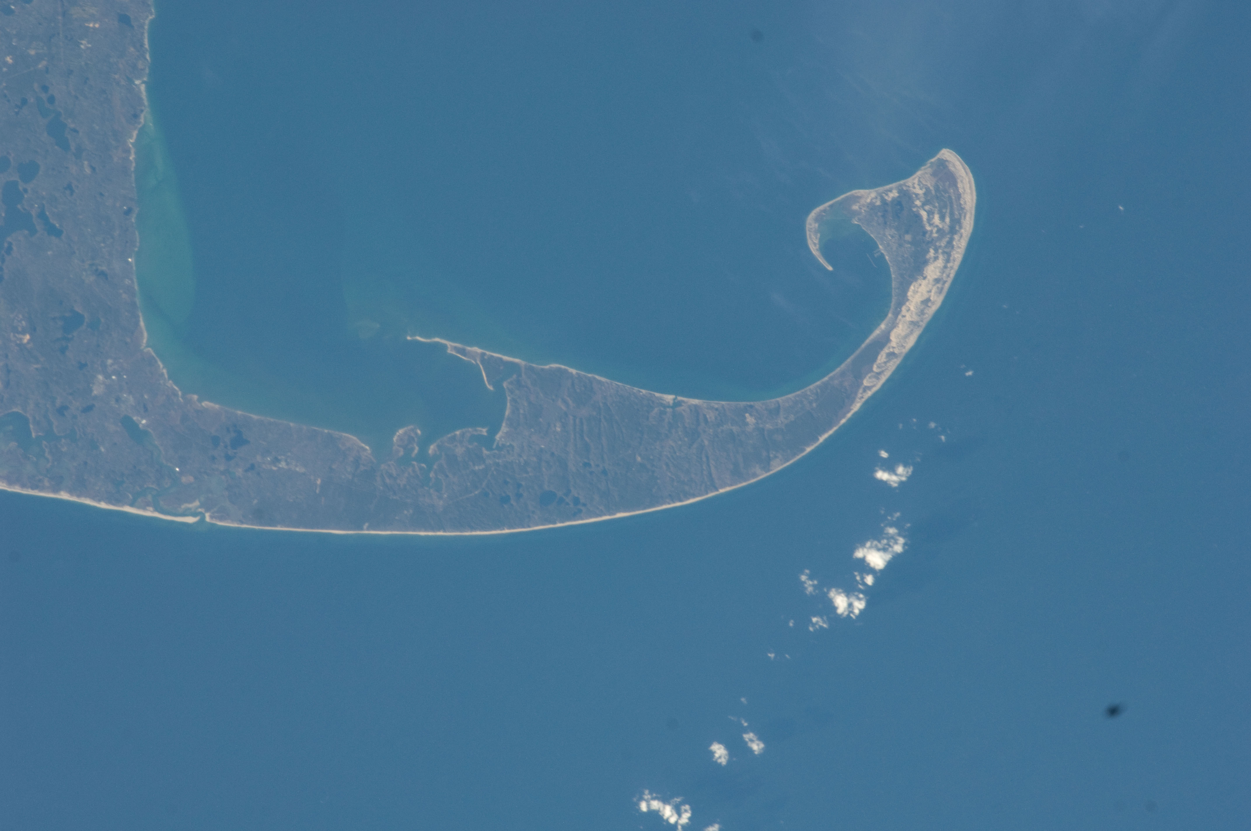
Spacecraft nadir point: 41.5° N, 70.7° W
Photo center point: 42.0° N, 70.1° W
Photo center point by machine learning:
Photo center point: 42.0° N, 70.1° W
Photo center point by machine learning:
Nadir to Photo Center: Northeast
Spacecraft Altitude: 216 nautical miles (400km)
Country or Geographic Name: | USA-MASSACHUSETTS |
Features: | PUBLIC INPUTS (from public image detectives, not NASA): MASSACHUSETTS, PROVINCETOWN, WELLFLEET, CAPE COD BAY, ATLANTIC OCEAN, JEREMY POINT, GREAT ISLAND, LIEUTENANT ISLAND, GULL POND, GREAT POND, LONG POND,MASSACHUSETTS, CAPE COD BAY, ISTHMUS, PROVINCETOWN, WELLFLEET,TRURO MA, WELLFLEET MA, PROVINCETOWN MA, CAPE COD BAY, WELLFLEET HARBOR, RACE POINT, JEREMY POINT, BILLINGSGATE ISLAND, PROVINCETOWN MUNICIPAL AIRPORT (KPVC) |
| Features Found Using Machine Learning: | |
Cloud Cover Percentage: | 10 (1-10)% |
Sun Elevation Angle: | 18° |
Sun Azimuth: | 144° |
Camera: | Nikon D2Xs Electronic Still Camera |
Focal Length: | 180mm |
Camera Tilt: | 12 degrees |
Format: | 4288E: 4288 x 2848 pixel CMOS sensor, RGBG imager color filter |
Film Exposure: | |
| Additional Information | |
| Width | Height | Annotated | Cropped | Purpose | Links |
|---|---|---|---|---|---|
| 4288 pixels | 2848 pixels | No | No | Download Image | |
| 640 pixels | 425 pixels | No | No | Download Image |
Download Packaged File
Download a Google Earth KML for this Image
View photo footprint information
Download a GeoTIFF for this photo
Image Caption: none
