< ISS030-E-12516 >

| NASA Photo ID | ISS030-E-12516 |
| Focal Length | 400mm |
| Date taken | 2011.12.17 |
| Time taken | 17:28:02 GMT |
4288 x 2848 pixels 720 x 480 pixels 4288 x 2848 pixels 640 x 425 pixels

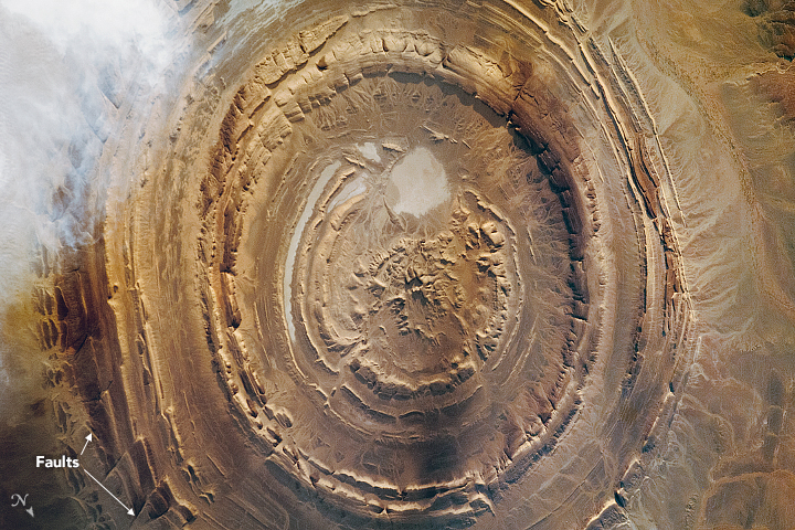
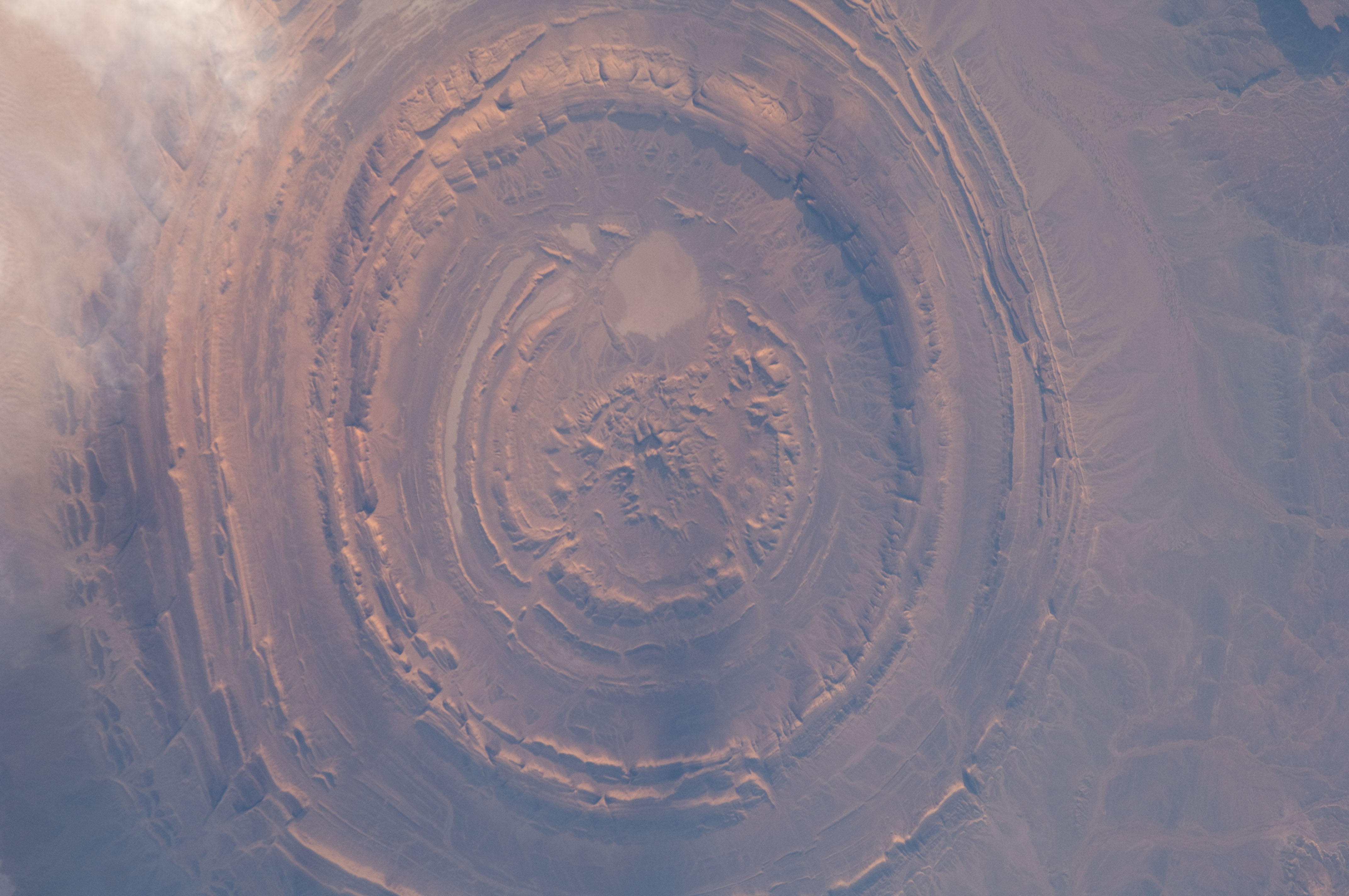


Photo center point: 21.1° N, 11.4° W
Photo center point by machine learning:
The Richat Structure of Mauritania has captured the attention of astronauts for about as long as NASA has sent humans into orbit around Earth. This circular geologic feature is thought to be caused by an uplifted dome geologists would classify it as a domed anticline that has been eroded to expose the originally flat rock layers.
In this type of geologic structure, rocks exposed in the center of the bulls-eye are older than rocks forming the outer rings. This structure measures 45 kilometers (28 miles) across and is made up of igneous and sedimentary rocks. There are several faults visible (lower left) where strata that were once continuous have been shifted apart.
Most of Mauritania lies within the Sahara Desert, where dry climate conditions and periodic droughts create difficult living conditions. Approximately 3.7 million people live in Mauritania, though much of the population lives along its Atlantic coastline, about 500 kilometers (300 miles) from the Richat Structure.
