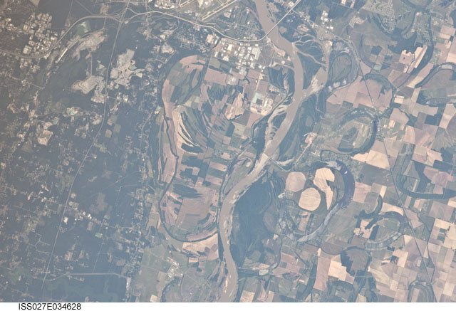
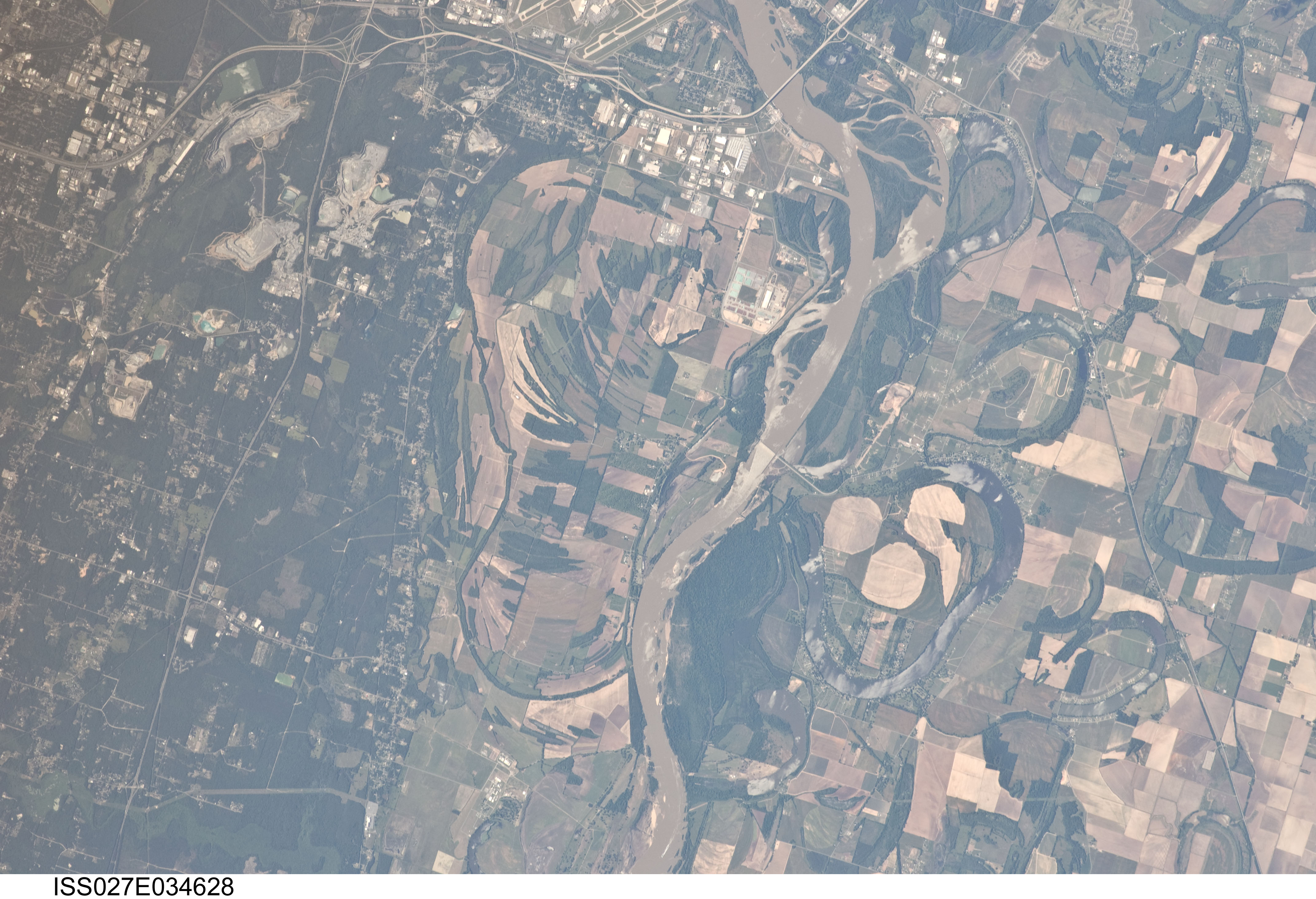
ISS027-E-34628
| NASA Photo ID | ISS027-E-34628 |
| Focal Length | 400mm |
| Date taken | 2011.05.17 |
| Time taken | 21:14:19 GMT |
Cloud masks available for this image:
Spacecraft nadir point: 34.7° N, 90.6° W
Photo center point: 34.6° N, 92.2° W
Photo center point by machine learning: 34.66° N, 92.18° W
Photo center point: 34.6° N, 92.2° W
Photo center point by machine learning: 34.66° N, 92.18° W
Nadir to Photo Center: West
Spacecraft Altitude: 184 nautical miles (341km)

Country or Geographic Name: | USA-ARKANSAS |
Features: | ARKANSAS R. FLOODPLAIN, OXBOW LAKES, AGR., FOR., SE. LITTLE ROCK |
| Features Found Using Machine Learning: | |
Cloud Cover Percentage: | 10 (1-10)% |
Sun Elevation Angle: | 44° |
Sun Azimuth: | 264° |
Camera: | Nikon D2Xs Electronic Still Camera |
Focal Length: | 400mm |
Camera Tilt: | 28 degrees |
Format: | 4288E: 4288 x 2848 pixel CMOS sensor, RGBG imager color filter |
Film Exposure: | |
| Additional Information | |
| Width | Height | Annotated | Cropped | Purpose | Links |
|---|---|---|---|---|---|
| 4288 pixels | 2929 pixels | No | No | Download Image | |
| 640 pixels | 437 pixels | No | No | Download Image |
Download Packaged File
Download a Google Earth KML for this Image
View photo footprint information
Download a GeoTIFF for this photo
Image Caption: none
