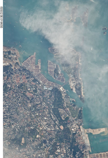
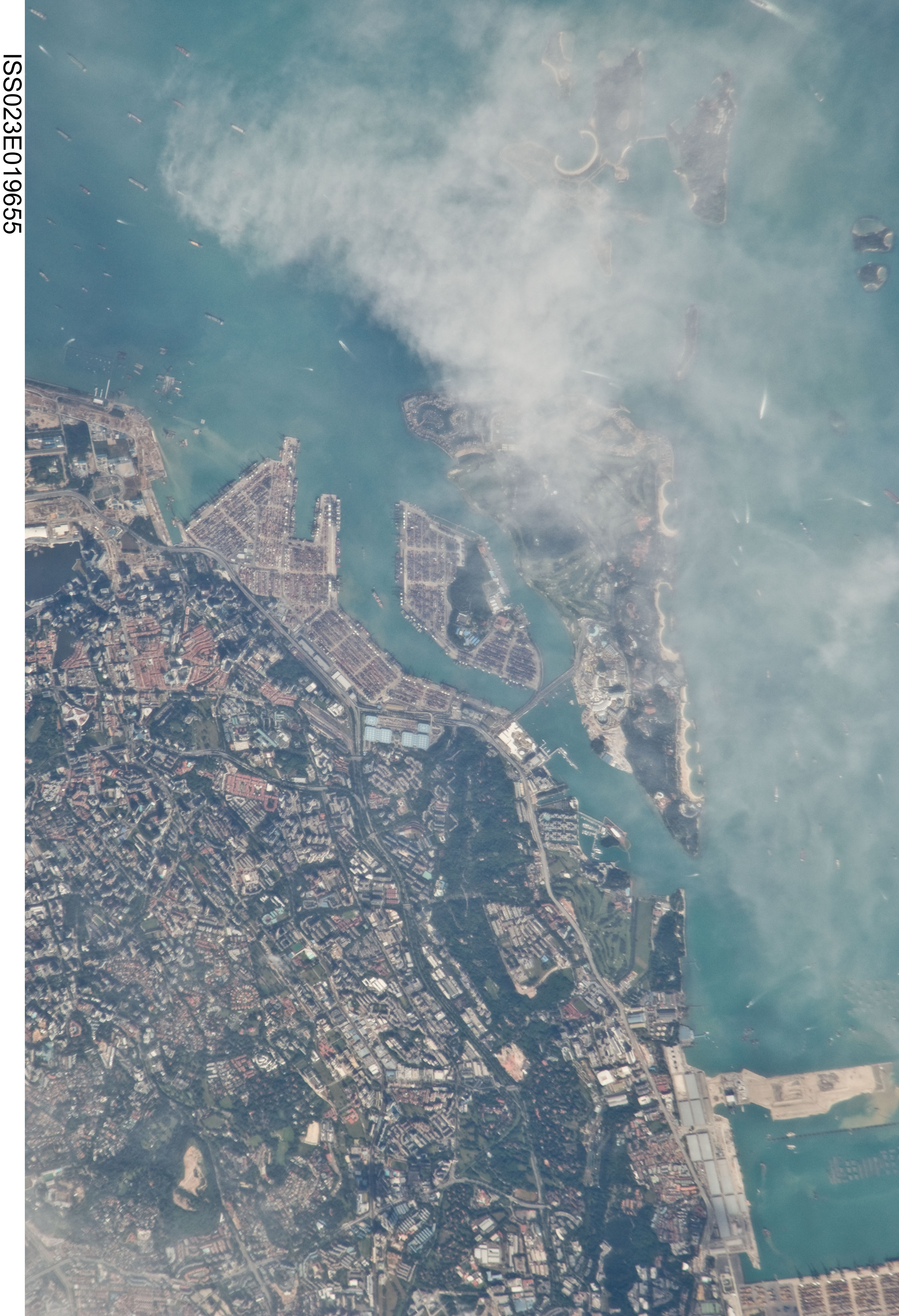
ISS023-E-19655
| NASA Photo ID | ISS023-E-19655 |
| Focal Length | 800mm |
| Date taken | 2010.04.06 |
| Time taken | 08:02:57 GMT |
Cloud masks available for this image:
Spacecraft nadir point: 0.2° N, 104.1° E
Photo center point: 1.3° N, 103.8° E
Photo center point by machine learning:
Photo center point: 1.3° N, 103.8° E
Photo center point by machine learning:
Nadir to Photo Center: North
Spacecraft Altitude: 186 nautical miles (344km)
Country or Geographic Name: | SINGAPORE |
Features: | SINGAPORE, SELAT PANDAN, SENTOSA ISLAND, PORT, COAST |
| Features Found Using Machine Learning: | |
Cloud Cover Percentage: | 25 (11-25)% |
Sun Elevation Angle: | 45° |
Sun Azimuth: | 279° |
Camera: | Nikon D2Xs Electronic Still Camera |
Focal Length: | 800mm |
Camera Tilt: | 20 degrees |
Format: | 4288E: 4288 x 2848 pixel CMOS sensor, RGBG imager color filter |
Film Exposure: | |
| Additional Information | |
| Width | Height | Annotated | Cropped | Purpose | Links |
|---|---|---|---|---|---|
| 2929 pixels | 4288 pixels | No | No | Download Image | |
| 437 pixels | 640 pixels | No | No | Download Image |
Download Packaged File
Download a Google Earth KML for this Image
View photo footprint information
Download a GeoTIFF for this photo
Image Caption: 096_asia-myanmar-malaysia-singapore-indonesia_254B
