ISS022-E-12031
| NASA Photo ID | ISS022-E-12031 |
| Focal Length | 800mm |
| Date taken | 2009.12.16 |
| Time taken | 15:31:51 GMT |
Resolutions offered for this image:
1000 x 664 pixels 540 x 359 pixels 720 x 480 pixels 4288 x 2929 pixels 640 x 437 pixels
1000 x 664 pixels 540 x 359 pixels 720 x 480 pixels 4288 x 2929 pixels 640 x 437 pixels


Cloud masks available for this image:
Spacecraft nadir point: 11.8° N, 58.8° W
Photo center point: 13.1° N, 59.6° W
Photo center point by machine learning:
Photo center point: 13.1° N, 59.6° W
Photo center point by machine learning:
Nadir to Photo Center: Northwest
Spacecraft Altitude: 182 nautical miles (337km)
Country or Geographic Name: | LESSER ANTILLES |
Features: | BARBADOS I., BRIDGETOWN, PORT, BEACHES |
| Features Found Using Machine Learning: | |
Cloud Cover Percentage: | 10 (1-10)% |
Sun Elevation Angle: | 55° |
Sun Azimuth: | 172° |
Camera: | Nikon D2Xs Electronic Still Camera |
Focal Length: | 800mm |
Camera Tilt: | 27 degrees |
Format: | 4288E: 4288 x 2848 pixel CMOS sensor, RGBG imager color filter |
Film Exposure: | |
| Additional Information | |
| Width | Height | Annotated | Cropped | Purpose | Links |
|---|---|---|---|---|---|
| 1000 pixels | 664 pixels | No | Yes | Earth From Space collection | Download Image |
| 540 pixels | 359 pixels | Yes | Yes | Earth From Space collection | Download Image |
| 720 pixels | 480 pixels | Yes | Yes | NASA's Earth Observatory web site | Download Image |
| 4288 pixels | 2929 pixels | No | No | Download Image | |
| 640 pixels | 437 pixels | No | No | Download Image |
Download Packaged File
Download a Google Earth KML for this Image
View photo footprint information
Download a GeoTIFF for this photo
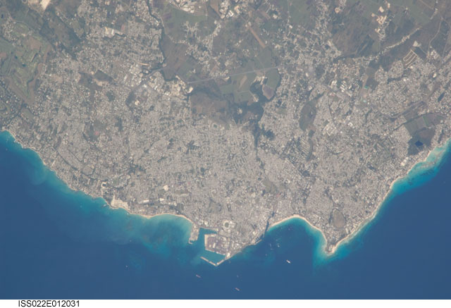
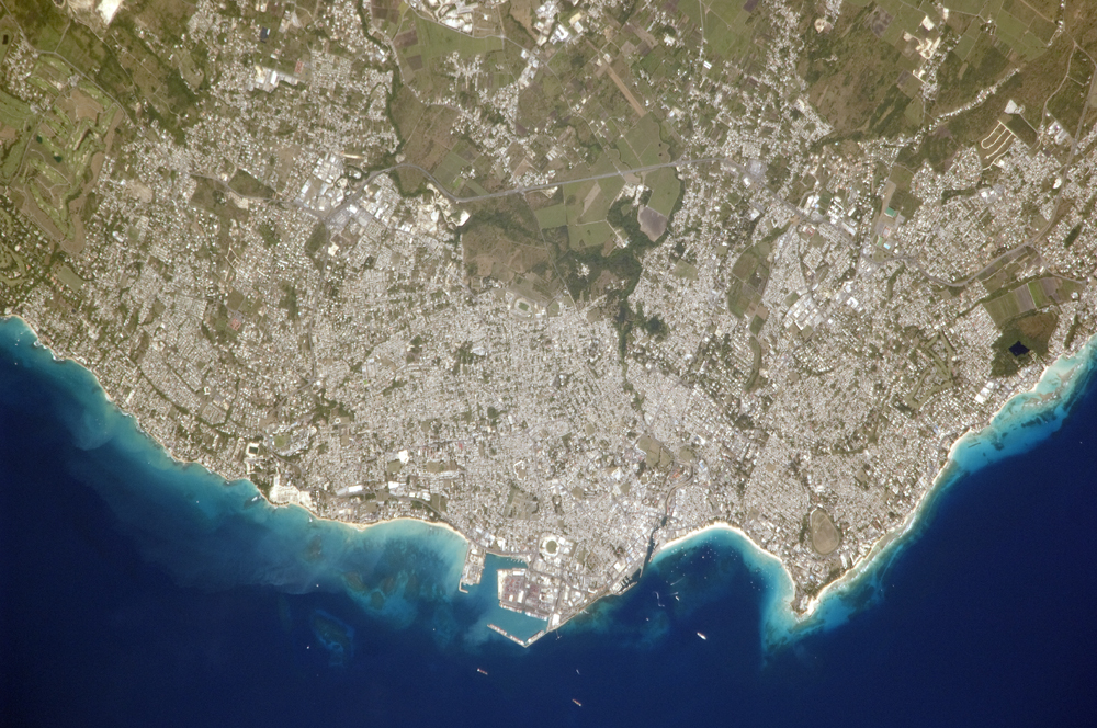
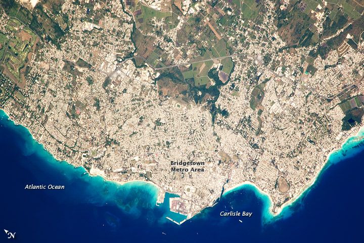
Image Caption: Greater Bridgetown Area, Barbados
Bridgetown is the capital city of the island nation Barbados, located to the east of the Lesser Antilles Island chain. While Barbados is considered part of the Lesser Antilles, it is located within the western Atlantic Ocean rather than the Caribbean Sea. Barbados is a member of the British Commonwealth, and considers Queen Elizabeth II to be its constitutional monarch.
Besides being the seat of government, Bridgetown is the largest city in Barbados. It and the surrounding towns that make up the Greater Bridgetown area are located along the southwestern coastline of the island. The metropolitan area is readily recognizable in this astronaut photograph due to the gray and white rooftops and street grids (image center) that contrast with green vegetated fields and riverside areas of the island's interior to the northeast (image top center).
Bridgetown is a major port destination for both commercial and cruise ships serving the eastern Caribbean--several ships are visible within Carlisle Bay. Water color in the image changes from light blue along the coastline--indicating shallow water--to the dark blue of deeper water away from the island.
