ISS021-E-23475

| NASA Photo ID | ISS021-E-23475 |
| Focal Length | 400mm |
| Date taken | 2009.11.11 |
| Time taken | 21:08:34 GMT |
Resolutions offered for this image:
1000 x 664 pixels 540 x 359 pixels 720 x 480 pixels 4288 x 2929 pixels 640 x 437 pixels
1000 x 664 pixels 540 x 359 pixels 720 x 480 pixels 4288 x 2929 pixels 640 x 437 pixels
Cloud masks available for this image:
Spacecraft nadir point: 14.2° N, 88.7° W
Photo center point: 13.7° N, 89.0° W
Photo center point by machine learning:
Photo center point: 13.7° N, 89.0° W
Photo center point by machine learning:
Nadir to Photo Center: Southwest
Spacecraft Altitude: 182 nautical miles (337km)
Camera: | Nikon D2Xs Electronic Still Camera |
Focal Length: | 400mm |
Camera Tilt: | 11 degrees |
Format: | 4288E: 4288 x 2848 pixel CMOS sensor, RGBG imager color filter |
Film Exposure: | |
| Additional Information | |
| Width | Height | Annotated | Cropped | Purpose | Links |
|---|---|---|---|---|---|
| 1000 pixels | 664 pixels | No | Yes | Earth From Space collection | Download Image |
| 540 pixels | 359 pixels | Yes | Yes | Earth From Space collection | Download Image |
| 720 pixels | 480 pixels | Yes | Yes | NASA's Earth Observatory web site | Download Image |
| 4288 pixels | 2929 pixels | No | No | Download Image | |
| 640 pixels | 437 pixels | No | No | Download Image |
Download Packaged File
Download a Google Earth KML for this Image
View photo footprint information
Download a GeoTIFF for this photo
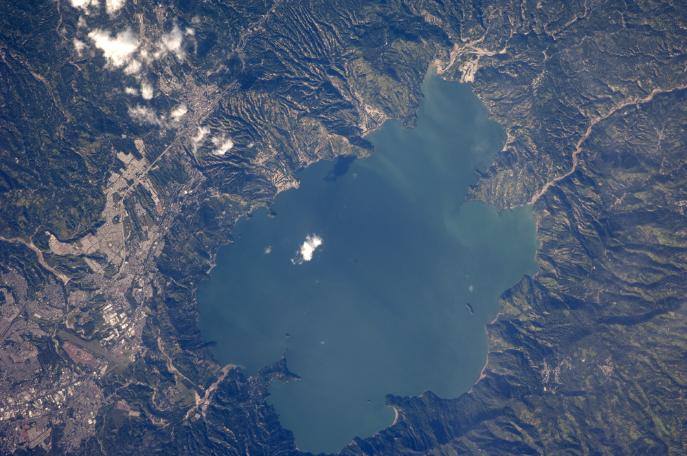
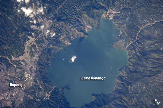
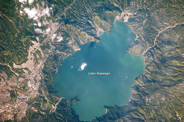
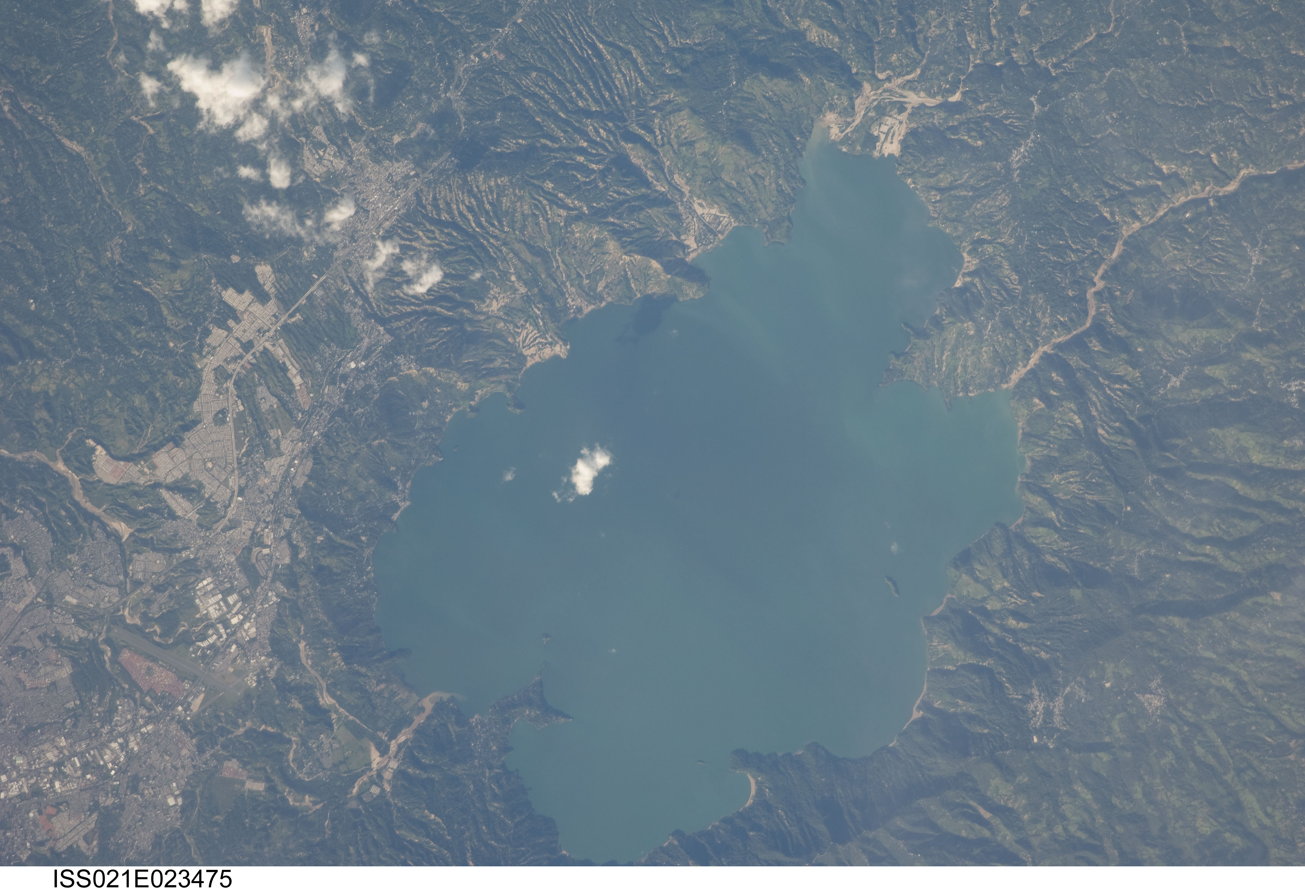
Image Caption: Lake Ilopango, El Salvador
The Central American country of El Salvador occupies a land area nearly the same size as the U.S. State of Massachusetts, and it includes numerous historically active volcanoes. This detailed astronaut photograph highlights the Ilopango Caldera that is located approximately 16 kilometers to the east of the capital city, San Salvador. Calderas are the geologic record of powerful volcanic eruptions that empty out a volcano's magma chamber; following the eruption, the overlying volcanic structure collapses into the newly formed void, leaving a large crater-like feature (the caldera).
The last caldera-forming eruption at Ilopango occurred during the fifth century AD; it was a powerful event that produced pyroclastic flows that destroyed early Mayan cities in the region. Later volcanic activity included the formation of several lava domes within the lake-filled caldera and near the shoreline. The only historical eruption at Ilopango took place in 1879-80. This activity resulted in the formation of a lava dome in the center of Lake Ilopango. The summit of the dome forms small islets known as Islas Quemadas (visible as small white dots in the larger image). The city of Ilopango borders the lake to the west (image left), while green, vegetated hills ring the rest of the shoreline. White, patchy cumulus clouds are also visible in the image (center and upper left).
