ISS020-E-8428
| NASA Photo ID | ISS020-E-8428 |
| Focal Length | 800mm |
| Date taken | 2009.06.10 |
| Time taken | 06:34:45 GMT |
Cloud masks available for this image:
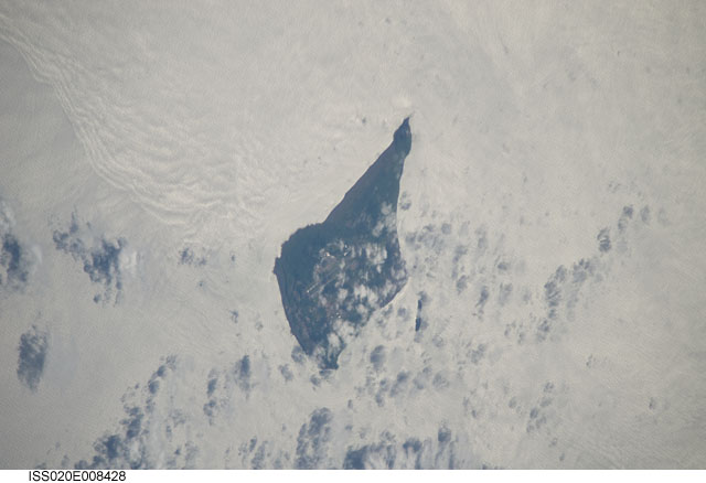
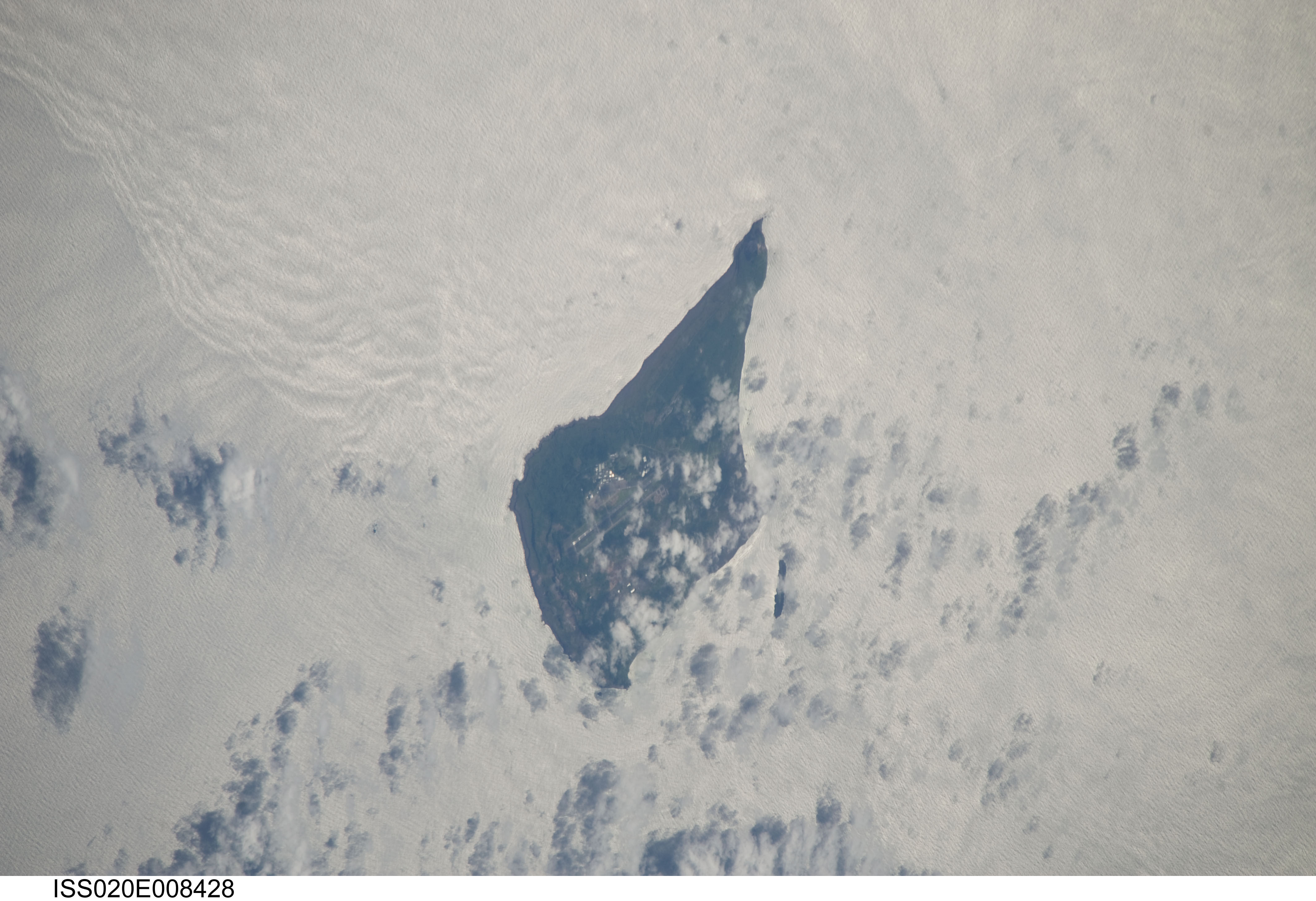
Spacecraft nadir point: 23.5° N, 144.9° E
Photo center point: 24.8° N, 141.3° E
Photo center point by machine learning:
Photo center point: 24.8° N, 141.3° E
Photo center point by machine learning:
Nadir to Photo Center: West
Spacecraft Altitude: 185 nautical miles (343km)
Country or Geographic Name: | JAPAN |
Features: | IWO JIMA, AIRFIELD, PACIFIC OCEAN |
| Features Found Using Machine Learning: | |
Cloud Cover Percentage: | 25 (11-25)% |
Sun Elevation Angle: | 32° |
Sun Azimuth: | 283° |
Camera: | Nikon D3 Electronic Still Camera |
Focal Length: | 800mm |
Camera Tilt: | 51 degrees |
Format: | 4256E: 4256 x 2832 pixel CMOS sensor, 36.0mm x 23.9mm, total pixels: 12.87 million, Nikon FX format |
Film Exposure: | |
| Additional Information | |
| Width | Height | Annotated | Cropped | Purpose | Links |
|---|---|---|---|---|---|
| 4256 pixels | 2913 pixels | No | No | Download Image | |
| 640 pixels | 438 pixels | No | No | Download Image |
Download Packaged File
Download a Google Earth KML for this Image
View photo footprint information
Download a GeoTIFF for this photo
Image Caption: none
