ISS020-E-7810
| NASA Photo ID | ISS020-E-7810 |
| Focal Length | 180mm |
| Date taken | 2009.05.29 |
| Time taken | 22:56:19 GMT |
Cloud masks available for this image:
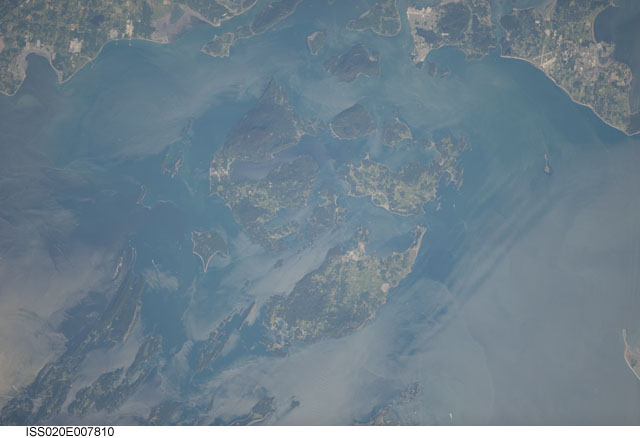
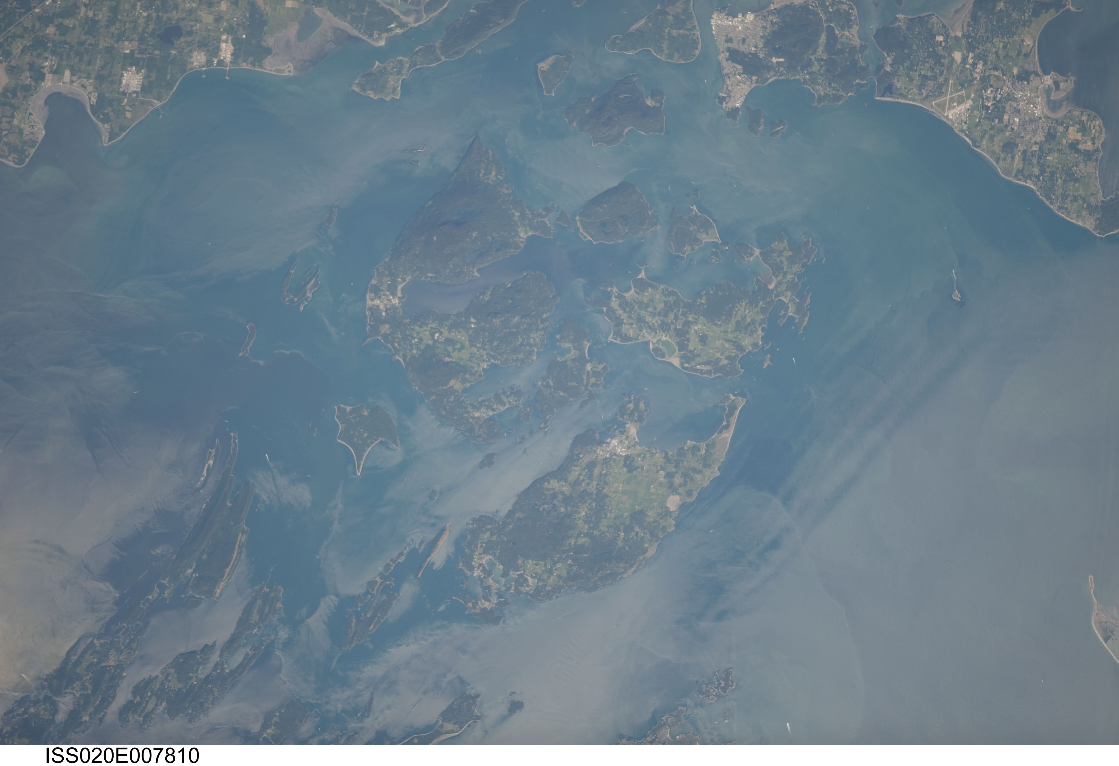
Spacecraft nadir point: 50.0° N, 121.5° W
Photo center point: 48.6° N, 123.0° W
Photo center point by machine learning:
Photo center point: 48.6° N, 123.0° W
Photo center point by machine learning:
Nadir to Photo Center: Southwest
Spacecraft Altitude: 182 nautical miles (337km)
Country or Geographic Name: | USA-WASHINGTON |
Features: | ORCAS I., SAN JUAN I., LOPEZ I. |
| Features Found Using Machine Learning: | |
Cloud Cover Percentage: | 10 (1-10)% |
Sun Elevation Angle: | 46° |
Sun Azimuth: | 246° |
Camera: | Nikon D3 Electronic Still Camera |
Focal Length: | 180mm |
Camera Tilt: | 34 degrees |
Format: | 4256E: 4256 x 2832 pixel CMOS sensor, 36.0mm x 23.9mm, total pixels: 12.87 million, Nikon FX format |
Film Exposure: | |
| Additional Information | |
| Width | Height | Annotated | Cropped | Purpose | Links |
|---|---|---|---|---|---|
| 4256 pixels | 2913 pixels | No | No | Download Image | |
| 640 pixels | 438 pixels | No | No | Download Image |
Download Packaged File
Download a Google Earth KML for this Image
View photo footprint information
Download a GeoTIFF for this photo
Image Caption: none
