ISS020-E-31502
| NASA Photo ID | ISS020-E-31502 |
| Focal Length | 200mm |
| Date taken | 2009.08.18 |
| Time taken | 16:10:07 GMT |
Cloud masks available for this image:
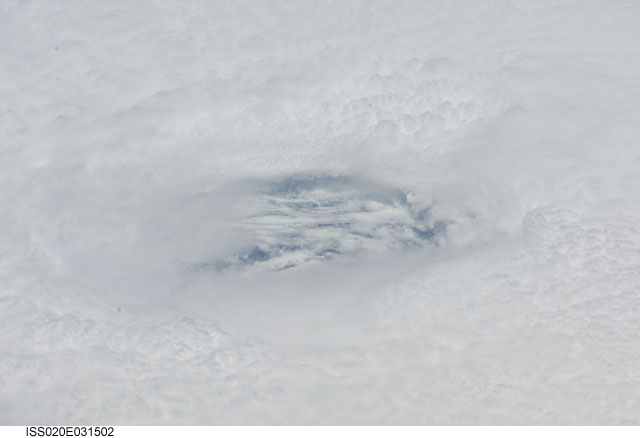
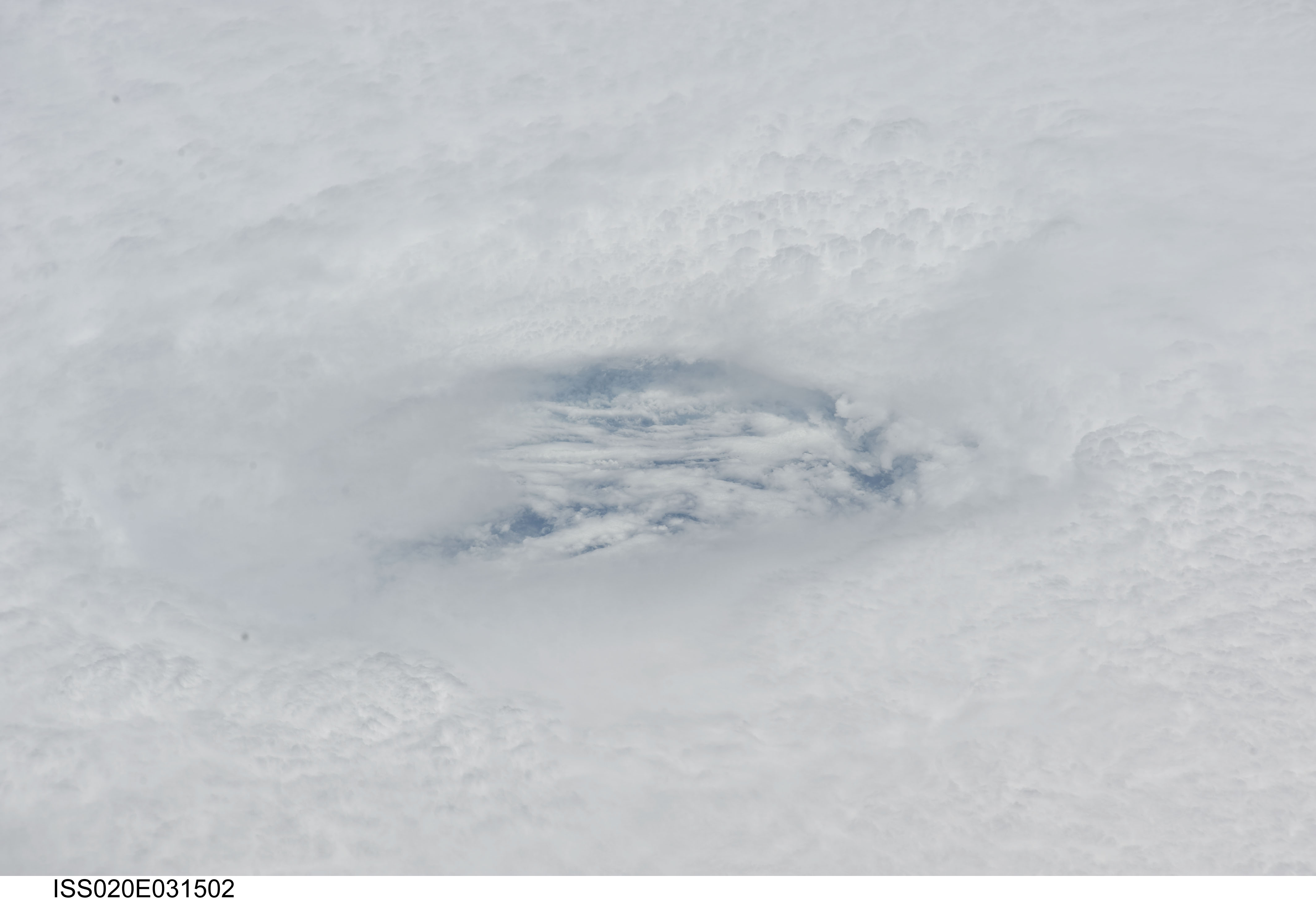
Spacecraft nadir point: 15.8° N, 56.5° W
Photo center point: 16.0° N, 51.0° W
Photo center point by machine learning:
Photo center point: 16.0° N, 51.0° W
Photo center point by machine learning:
Nadir to Photo Center: East
Spacecraft Altitude: 190 nautical miles (352km)
Country or Geographic Name: | ATLANTIC OCEAN |
Features: | HURRICANE BILL, EYEWALL |
| Features Found Using Machine Learning: | |
Cloud Cover Percentage: | 100 (76-100)% |
Sun Elevation Angle: | 84° |
Sun Azimuth: | 241° |
Camera: | Nikon D3 Electronic Still Camera |
Focal Length: | 200mm |
Camera Tilt: | High Oblique |
Format: | 4256E: 4256 x 2832 pixel CMOS sensor, 36.0mm x 23.9mm, total pixels: 12.87 million, Nikon FX format |
Film Exposure: | |
| Additional Information | |
| Width | Height | Annotated | Cropped | Purpose | Links |
|---|---|---|---|---|---|
| 4256 pixels | 2913 pixels | No | No | Download Image | |
| 640 pixels | 438 pixels | No | No | Download Image |
Download Packaged File
Download a Google Earth KML for this Image
View photo footprint information
Download a GeoTIFF for this photo
Image Caption: ISS020-E-031502 (18 Aug. 2009) --- Looking down the eye of Hurricane Bill in the Atlantic Ocean, an Expedition 20 crew member on the International Space Station captures a swirling cloud layer which is several thousand feet below the tops of the eye wall clouds. This view was taken on Aug. 18, 2009 at 16:10:07 GMT with a Nikkor 80-200mm zoom lens at the 200mm setting. At the time this photograph was taken, Hurricane Bill was centered at 15.9 degrees north latitude and 51.2 degrees west longitude, the winds were 90 knots (103.7 miles per hour) gusting to 110 knots (126.7 mph) and it was moving west-northwest (285 degrees) at 14 knots (16.1 mph).
