ISS017-E-5600
| NASA Photo ID | ISS017-E-5600 |
| Focal Length | 32mm |
| Date taken | 2008.04.29 |
| Time taken | 08:52:31 GMT |
Cloud masks available for this image:
Spacecraft nadir point: 20.0° N, 80.5° E
Photo center point: 13.5° N, 85.8° E
Photo center point by machine learning:
Photo center point: 13.5° N, 85.8° E
Photo center point by machine learning:
Nadir to Photo Center: Southeast
Spacecraft Altitude: 181 nautical miles (335km)
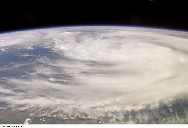
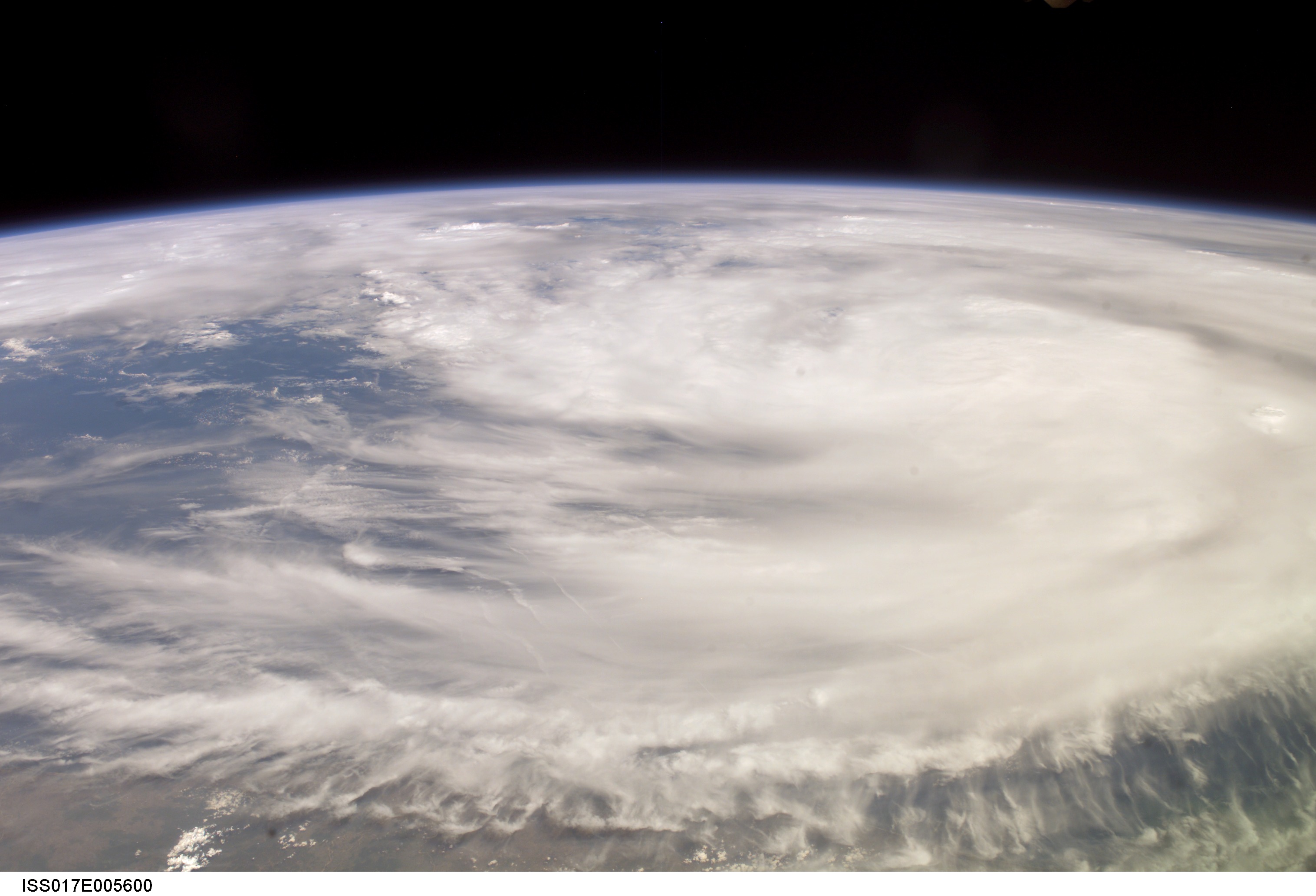
Country or Geographic Name: | BAY OF BENGAL |
Features: | PAN-TROPICAL CYCLONE NARGIS |
| Features Found Using Machine Learning: | PAN- |
Cloud Cover Percentage: | 100 (76-100)% |
Sun Elevation Angle: | 57° |
Sun Azimuth: | 266° |
Camera: | Kodak DCS760c Electronic Still Camera |
Focal Length: | 32mm |
Camera Tilt: | High Oblique |
Format: | 3060E: 3060 x 2036 pixel CCD, RGBG array |
Film Exposure: | |
| Additional Information | |
| Width | Height | Annotated | Cropped | Purpose | Links |
|---|---|---|---|---|---|
| 3032 pixels | 2064 pixels | No | No | Download Image | |
| 639 pixels | 435 pixels | No | No | Download Image |
Download Packaged File
Download a Google Earth KML for this Image
View photo footprint information
Download a GeoTIFF for this photo
Image Caption: ISS017-E-005600 (29 April 2008) --- Outflow obscures the definition of the eye and center of Tropical Cyclone Nargis, seen when the storm was at approximately 13.5 degrees north latitude and 86.2 degrees east longitude with maximum winds of 74.9 miles per hour. Photographed by a crew member aboard the International Space Station, the storm was moving east-northeast at 070 degrees at 4.6 miles per hour. This picture was made several days prior to impact at Burma.
