ISS017-E-15732
| NASA Photo ID | ISS017-E-15732 |
| Focal Length | 28mm |
| Date taken | 2008.09.09 |
| Time taken | 12:44:05 GMT |
Cloud masks available for this image:
Spacecraft nadir point: 21.5° N, 74.3° W
Photo center point: 22.5° N, 82.5° W
Photo center point by machine learning:
Photo center point: 22.5° N, 82.5° W
Photo center point by machine learning:
Nadir to Photo Center: West
Spacecraft Altitude: 188 nautical miles (348km)
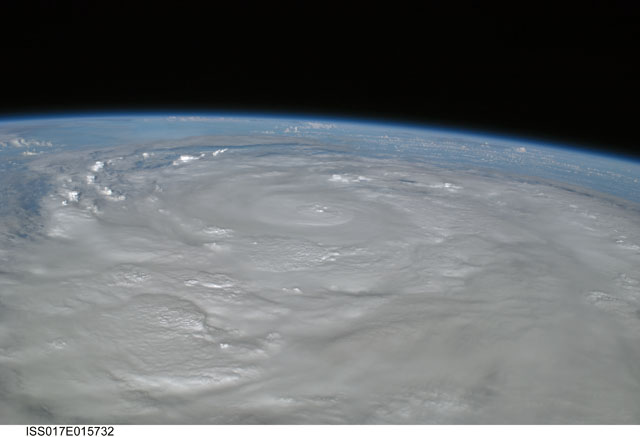
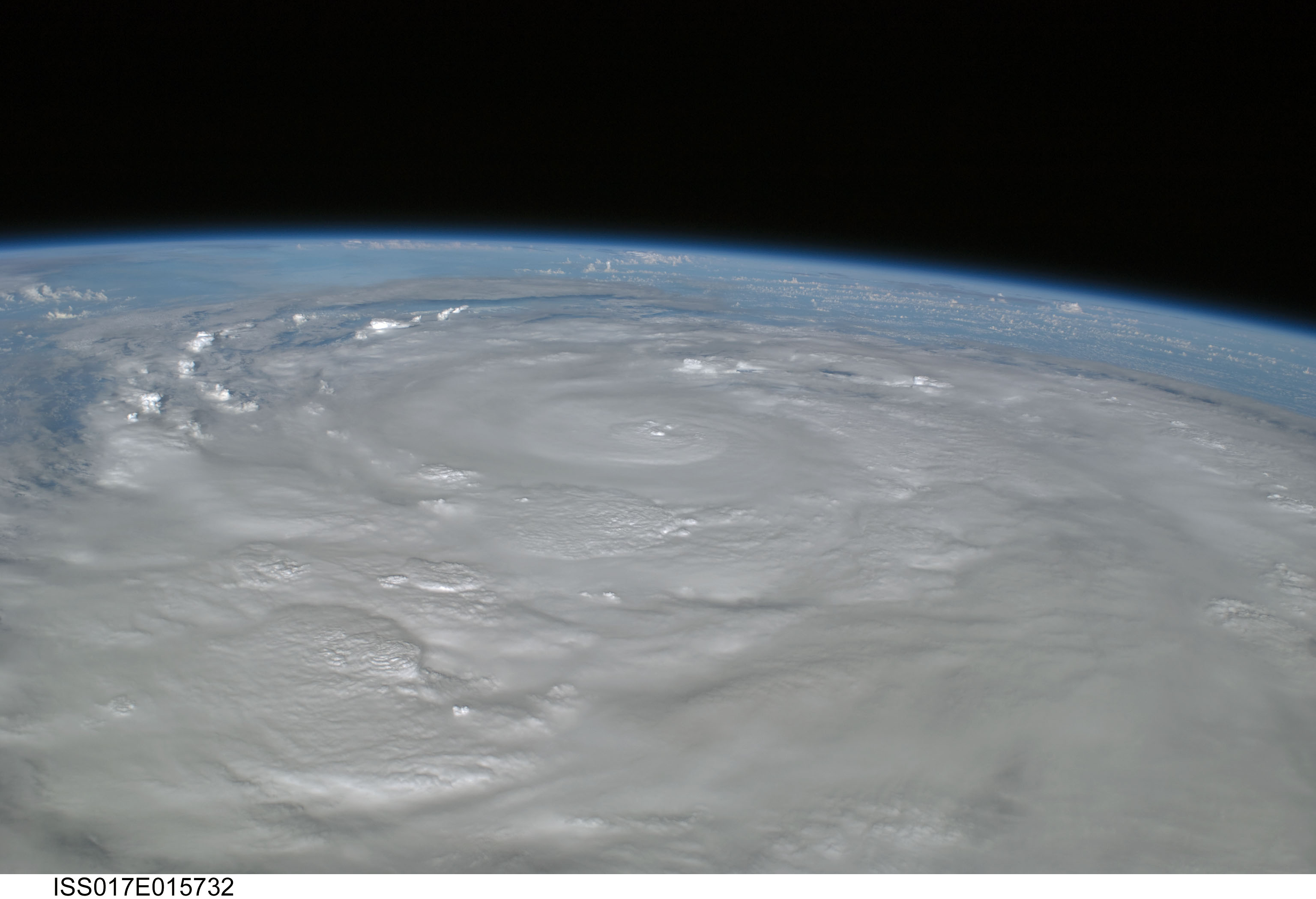
Country or Geographic Name: | CUBA |
Features: | PAN-HURRICANE IKE, EYE, BANDS |
| Features Found Using Machine Learning: | PAN- |
Cloud Cover Percentage: | 100 (76-100)% |
Sun Elevation Angle: | 27° |
Sun Azimuth: | 96° |
Camera: | Nikon D2Xs Electronic Still Camera |
Focal Length: | 28mm |
Camera Tilt: | High Oblique |
Format: | 4288E: 4288 x 2848 pixel CMOS sensor, RGBG imager color filter |
Film Exposure: | |
| Additional Information | |
| Width | Height | Annotated | Cropped | Purpose | Links |
|---|---|---|---|---|---|
| 3072 pixels | 2098 pixels | No | No | Download Image | |
| 640 pixels | 437 pixels | No | No | Download Image |
Download Packaged File
Download a Google Earth KML for this Image
View photo footprint information
Download a GeoTIFF for this photo
Image Caption: ISS017-E-015732 (9 Sept. 2008) --- Hurricane Ike covers more than half of Cuba in this image, photographed by the crew of ISS-17 aboard the International Space Station from a vantage point of 220 statute miles above Earth. The center of Ike was near 22.4 degrees north latitude and 82.4 degrees west longitude and moving 290 degrees at 11.7 miles per hour. Sustained winds were at 80.6 miles per hour, with gusts to 97.9 miles per hour and were forecast to strengthen as the eye moved back over the warm water in the gulf of Mexico.
