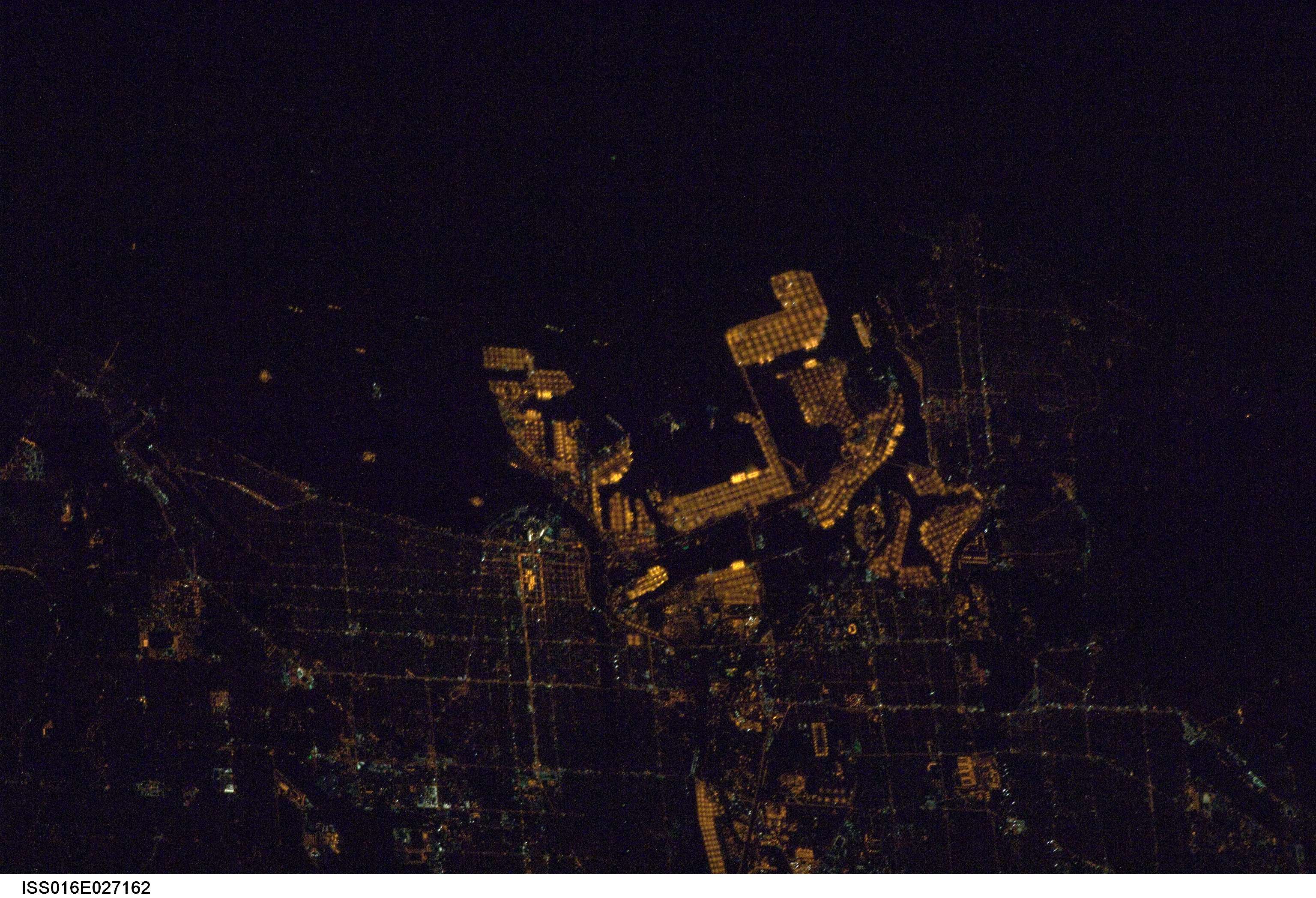
ISS016-E-27162

| NASA Photo ID | ISS016-E-27162 |
| Focal Length | 400mm |
| Date taken | 2008.02.04 |
| Time taken | 07:44:37 GMT |
Resolutions offered for this image:
1000 x 754 pixels 540 x 407 pixels 540 x 334 pixels 3072 x 2096 pixels 639 x 436 pixels
1000 x 754 pixels 540 x 407 pixels 540 x 334 pixels 3072 x 2096 pixels 639 x 436 pixels
Cloud masks available for this image:
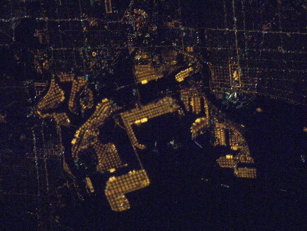
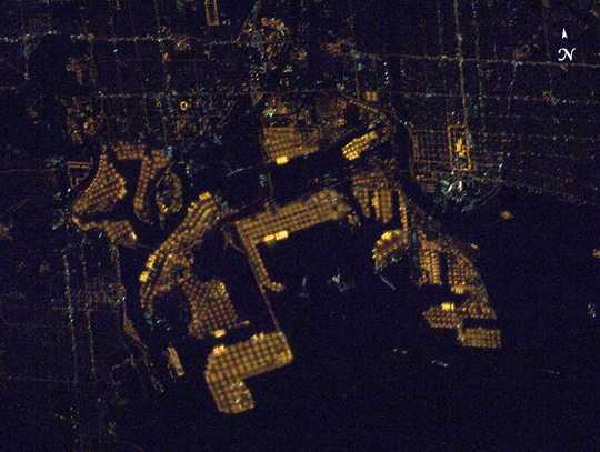
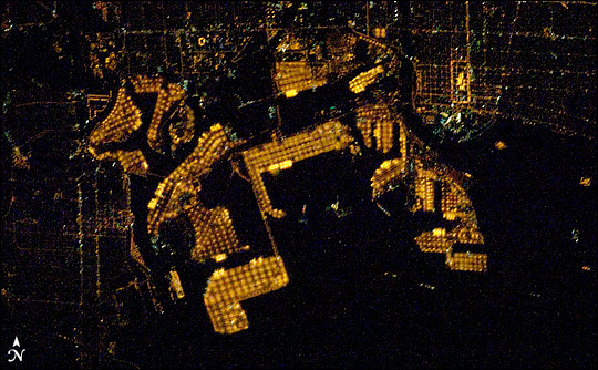
Spacecraft nadir point: 35.2° N, 117.1° W
Photo center point: 33.7° N, 118.2° W
Photo center point by machine learning: 33.75° N, 118.22° W
Photo center point: 33.7° N, 118.2° W
Photo center point by machine learning: 33.75° N, 118.22° W
Nadir to Photo Center: Southwest
Spacecraft Altitude: 180 nautical miles (333km)

Country or Geographic Name: | USA-CALIFORNIA |
Features: | LONG BEACH HARBOR AT NIGHT |
| Features Found Using Machine Learning: | |
Cloud Cover Percentage: | 10 (1-10)% |
Sun Elevation Angle: | -71° |
Sun Azimuth: | 347° |
Camera: | Nikon D1 Electronic Still Camera |
Focal Length: | 400mm |
Camera Tilt: | 32 degrees |
Format: | 2000E: 2000 x 1312 pixel CCD, RGBG imager color filter |
Film Exposure: | |
| Additional Information | |
| Width | Height | Annotated | Cropped | Purpose | Links |
|---|---|---|---|---|---|
| 1000 pixels | 754 pixels | No | Yes | Earth From Space collection | Download Image |
| 540 pixels | 407 pixels | Yes | Yes | Earth From Space collection | Download Image |
| 540 pixels | 334 pixels | Yes | Yes | NASA's Earth Observatory web site | Download Image |
| 3072 pixels | 2096 pixels | No | No | Download Image | |
| 639 pixels | 436 pixels | No | No | Download Image |
Download Packaged File
Download a Google Earth KML for this Image
View photo footprint information
Download a GeoTIFF for this photo
Image Caption: Long Beach, California. The port facilities of Long Beach, California are illuminated with regularly spaced orange sodium vapor lights to support the round-the-clock operations of one of the world's busiest commercial cargo ports.
