ISS016-E-20576
| NASA Photo ID | ISS016-E-20576 |
| Focal Length | 30mm |
| Date taken | 2008.01.02 |
| Time taken | 19:43:08 GMT |

Cloud masks available for this image:
Spacecraft nadir point: 51.8° N, 150.5° W
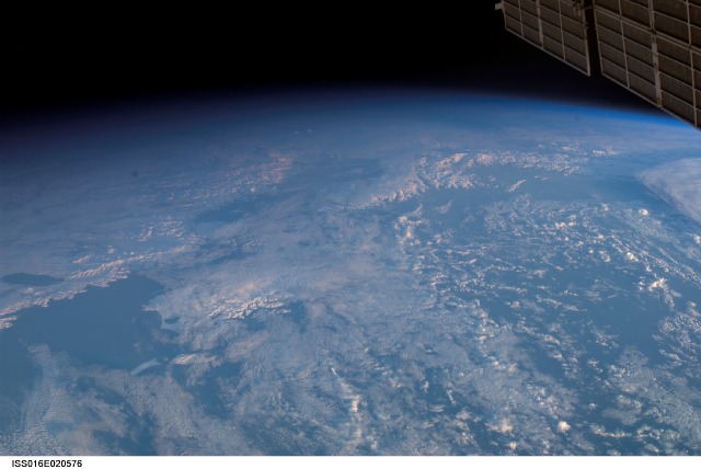
Photo center point: 59.0° N, 151.8° W
Photo center point by machine learning:
Photo center point: 59.0° N, 151.8° W
Photo center point by machine learning:
Nadir to Photo Center: North
Spacecraft Altitude: 177 nautical miles (328km)
Country or Geographic Name: | USA-ALASKA |
Features: | BECHAROF L., KENAI PEN., KODIAC I., TERMINATOR |
| Features Found Using Machine Learning: | PAN- |
Cloud Cover Percentage: | 50 (26-50)% |
Sun Elevation Angle: | 9° |
Sun Azimuth: | 147° |
Camera: | Nikon D1 Electronic Still Camera |
Focal Length: | 30mm |
Camera Tilt: | High Oblique |
Format: | 2000E: 2000 x 1312 pixel CCD, RGBG imager color filter |
Film Exposure: | |
| Additional Information | |
| Width | Height | Annotated | Cropped | Purpose | Links |
|---|---|---|---|---|---|
| 3008 pixels | 2016 pixels | No | No | Download Image | |
| 640 pixels | 428 pixels | No | No | Download Image |
Download Packaged File
Download a Google Earth KML for this Image
View photo footprint information
Download a GeoTIFF for this photo
Image Caption: none
