ISS015-E-9199

| NASA Photo ID | ISS015-E-9199 |
| Focal Length | 180mm |
| Date taken | 2007.05.23 |
| Time taken | 16:22:00 GMT |
Cloud masks available for this image:
Spacecraft nadir point: 51.1° N, 178.8° W
Photo center point:
Photo center point by machine learning:
Photo center point:
Photo center point by machine learning:
Nadir to Photo Center:
Spacecraft Altitude: 180 nautical miles (333km)
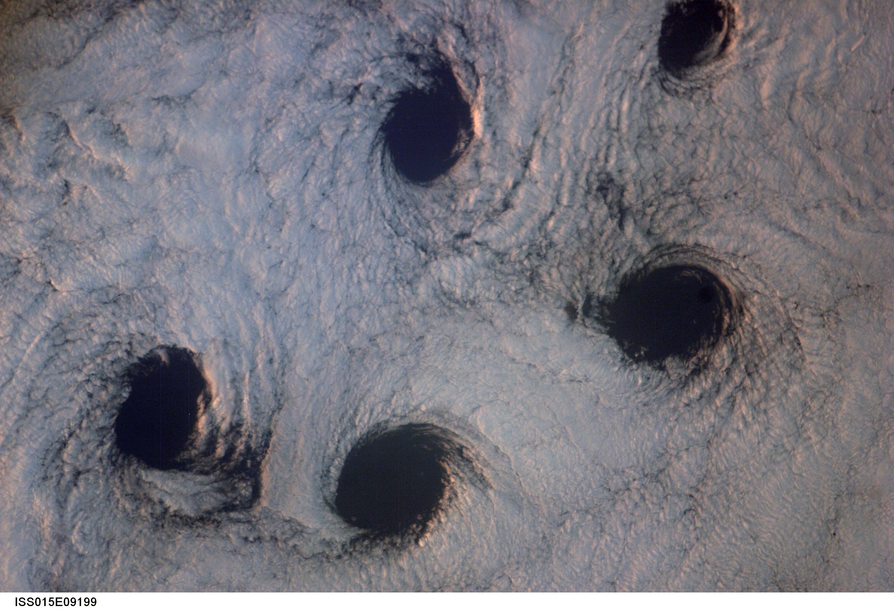
Country or Geographic Name: | CLOUDS |
Features: | CLOUD VORTICES FROM ALEUTIAN I |
| Features Found Using Machine Learning: | |
Cloud Cover Percentage: | 100 (76-100)% |
Sun Elevation Angle: | 3° |
Sun Azimuth: | 60° |
Camera: | Kodak DCS760c Electronic Still Camera |
Focal Length: | 180mm |
Camera Tilt: | High Oblique |
Format: | 3060E: 3060 x 2036 pixel CCD, RGBG array |
Film Exposure: | |
| Additional Information | |
| Width | Height | Annotated | Cropped | Purpose | Links |
|---|---|---|---|---|---|
| 3032 pixels | 2064 pixels | No | No | Download Image | |
| 639 pixels | 435 pixels | No | No | Download Image |
Download Packaged File
Download a Google Earth KML for this Image
View photo footprint information
Download a GeoTIFF for this photo
Image Caption: ISS015-E-09199 (23 May 2007) --- Von Karman cloud vortices near the Aleutian Islands are featured in this image photographed by an Expedition 15 crewmember on the International Space Station. The vortices are created by the wind encountering a barrier such as an island, changing direction and velocity and forming eddies in the wind and cloud pattern on the lee side of the island. The nadir point of the space station when the image was taken was 51.1 degrees north latitude and 178.8 degrees west longitude.
