ISS014-E-18731

| NASA Photo ID | ISS014-E-18731 |
| Focal Length | 400mm |
| Date taken | 2007.03.31 |
| Time taken | 03:22:41 GMT |
Cloud masks available for this image:
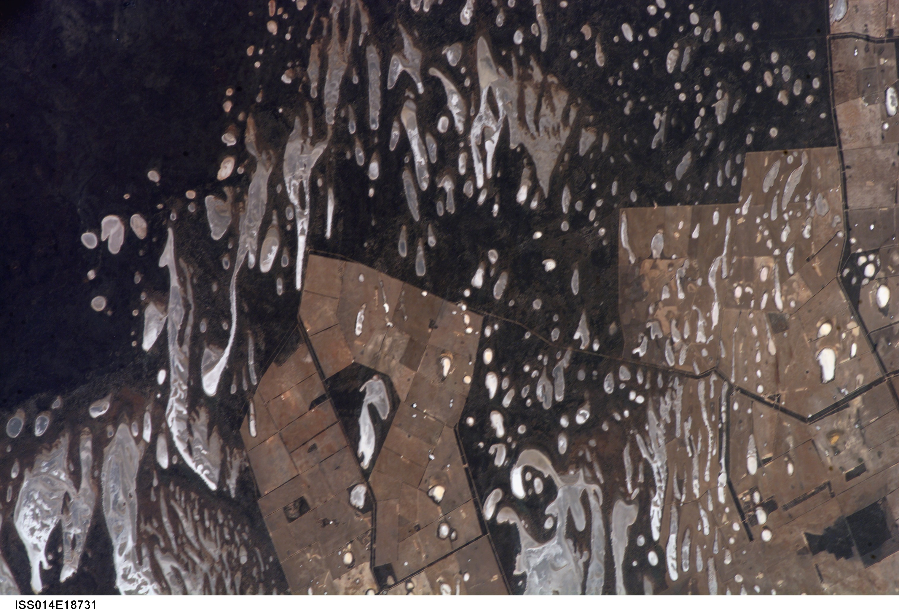
Spacecraft nadir point: 34.7° S, 121.4° E
Photo center point: 32.9° S, 122.0° E
Photo center point by machine learning:
Photo center point: 32.9° S, 122.0° E
Photo center point by machine learning:
Nadir to Photo Center: North
Spacecraft Altitude: 188 nautical miles (348km)
Country or Geographic Name: | AUSTRALIA-WA |
Features: | RANGELAND SE. OF L. DUNDAS |
| Features Found Using Machine Learning: | |
Cloud Cover Percentage: | 10 (1-10)% |
Sun Elevation Angle: | 51° |
Sun Azimuth: | 14° |
Camera: | Kodak DCS760c Electronic Still Camera |
Focal Length: | 400mm |
Camera Tilt: | 31 degrees |
Format: | 3060E: 3060 x 2036 pixel CCD, RGBG array |
Film Exposure: | |
| Additional Information | |
| Width | Height | Annotated | Cropped | Purpose | Links |
|---|---|---|---|---|---|
| 3032 pixels | 2064 pixels | No | No | Download Image | |
| 639 pixels | 435 pixels | No | No | Download Image |
Download Packaged File
Download a Google Earth KML for this Image
View photo footprint information
Download a GeoTIFF for this photo
Image Caption: ISS014-E-18731 (31 March 2007) --- Rangeland southeast of Lake Dundas in Western Australia is featured in this image photographed by an Expedition 14 crewmember on the International Space Station.
