ISS013-E-81590

| NASA Photo ID | ISS013-E-81590 |
| Focal Length | 25mm |
| Date taken | 2006.09.15 |
| Time taken | 12:40:57 GMT |
Cloud masks available for this image:
Spacecraft nadir point: 39.2° N, 62.6° W
Photo center point:
Photo center point by machine learning:
Photo center point:
Photo center point by machine learning:
Nadir to Photo Center:
Spacecraft Altitude: 181 nautical miles (335km)
Country or Geographic Name: | |
Features: | |
| Features Found Using Machine Learning: | PAN- |
Cloud Cover Percentage: | 45 (26-50)% |
Sun Elevation Angle: | 31° |
Sun Azimuth: | 114° |
Camera: | K760C-01462 |
Focal Length: | 25mm |
Camera Tilt: | |
Format: | |
Film Exposure: | |
| Additional Information | |
| Width | Height | Annotated | Cropped | Purpose | Links |
|---|---|---|---|---|---|
| 3032 pixels | 2064 pixels | No | No | Download Image | |
| 639 pixels | 435 pixels | No | No | Download Image |
Download Packaged File
Download a Google Earth KML for this Image
View photo footprint information
Download a GeoTIFF for this photo
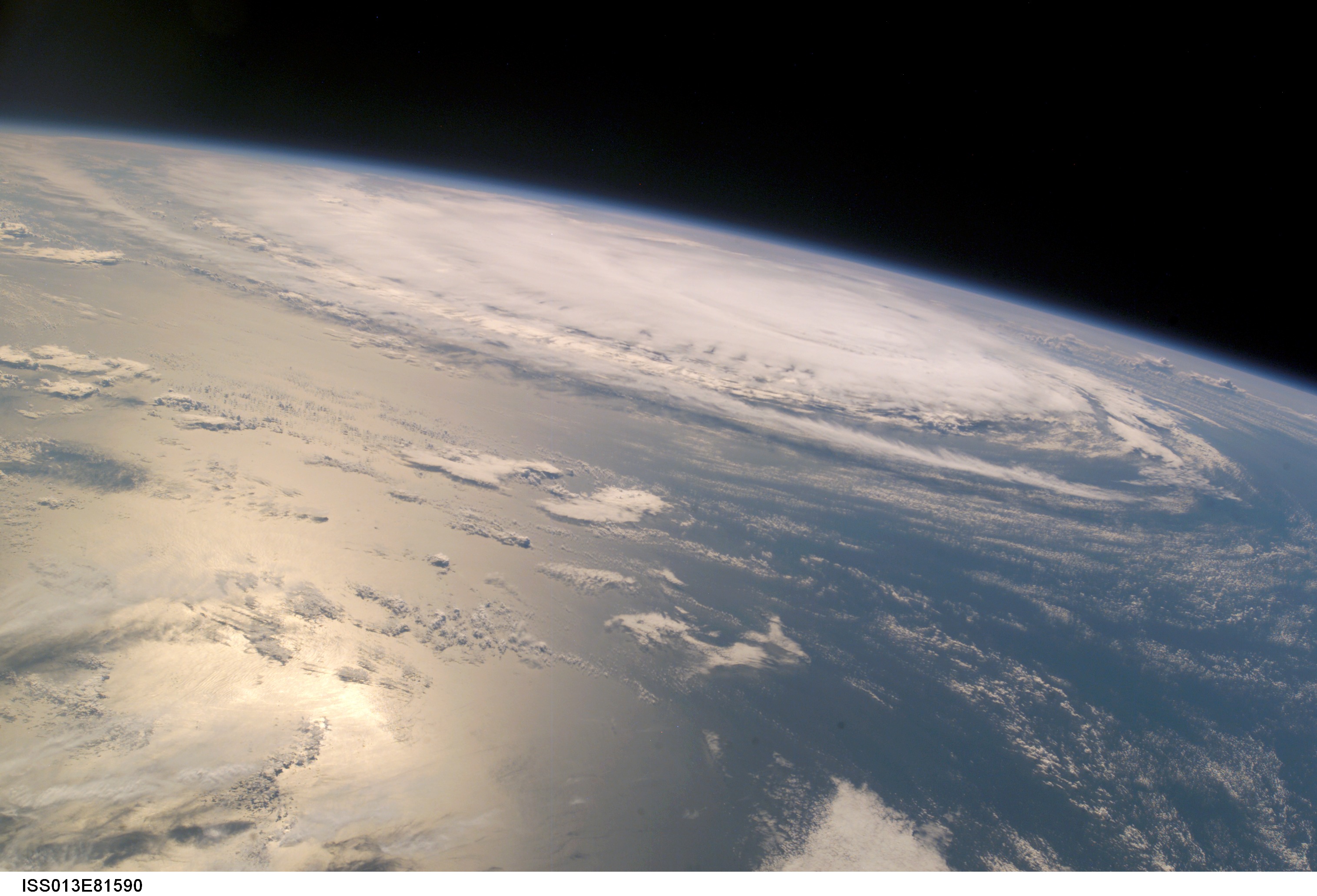
Image Caption: ISS013-E-81590 (15 Sept. 2006) --- Hurricane Gordon was captured at 12:40:57 GMT, Sept. 15, 2006 with a digital still camera, equipped with a 20-35mm lens, by one of the crewmembers aboard the International Space Station. The center of the storm was located near 31.3 degrees north latitude and 53.3 degrees west longitude, while moving northeast. At the time the photo was taken, the sustained winds were 85 nautical miles per hour with gusts to 105 nautical miles per hour.
