ISS013-E-6947
| NASA Photo ID | ISS013-E-6947 |
| Focal Length | 800mm |
| Date taken | 2006.04.12 |
| Time taken | 19:38:38 GMT |
1000 x 660 pixels 540 x 356 pixels 540 x 405 pixels 1520 x 1008 pixels 639 x 435 pixels

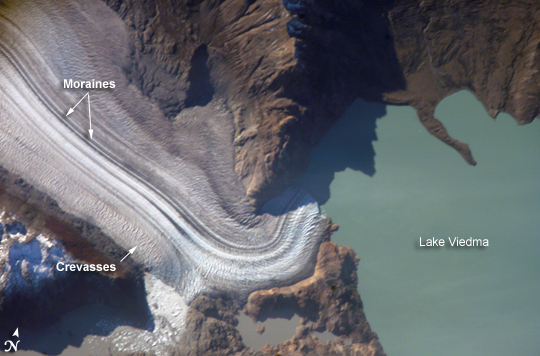
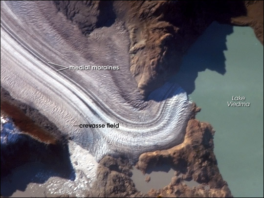
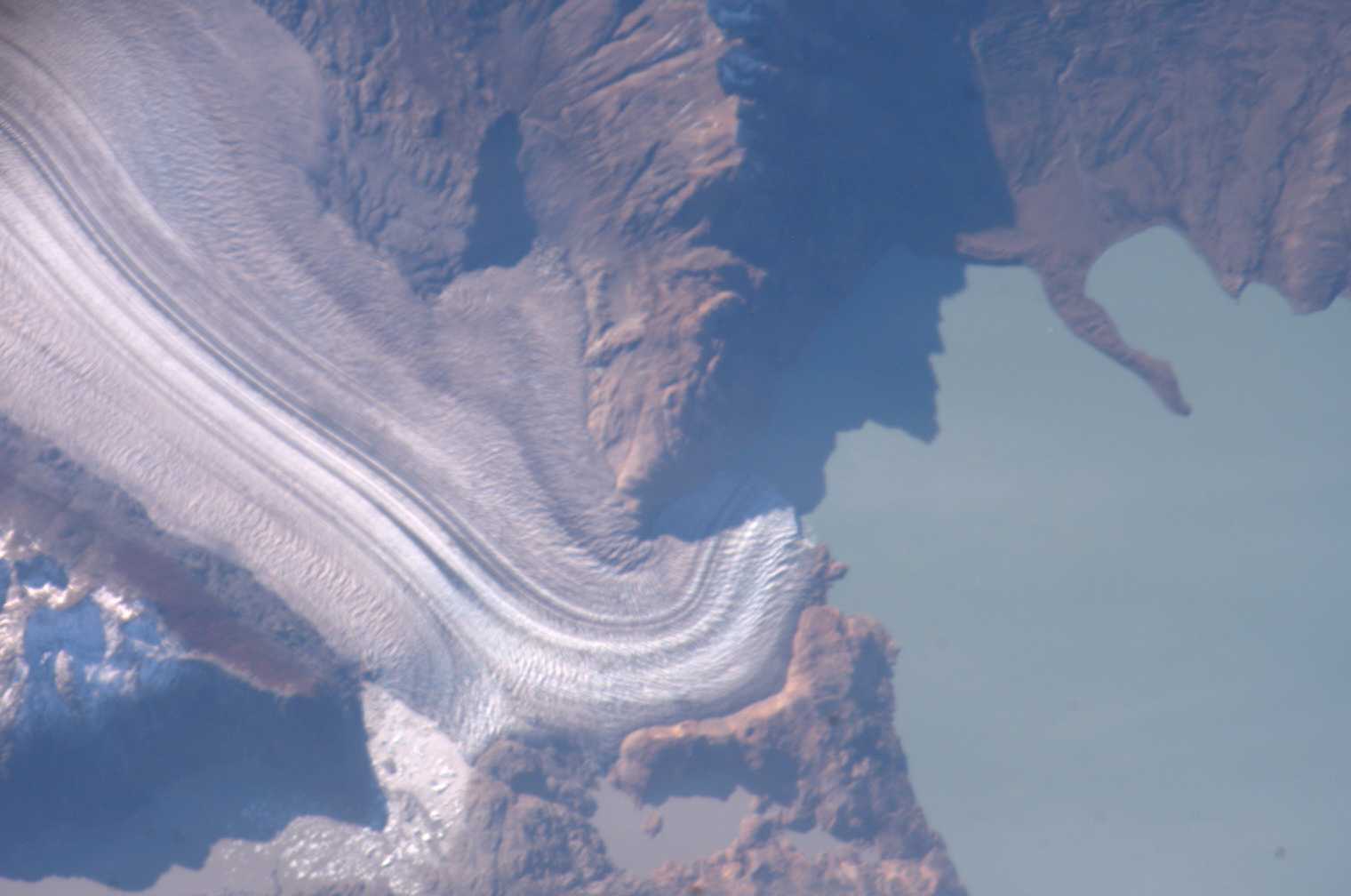


Photo center point: 49.5° S, 73.0° W
Photo center point by machine learning:
Country or Geographic Name: | ARGENTINA |
Features: | VIEDMA GLACIER, MT. FITZROY |
| Features Found Using Machine Learning: | |
Cloud Cover Percentage: | 10 (1-10)% |
Sun Elevation Angle: | 20° |
Sun Azimuth: | 316° |
Camera: | Kodak DCS760c Electronic Still Camera |
Focal Length: | 800mm |
Camera Tilt: | 28 degrees |
Format: | 3060E: 3060 x 2036 pixel CCD, RGBG array |
Film Exposure: | |
| Additional Information | |
| Width | Height | Annotated | Cropped | Purpose | Links |
|---|---|---|---|---|---|
| 1000 pixels | 660 pixels | No | Yes | Earth From Space collection | Download Image |
| 540 pixels | 356 pixels | Yes | Yes | Earth From Space collection | Download Image |
| 540 pixels | 405 pixels | Yes | Yes | NASA's Earth Observatory web site | Download Image |
| 1520 pixels | 1008 pixels | No | No | Not enhanced | Download Image |
| 639 pixels | 435 pixels | No | No | Download Image |
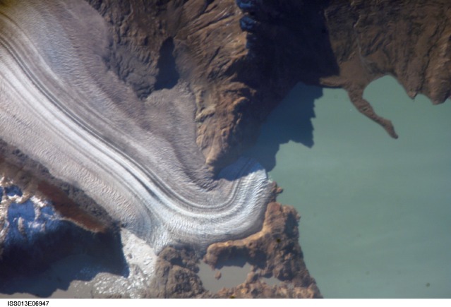
The icefields of Patagonia, located at the southern end of South America, are the largest masses of ice in the temperate Southern Hemisphere (approximately 55,000 square kilometers). The icefields contain numerous valley glaciers that terminate in meltwater-fed lakes. These are known as "calving" glaciers, as they lose mass when large ice chunks collapse from the terminus--or end--of the glacier. These newly separated chunks of ice are then free to float away, much like ice cubes in a punch bowl.
The terminus of the Viedma Glacier, approximately 2 kilometers across where it enters Lake Viedma, is shown in this astronaut photograph. Moraines are accumulations of soil and rock debris that form along the sides and front of a glacier as it flows across the landscape (much like a bulldozer). Independent valley glaciers can merge together as they flow down slope, and the moraines become entrained in the center of the new ice mass. These medial moraines are visible as dark parallel lines within the white central mass of the glacier (image center and left). Crevasses--oriented at right angles to the medial moraines--are also visible in the grey-brown ice along the sides of the glacier. The canyon-like crevasses form as a result of stress between the slower moving ice along the valley sides (where there is greater friction) and the more rapidly moving ice in the center of the glacier. Calving of ice from the southwestern fork of the glacier terminus is visible at image lower left.
As they respond to regional climate change, the Patagonian glaciers are closely monitored using remotely sensed data. Scientists compare series of images collected over time to monitor the change in ice extent and position. Scientists have also estimated changes in volume using topographic data from NASA's Shuttle Radar Topography Mission. The Global Land Ice Measurements from Space (GLIMS) Website is an excellent resource for glacier-monitoring information.
