ISS012-E-9639
| NASA Photo ID | ISS012-E-9639 |
| Focal Length | 400mm |
| Date taken | 2005.11.29 |
| Time taken | 14:03:32 GMT |
Cloud masks available for this image:
Spacecraft nadir point: 18.7° N, 18.3° E
Photo center point: 19.1° N, 19.2° E
Photo center point by machine learning:
Photo center point: 19.1° N, 19.2° E
Photo center point by machine learning:
Nadir to Photo Center: East
Spacecraft Altitude: 192 nautical miles (356km)
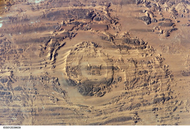
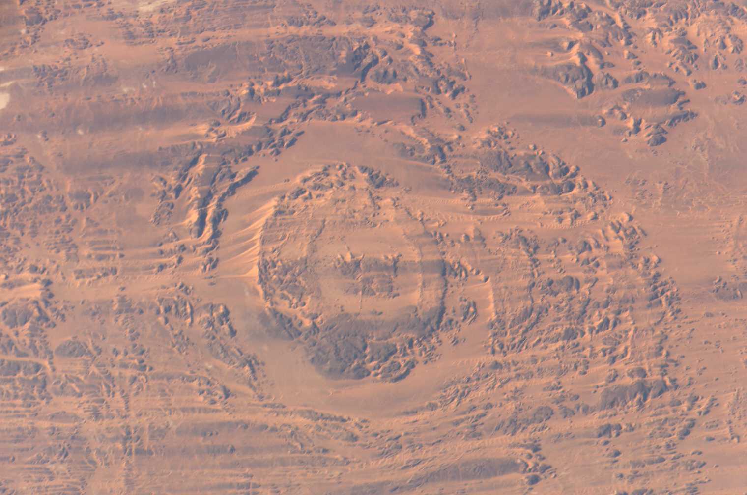
Country or Geographic Name: | CHAD |
Features: | AOROUNGA IMPACT CRATER |
| Features Found Using Machine Learning: | |
Cloud Cover Percentage: | 10 (1-10)% |
Sun Elevation Angle: | 25° |
Sun Azimuth: | 234° |
Camera: | Kodak DCS760c Electronic Still Camera |
Focal Length: | 400mm |
Camera Tilt: | 17 degrees |
Format: | 3060E: 3060 x 2036 pixel CCD, RGBG array |
Film Exposure: | |
| Additional Information | |
| Width | Height | Annotated | Cropped | Purpose | Links |
|---|---|---|---|---|---|
| 1520 pixels | 1008 pixels | No | No | Not enhanced | Download Image |
| 639 pixels | 435 pixels | No | No | Download Image |
Download Packaged File
Download a Google Earth KML for this Image
View photo footprint information
Download a GeoTIFF for this photo
Image Caption: ISS012-E-09639 (29 Nov. 2005) --- The impact of an asteroid or comet several hundred million years ago, according to scientists, left scars in the landscape that are still visible in this International Space Station/Expedition 12 picture of an area in the Sahara Desert of northern Chad. The concentric ring structure is the Aorounga impact crater, with a diameter of about 17 kilometers (10.5 miles). The original crater was buried by sediments, which were then partially eroded to reveal the current ring-like appearance. Scientists note a number of valleys cut by thousands of years of wind erosion. The area shown is centered at approximately 19.1 degrees north latitude and 19.3 degrees east longitude.
