ISS012-E-8797
| NASA Photo ID | ISS012-E-8797 |
| Focal Length | 800mm |
| Date taken | 2005.11.20 |
| Time taken | 16:07:30 GMT |
Cloud masks available for this image:
Spacecraft nadir point: 43.9° N, 73.6° W
Photo center point: 41.4° N, 74.0° W
Photo center point by machine learning:
Photo center point: 41.4° N, 74.0° W
Photo center point by machine learning:
Nadir to Photo Center: South
Spacecraft Altitude: 188 nautical miles (348km)
Country or Geographic Name: | USA-NEW YORK |
Features: | HUDSON RIVER, LAKES |
| Features Found Using Machine Learning: | |
Cloud Cover Percentage: | 10 (1-10)% |
Sun Elevation Angle: | 26° |
Sun Azimuth: | 171° |
Camera: | Kodak DCS760c Electronic Still Camera |
Focal Length: | 800mm |
Camera Tilt: | 39 degrees |
Format: | 3060E: 3060 x 2036 pixel CCD, RGBG array |
Film Exposure: | |
| Additional Information | |
| Width | Height | Annotated | Cropped | Purpose | Links |
|---|---|---|---|---|---|
| 1520 pixels | 1008 pixels | No | No | Not enhanced | Download Image |
| 639 pixels | 435 pixels | No | No | Download Image |
Download Packaged File
Download a Google Earth KML for this Image
View photo footprint information
Download a GeoTIFF for this photo
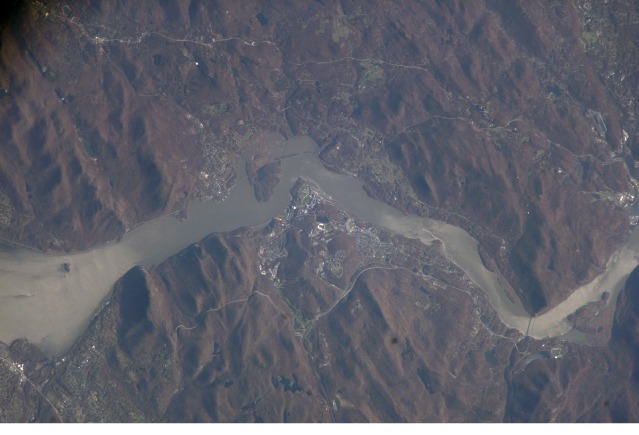
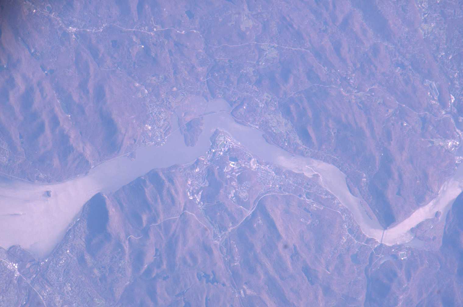
Image Caption: ISS012-E-08797 (20 Nov. 2005) --- West Point, NY, home of the United States Military Academy since 1802, is featured in this electronic still image recorded from the International Space Station during Expedition 12. West Point is located on the high west bank of the Hudson River north of New York City. North is at the top in this almost vertical view.
