ISS012-E-23057
| NASA Photo ID | ISS012-E-23057 |
| Focal Length | 180mm |
| Date taken | 2006.03.02 |
| Time taken | 12:21:08 GMT |
1000 x 884 pixels 540 x 334 pixels 540 x 354 pixels 540 x 782 pixels 1520 x 1008 pixels 639 x 435 pixels

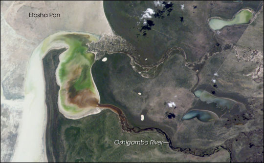
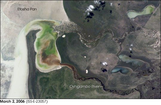

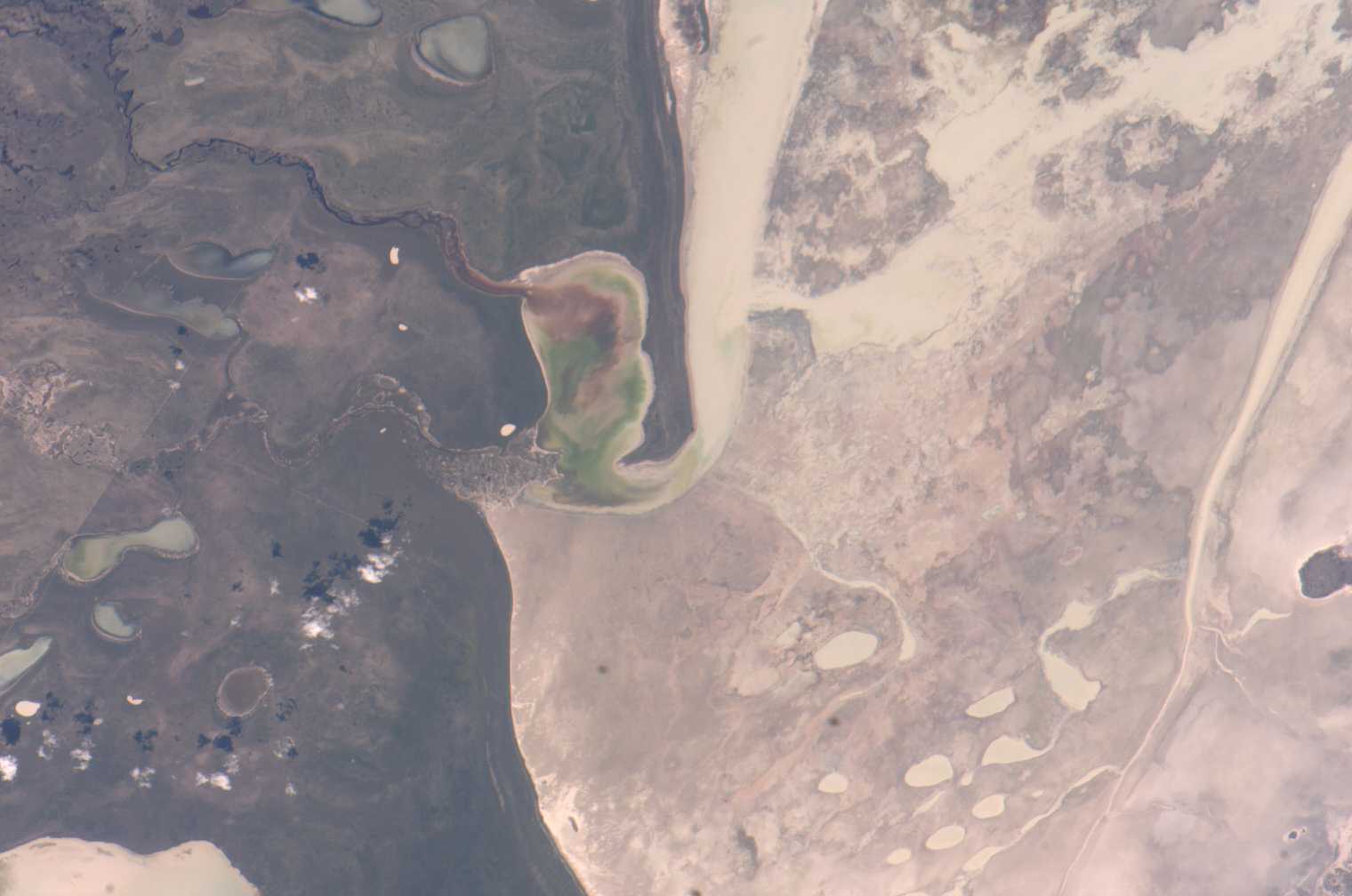
Photo center point: 18.5° S, 16.0° E
Photo center point by machine learning:
Country or Geographic Name: | NAMIBIA |
Features: | ETOSHA PAN DRY LAKE, INLET |
| Features Found Using Machine Learning: | |
Cloud Cover Percentage: | 10 (1-10)% |
Sun Elevation Angle: | 69° |
Sun Azimuth: | 299° |
Camera: | Kodak DCS760c Electronic Still Camera |
Focal Length: | 180mm |
Camera Tilt: | 8 degrees |
Format: | 3060E: 3060 x 2036 pixel CCD, RGBG array |
Film Exposure: | |
| Additional Information | |
| Width | Height | Annotated | Cropped | Purpose | Links |
|---|---|---|---|---|---|
| 1000 pixels | 884 pixels | No | Yes | Earth From Space collection | Download Image |
| 540 pixels | 334 pixels | Yes | Yes | Earth From Space collection | Download Image |
| 540 pixels | 354 pixels | Yes | Yes | NASA's Earth Observatory web site | Download Image |
| 540 pixels | 782 pixels | Yes | Yes | NASA's Earth Observatory web site | Download Image |
| 1520 pixels | 1008 pixels | No | No | Not enhanced | Download Image |
| 639 pixels | 435 pixels | No | No | Download Image |
High-resolution Images:
March 2, 2006 (320 kB JPEG)
June 24, 2005 (380 kB JPEG)
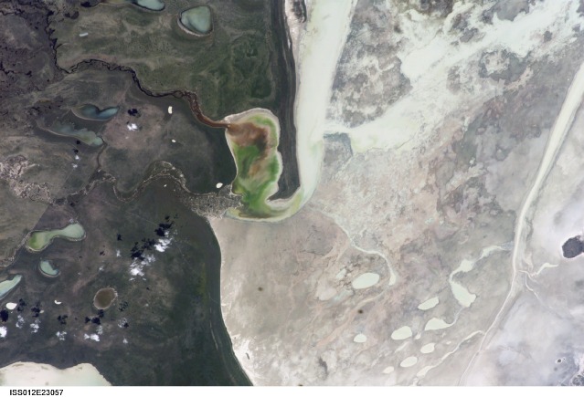
Etosha Pan in northern Namibia is a large, dry lakebed in the Kalahari Desert. The 120-kilometer-long (75-mile-long) lake and its surroundings are protected as one of Namibia's largest wildlife parks. Herds of elephants occupy the dense mopane woodland on the south side of the lake. Mopane trees are common throughout south-central Africa, and host the mopane worm, which is the larval form of the Mopane Emperor Moth and an important source of protein for rural communities. About 16,000 years ago, when ice sheets were melting across Northern Hemisphere land masses, a wet climate phase in southern Africa filled Etosha Lake. Today, Etosha Pan is seldom seen with even a thin sheet of water covering the salt pan.
Two images taken about nine months apart document an unusually wet summer in southern Africa. The upper view (March 2006) shows the point where the Oshigambo River flows into the salt lake; the lower regional image (June 2005) shows the same inlet--but dry--on the north shore of Etosha Pan. The Oshigambo River is almost never seen with water, but in early 2006, rainfall twice the average amount in the river's catchment generated flow. Greens and browns show vegetation and algae growing in different depths of water where the river enters the dry lake (upper image, center). Typically, little river water or sediment reaches the dry lake because water seeps into the riverbed along its 250-kilometer (55-mile) course, reducing discharge along the way. In this image, there was enough surface flow to reach the Etosha Pan, but too little water reached the mouth of the river to flow beyond the inlet bay. The unusual levels of precipitation also filled several small, usually dry lakes to the north (upper image, right).
