ISS012-E-21250

| NASA Photo ID | ISS012-E-21250 |
| Focal Length | 50mm |
| Date taken | 2006.03.21 |
| Time taken | 07:57:04 GMT |
1000 x 1518 pixels 540 x 820 pixels 540 x 720 pixels 1520 x 1008 pixels 639 x 435 pixels

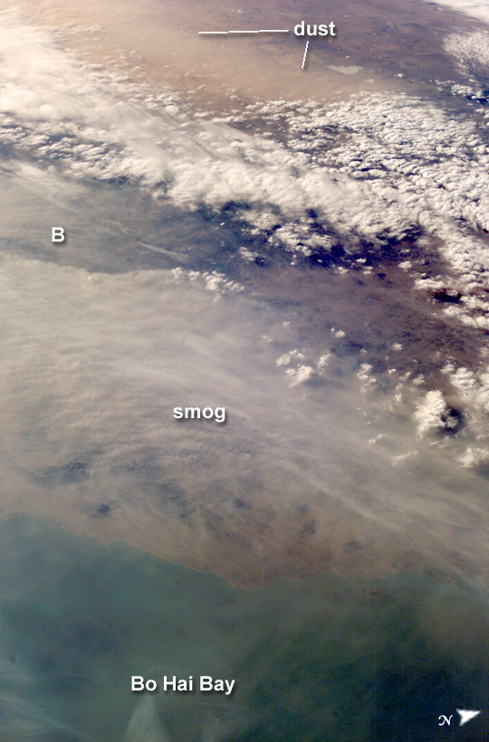
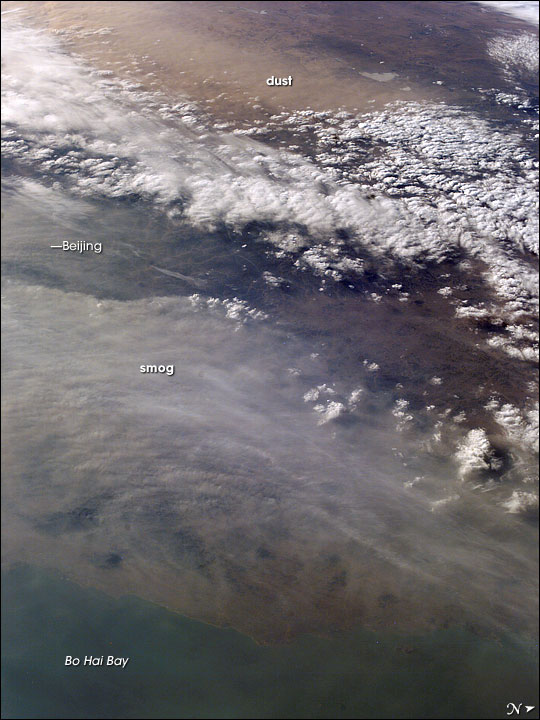
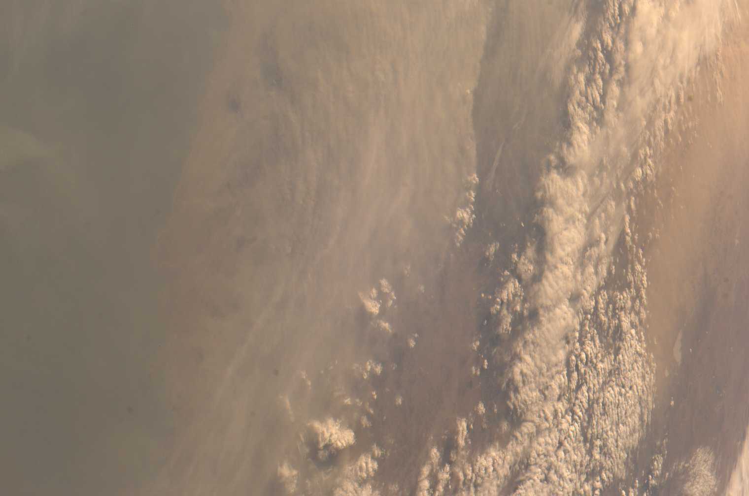
Photo center point: 41.0° N, 119.0° E
Photo center point by machine learning:
Camera: | Kodak DCS760c Electronic Still Camera |
Focal Length: | 50mm |
Camera Tilt: | High Oblique |
Format: | 3060E: 3060 x 2036 pixel CCD, RGBG array |
Film Exposure: | |
| Additional Information | |
| Width | Height | Annotated | Cropped | Purpose | Links |
|---|---|---|---|---|---|
| 1000 pixels | 1518 pixels | No | Yes | Earth From Space collection | Download Image |
| 540 pixels | 820 pixels | Yes | Yes | Earth From Space collection | Download Image |
| 540 pixels | 720 pixels | Yes | Yes | NASA's Earth Observatory web site | Download Image |
| 1520 pixels | 1008 pixels | No | No | Not enhanced | Download Image |
| 639 pixels | 435 pixels | No | No | Download Image |
Much of the land surface is obscured in this oblique image of the North China Plain and parts of Inner Mongolia. In this image, a mass of gray smog--mainly industrial pollution and smoke from domestic burning--obscures Beijing and surrounding cities. Numerous plumes with their source points appear within the mass. Beijing suffers some of the worst air pollution in the world from these chronic sources, and the characteristic colors and textures of the smog can be easily seen through the windows of the International Space Station. The pale brown material in Bo Hai Bay, about 300 kilometers east of Beijing, is sediment from the Yellow River and other rivers.
Separated from the smog mass by a band of puffy, white cumulus clouds is a light brown plume of dust. The line of white clouds has developed along the steep slope that separates the heavily populated North China Plain--the location of the largest population concentration on Earth--and the sparsely populated semi-desert plains of Inner Mongolia. Most Northern Hemisphere deserts saw dust storms in the spring of 2006, and the Gobi and Taklimakan Deserts of western China were no exception. Dust plumes originating in these deserts typically extend hundreds of kilometers eastward, regularly depositing dust on Beijing, the Korean Peninsula, and Japan. Some plumes even extend over the Pacific Ocean. In extreme cases, visible masses of Gobi-derived dust have reached North America.
An astronaut handheld-camera image taken in 1996 shows a broad corridor of smog moving off the mainland out into the Pacific Ocean from China's more southerly population center near Taiwan.
