ISS011-E-12147
| NASA Photo ID | ISS011-E-12147 |
| Focal Length | 800mm |
| Date taken | 2005.08.26 |
| Time taken | 13:56:37 GMT |
Cloud masks available for this image:
Spacecraft nadir point: 48.3° S, 41.6° W
Photo center point: 54.5° S, 36.2° W
Photo center point by machine learning:
Photo center point: 54.5° S, 36.2° W
Photo center point by machine learning:
Nadir to Photo Center: Southeast
Spacecraft Altitude: 193 nautical miles (357km)
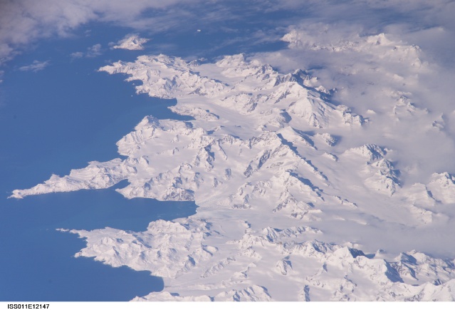
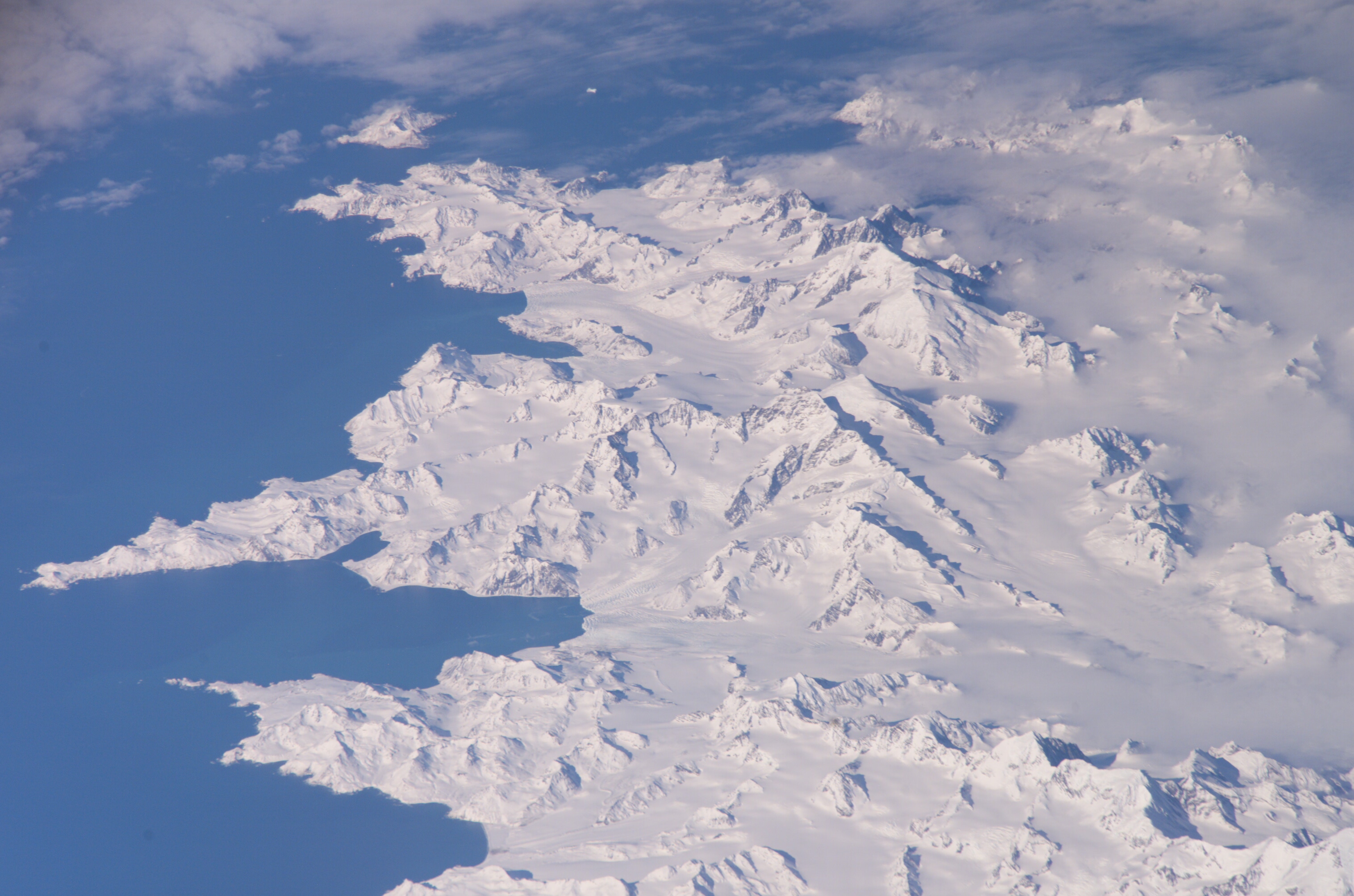
Country or Geographic Name: | SOUTH GEORGIA IS. |
Features: | ROYAL B., C. CHARLOTTE, GL. |
| Features Found Using Machine Learning: | |
Cloud Cover Percentage: | 25 (11-25)% |
Sun Elevation Angle: | 31° |
Sun Azimuth: | 15° |
Camera: | Kodak DCS760c Electronic Still Camera |
Focal Length: | 800mm |
Camera Tilt: | High Oblique |
Format: | 3060E: 3060 x 2036 pixel CCD, RGBG array |
Film Exposure: | |
| Additional Information | |
| Width | Height | Annotated | Cropped | Purpose | Links |
|---|---|---|---|---|---|
| 3032 pixels | 2008 pixels | No | No | Not enhanced | Download Image |
| 639 pixels | 435 pixels | No | No | Download Image |
Download Packaged File
Download a Google Earth KML for this Image
View photo footprint information
Download a GeoTIFF for this photo
Image Caption: ISS011-E-12147 (26 Aug. 2005) --- South Georgia Island is featured in this image photographed by an Expedition 11 crewmember on the International Space Station. There is no permanent human base on South Georgia Island, a British territory in the South Atlantic Ocean that lies 1300 kilometers east of the Falkland Islands. Using a long lens (800 mm focal length) and positioned for an oblique view, the crew of the international space station was able to capture the rugged and isolated landscape of the northern shore of the island. The high mountains protect the north and eastern coast of the island from the prevailing gales coming from Antarctica and the west. The steep topography also makes deep embayments along the coast that provide habitat for wildlife and anchorages for whaling ships. The island supports major rookeries of penguins and albatrosses, and large seal populations. This view centers on Mt. Paget and Cumberland Bay. The former whaling station Grytviken is located within the bay. The encampment supports the scientific base for the British Antarctic Survey and Bird Island Research Station.
