ISS010-E-9366
| NASA Photo ID | ISS010-E-9366 |
| Focal Length | 50mm |
| Date taken | 2004.12.04 |
| Time taken | 15:01:14 GMT |
540 x 374 pixels 1000 x 693 pixels 1000 x 693 pixels 540 x 374 pixels 3032 x 2064 pixels 639 x 435 pixels
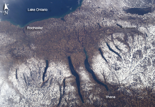


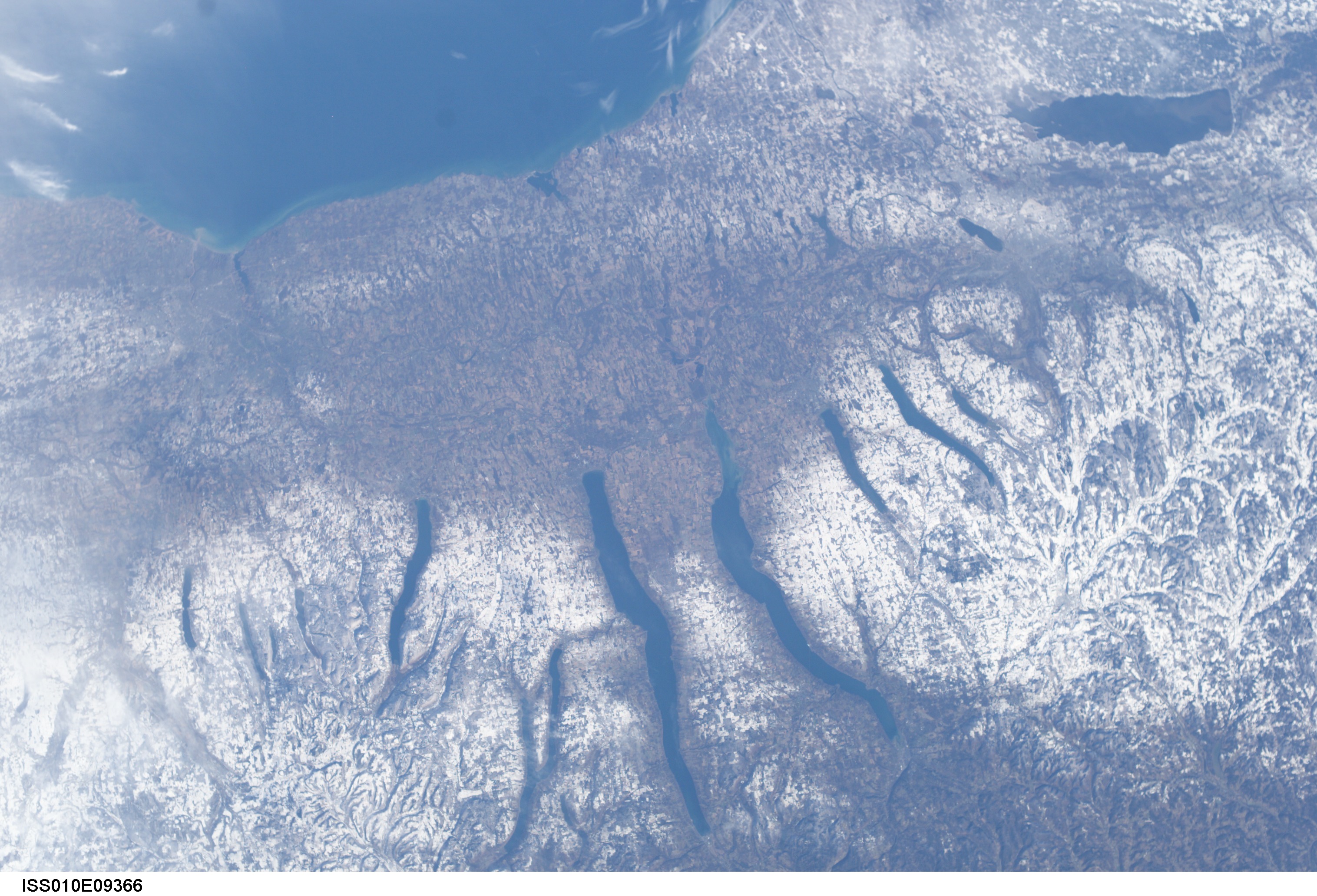


Photo center point: 43.0° N, 77.0° W
Photo center point by machine learning:
Country or Geographic Name: | USA-NEW YORK |
Features: | LAKE ONTARIO, SYRACUSE, SNOW |
| Features Found Using Machine Learning: | |
Cloud Cover Percentage: | 10 (1-10)% |
Sun Elevation Angle: | 20° |
Sun Azimuth: | 153° |
Camera: | Kodak DCS760c Electronic Still Camera |
Focal Length: | 50mm |
Camera Tilt: | 34 degrees |
Format: | 3060E: 3060 x 2036 pixel CCD, RGBG array |
Film Exposure: | |
| Additional Information | |
| Width | Height | Annotated | Cropped | Purpose | Links |
|---|---|---|---|---|---|
| 540 pixels | 374 pixels | Yes | Yes | Earth From Space collection | Download Image |
| 1000 pixels | 693 pixels | No | Yes | NASA's Earth Observatory web site | Download Image |
| 1000 pixels | 693 pixels | No | No | NASA's Earth Observatory web site | Download Image |
| 540 pixels | 374 pixels | Yes | Yes | NASA's Earth Observatory web site | Download Image |
| 3032 pixels | 2064 pixels | No | No | Download Image | |
| 639 pixels | 435 pixels | No | No | Download Image |
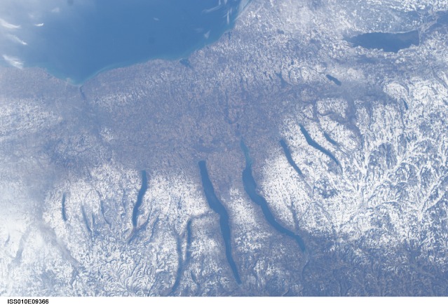
A late fall snowstorm frosted the hills of the Finger Lakes region of central New York in early December. Shapes of the snow-covered hills are accented by the low Sun angles, and contrast with the darker, finger-shaped lakes filling the region's valleys. The steep, roughly parallel valleys and hills of the Finger Lakes region were shaped by advancing and retreating ice sheets that were as much as 2 miles deep during the last ice age (2 million years to about 10,000 years ago). River valleys were scoured into deep troughs; many are now filled with lakes. The two largest lakes, Seneca and Cayuga, are so deep that the base of their lakebeds are below sea level.
The cities of Rochester, Syracuse, and Ithaca are included in this field-of-view, taken from the International Space Station. These three cities enjoy large seasonal snowpacks, thanks to the influence of the Great Lakes producing lake-effect snowstorms. Despite its reputation for long winters, the region is balmy compared with the glacial climate present when the landscape was carved. At the time of the greatest ice extent, yearly average temperatures over northern North America were several degrees lower than today.
