ISS010-E-5194
| NASA Photo ID | ISS010-E-5194 |
| Focal Length | 180mm |
| Date taken | 2004.10.27 |
| Time taken | 14:15:06 GMT |
Resolutions offered for this image:
1000 x 628 pixels 540 x 339 pixels 3032 x 2064 pixels 639 x 435 pixels
1000 x 628 pixels 540 x 339 pixels 3032 x 2064 pixels 639 x 435 pixels

Cloud masks available for this image:
Spacecraft nadir point: 8.8° N, 66.9° W
Photo center point: 10.0° N, 67.5° W
Photo center point by machine learning:
Photo center point: 10.0° N, 67.5° W
Photo center point by machine learning:
Nadir to Photo Center: North
Spacecraft Altitude: 195 nautical miles (361km)
Country or Geographic Name: | VENEZUELA |
Features: | L. VALENCIA, MARACAY, MTS. |
| Features Found Using Machine Learning: | |
Cloud Cover Percentage: | 10 (1-10)% |
Sun Elevation Angle: | 54° |
Sun Azimuth: | 127° |
Camera: | Kodak DCS760c Electronic Still Camera |
Focal Length: | 180mm |
Camera Tilt: | 22 degrees |
Format: | 3060E: 3060 x 2036 pixel CCD, RGBG array |
Film Exposure: | |
| Additional Information | |
| Width | Height | Annotated | Cropped | Purpose | Links |
|---|---|---|---|---|---|
| 1000 pixels | 628 pixels | No | Yes | Earth From Space collection | Download Image |
| 540 pixels | 339 pixels | Yes | Yes | Earth From Space collection | Download Image |
| 3032 pixels | 2064 pixels | No | No | Download Image | |
| 639 pixels | 435 pixels | No | No | Download Image |
Download Packaged File
Download a Google Earth KML for this Image
View photo footprint information
Download a GeoTIFF for this photo
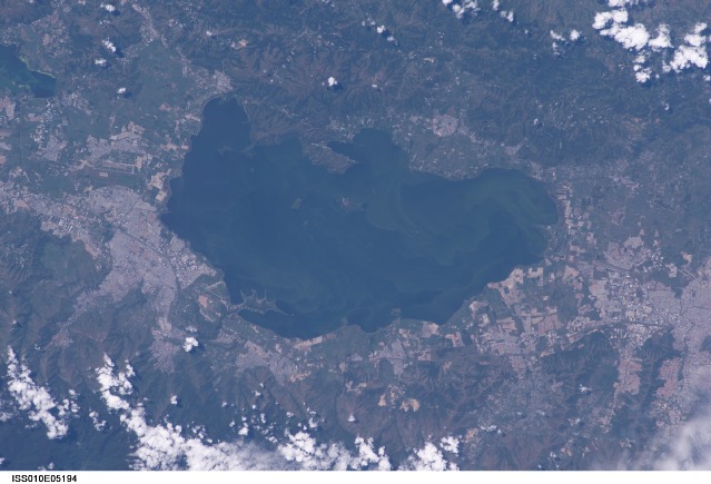
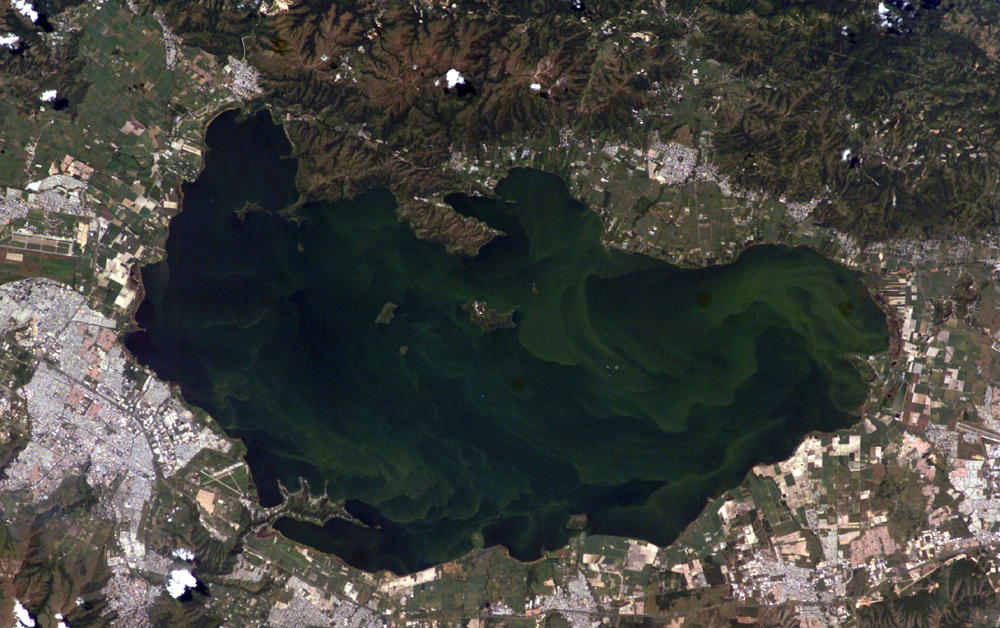
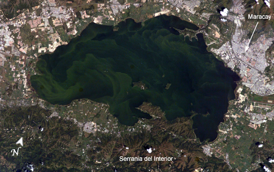
Image Caption: Lago de Valencia (Lake Valencia) is located in north-central Venezuela and is the largest freshwater lake in the country. The lake was formed approximately 2-3 million years ago due to faulting and subsequent damming of the Valencia River. The lake has been completely dry during several discrete periods of its geologic history. Since 1976 Lake Valencia water levels have risen due to diversion of water from neighboring watersheds--it currently acts as a reservoir for the surrounding urban centers (such as Maracay).
The vivid green algal blooms present in this image result from a continual influx of untreated wastewater from the surrounding urban, agricultural, and industrial land uses. This contributes to ongoing eutrophication, contamination, and salinization of the lake. Despite its picturesque location between the Cordillera de la Costa to the north and the Serrania del Interior to the south, Lake Valencia's poor water quality limits opportunities for tourism and recreational activities.
The vivid green algal blooms present in this image result from a continual influx of untreated wastewater from the surrounding urban, agricultural, and industrial land uses. This contributes to ongoing eutrophication, contamination, and salinization of the lake. Despite its picturesque location between the Cordillera de la Costa to the north and the Serrania del Interior to the south, Lake Valencia's poor water quality limits opportunities for tourism and recreational activities.
