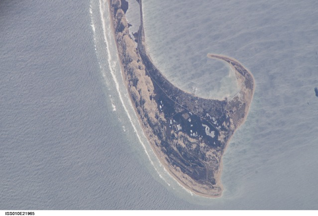
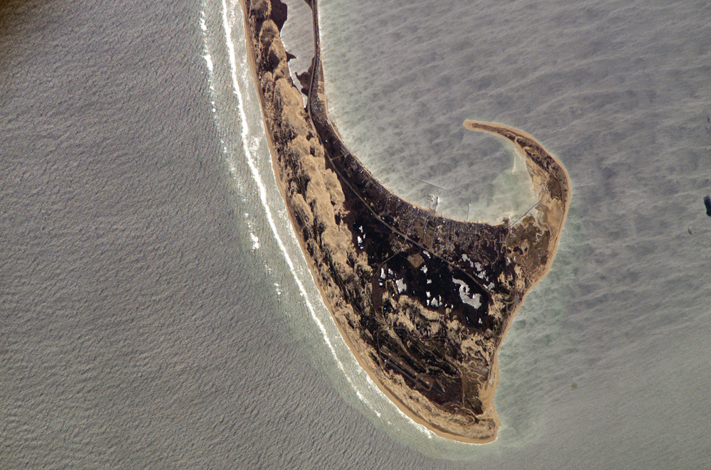
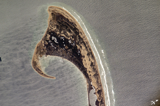
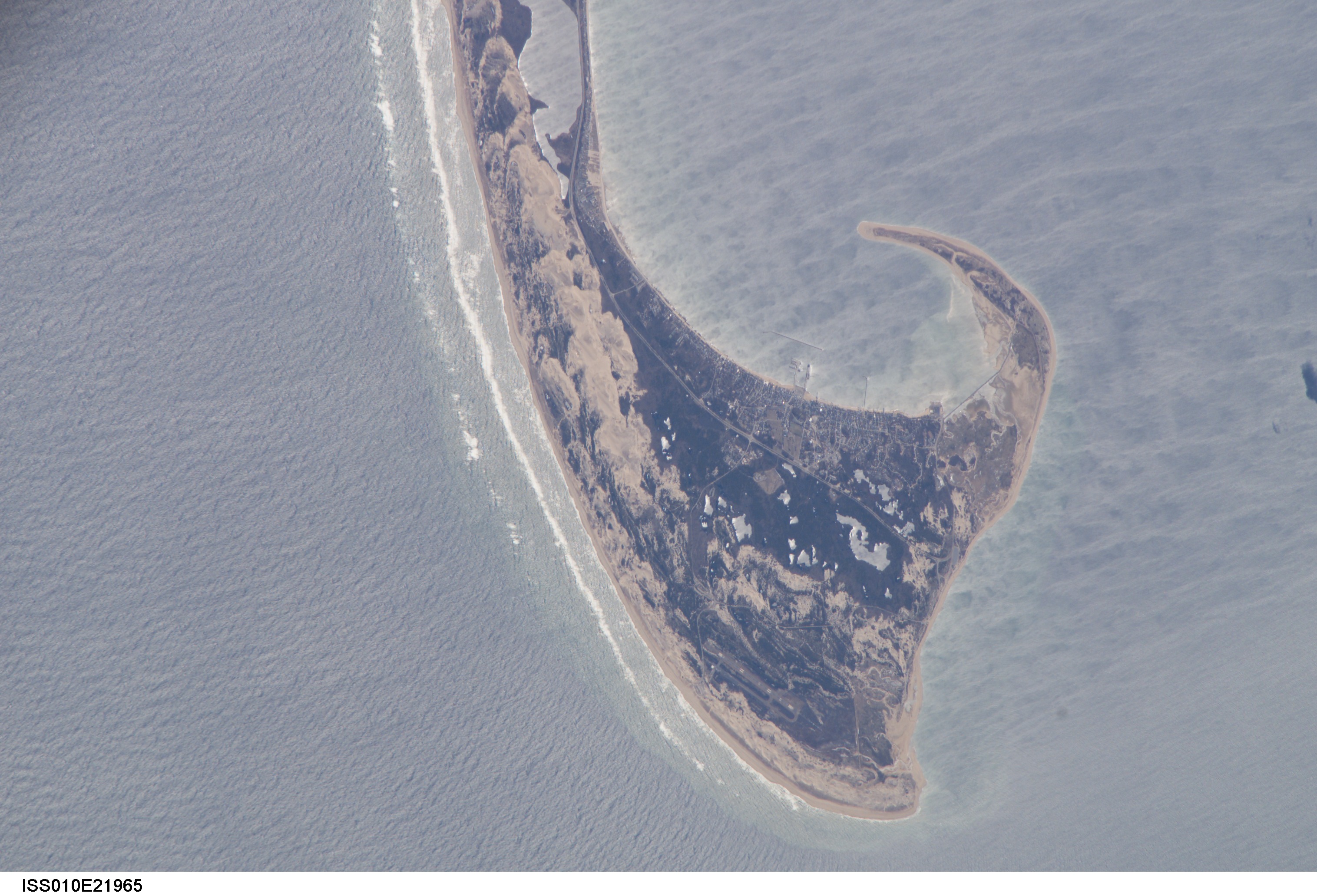
ISS010-E-21965
| NASA Photo ID | ISS010-E-21965 |
| Focal Length | 800mm |
| Date taken | 2005.03.30 |
| Time taken | 15:41:12 GMT |
Resolutions offered for this image:
1000 x 661 pixels 540 x 357 pixels 3032 x 2064 pixels 639 x 435 pixels
1000 x 661 pixels 540 x 357 pixels 3032 x 2064 pixels 639 x 435 pixels
Cloud masks available for this image:
Spacecraft nadir point: 44.7° N, 69.4° W
Photo center point: 42.1° N, 70.1° W
Photo center point by machine learning:
Photo center point: 42.1° N, 70.1° W
Photo center point by machine learning:
Nadir to Photo Center: South
Spacecraft Altitude: 191 nautical miles (354km)
Country or Geographic Name: | USA-MASSACHUSETTS |
Features: | C. COD, DUNES, PROVINCETOWN |
| Features Found Using Machine Learning: | |
Cloud Cover Percentage: | 10 (1-10)% |
Sun Elevation Angle: | 47° |
Sun Azimuth: | 157° |
Camera: | Kodak DCS760c Electronic Still Camera |
Focal Length: | 800mm |
Camera Tilt: | 40 degrees |
Format: | 3060E: 3060 x 2036 pixel CCD, RGBG array |
Film Exposure: | |
| Additional Information | |
| Width | Height | Annotated | Cropped | Purpose | Links |
|---|---|---|---|---|---|
| 1000 pixels | 661 pixels | No | Yes | Earth From Space collection | Download Image |
| 540 pixels | 357 pixels | Yes | Yes | Earth From Space collection | Download Image |
| 3032 pixels | 2064 pixels | No | No | Download Image | |
| 639 pixels | 435 pixels | No | No | Download Image |
Download Packaged File
Download a Google Earth KML for this Image
View photo footprint information
Download a GeoTIFF for this photo
Image Caption: ISS010-E-21965 (30 March 2005) --- The northernmost parts of the Cape Cod National Seashore are featured in this image photographed by an Expedition 10 crewmember on the International Space Station.
