ISS008-E-7600

| NASA Photo ID | ISS008-E-7600 |
| Focal Length | 155mm |
| Date taken | 2003.12.10 |
| Time taken | 08:24:01 GMT |
1000 x 662 pixels 540 x 357 pixels 540 x 334 pixels 3032 x 2064 pixels 639 x 435 pixels

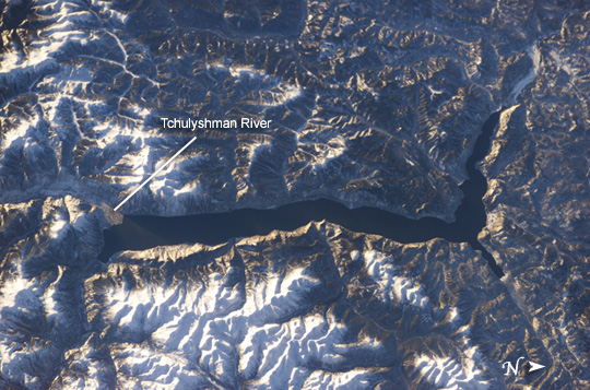

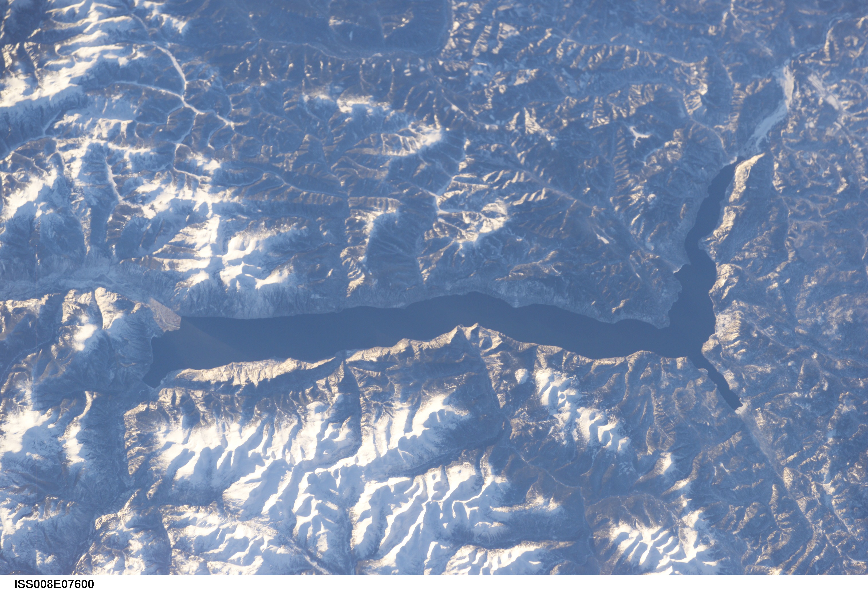
Photo center point: 51.5° N, 87.5° E
Photo center point by machine learning:
Country or Geographic Name: | RUSSIAN FEDERATION |
Features: | LAKE TELETSKOYE |
| Features Found Using Machine Learning: | |
Cloud Cover Percentage: | 10 (1-10)% |
Sun Elevation Angle: | 10° |
Sun Azimuth: | 211° |
Camera: | Kodak DCS760c Electronic Still Camera |
Focal Length: | 155mm |
Camera Tilt: | 26 degrees |
Format: | 3060E: 3060 x 2036 pixel CCD, RGBG array |
Film Exposure: | |
| Additional Information | |
| Width | Height | Annotated | Cropped | Purpose | Links |
|---|---|---|---|---|---|
| 1000 pixels | 662 pixels | No | No | Earth From Space collection | Download Image |
| 540 pixels | 357 pixels | Yes | Yes | Earth From Space collection | Download Image |
| 540 pixels | 334 pixels | Yes | Yes | NASA's Earth Observatory web site | Download Image |
| 3032 pixels | 2064 pixels | No | No | Download Image | |
| 639 pixels | 435 pixels | No | No | Download Image |
Lake Teletskoye, one of Siberia's prime tourist destinations, is a large lake that is nestled in a narrow valley between the snow-capped Al-tyntu (west, at top) and Korbu (east, at bottom) mountain ridges of the Altai Mountains. The lake is nearly 80 kilometers long by 5 kilometers wide and 325 meters deep; it is one of the deepest lakes in the world.
But Lake Teletskoye is more than a large, deep lake. It is located within the 9,000 km2 Altaisky Zapovednik nature reserve, which helps protect its unspoiled waters. The main flow into the lake is the Tchulyshman River, but approximately 70 rivers and hundreds of seasonal streams also flow into the lake. The lake water drains and ultimately flows north to become one of Siberia's great rivers, the Ob. Surrounding the lake are ancient taiga forests. Large lakes such as Teletskoye serve as repositories of regional paleoclimate data including sediment records and atmospheric pollutants. Teletskoye is included as one of Russia's long-term ecological monitoring sites.
