ISS008-E-5095

| NASA Photo ID | ISS008-E-5095 |
| Focal Length | 50mm |
| Date taken | 2003.11.02 |
| Time taken | 17:34:07 GMT |
Resolutions offered for this image:
3032 x 1996 pixels 540 x 355 pixels 1000 x 658 pixels 3032 x 2064 pixels 639 x 435 pixels
3032 x 1996 pixels 540 x 355 pixels 1000 x 658 pixels 3032 x 2064 pixels 639 x 435 pixels

Cloud masks available for this image:
Spacecraft nadir point: 45.9° N, 137.7° W
Photo center point: 36.5° N, 119.5° W
Photo center point by machine learning:
Photo center point: 36.5° N, 119.5° W
Photo center point by machine learning:
Nadir to Photo Center: Southeast
Spacecraft Altitude: 198 nautical miles (367km)
Country or Geographic Name: | USA-CALIFORNIA |
Features: | SMOG, LOWER SAN JOAQUIN VALLEY |
| Features Found Using Machine Learning: | |
Cloud Cover Percentage: | 25 (11-25)% |
Sun Elevation Angle: | 14° |
Sun Azimuth: | 130° |
Camera: | Kodak DCS760c Electronic Still Camera |
Focal Length: | 50mm |
Camera Tilt: | High Oblique |
Format: | 3060E: 3060 x 2036 pixel CCD, RGBG array |
Film Exposure: | |
| Additional Information | |
| Width | Height | Annotated | Cropped | Purpose | Links |
|---|---|---|---|---|---|
| 3032 pixels | 1996 pixels | No | Yes | Earth From Space collection | Download Image |
| 540 pixels | 355 pixels | No | Yes | Earth From Space collection | Download Image |
| 1000 pixels | 658 pixels | Yes | Yes | NASA's Earth Observatory web site | Download Image |
| 3032 pixels | 2064 pixels | No | No | Download Image | |
| 639 pixels | 435 pixels | No | No | Download Image |
Download Packaged File
Download a Google Earth KML for this Image
View photo footprint information
Download a GeoTIFF for this photo
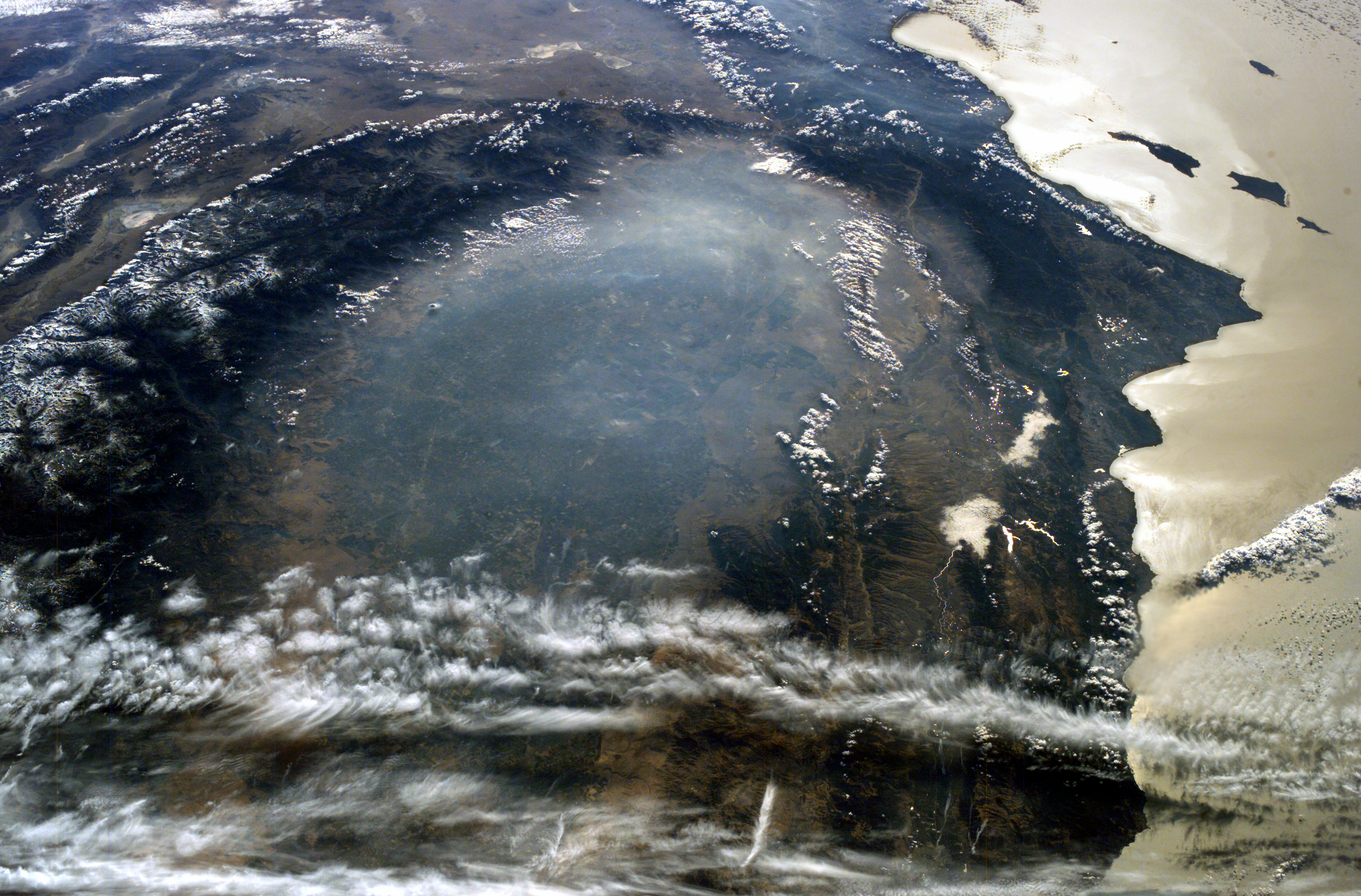
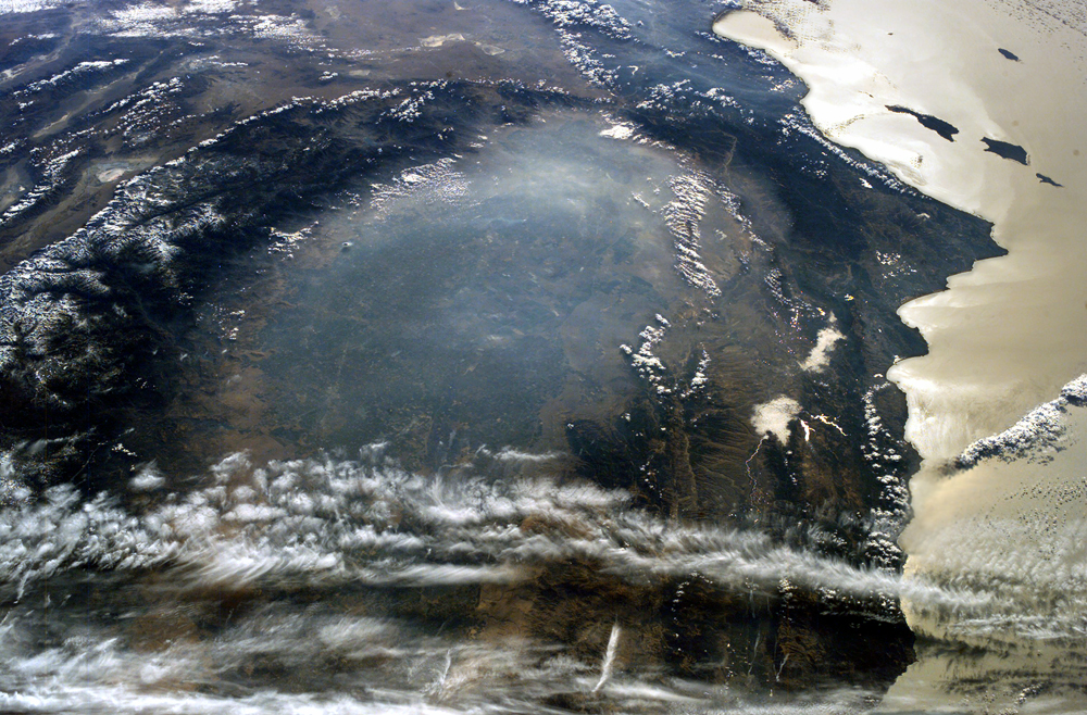
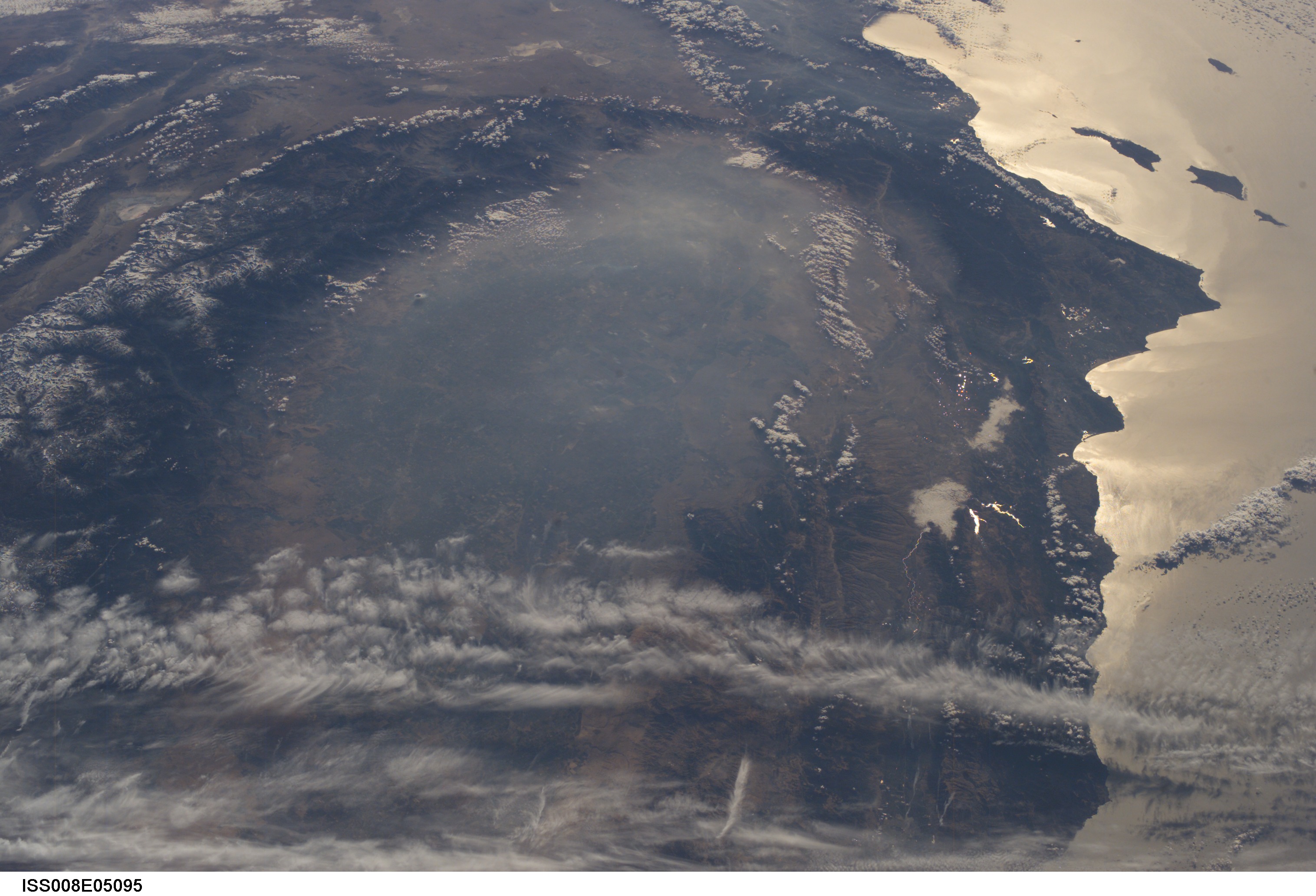
Image Caption: The smoky remnants of October's devastating fires still filled the southern California Central Valley on November 2, 2003. This "upside down" digital photograph was taken from the International Space Station from a position over the Pacific Northwest looking southward toward southern California.
At the time this image was acquired, the fires had finally been brought under control, but ash and smoke remained trapped in the atmosphere above the valley, a bowl of land ringed by the Sierra Nevada Mountains to the east (left) and the Coast Range Mountains to the west (right). The band of clouds at the bottom of the image is at an altitude above the mountains. The amber color in the sunglint over the Pacific coastal waters (right) also indicates the presence of smoke. At the top center of the image, the Mojave Desert comes to a point at the southern end of the Central Valley.
This image is part of a series of images of the California fires taken by the ISS crew. Just a week earlier, the astronauts observed and documented the California fires at their worst.
