ISS008-E-21752

| NASA Photo ID | ISS008-E-21752 |
| Focal Length | 200mm |
| Date taken | 2004.04.16 |
| Time taken | 11:57:24 GMT |
Resolutions offered for this image:
3032 x 2064 pixels 1000 x 1163 pixels 540 x 628 pixels 540 x 628 pixels 3032 x 2064 pixels 639 x 435 pixels
3032 x 2064 pixels 1000 x 1163 pixels 540 x 628 pixels 540 x 628 pixels 3032 x 2064 pixels 639 x 435 pixels
Cloud masks available for this image:
Spacecraft nadir point: 41.8° N, 31.0° E
Photo center point: 41.0° N, 29.0° E
Photo center point by machine learning:
Photo center point: 41.0° N, 29.0° E
Photo center point by machine learning:
Nadir to Photo Center: West
Spacecraft Altitude: 193 nautical miles (357km)
Camera: | Kodak DCS760c Electronic Still Camera |
Focal Length: | 200mm |
Camera Tilt: | 34 degrees |
Format: | 3060E: 3060 x 2036 pixel CCD, RGBG array |
Film Exposure: | |
| Additional Information | |
| Width | Height | Annotated | Cropped | Purpose | Links |
|---|---|---|---|---|---|
| 3032 pixels | 2064 pixels | No | No | NASA's Earth Observatory web site | Download Image |
| 1000 pixels | 1163 pixels | No | Yes | NASA's Earth Observatory web site | Download Image |
| 540 pixels | 628 pixels | Yes | Yes | NASA's Earth Observatory web site | Download Image |
| 540 pixels | 628 pixels | Yes | Yes | NASA's Earth Observatory web site | Download Image |
| 3032 pixels | 2064 pixels | No | No | Download Image | |
| 639 pixels | 435 pixels | No | No | Download Image |
Download Packaged File
Download a Google Earth KML for this Image
View photo footprint information
Download a GeoTIFF for this photo
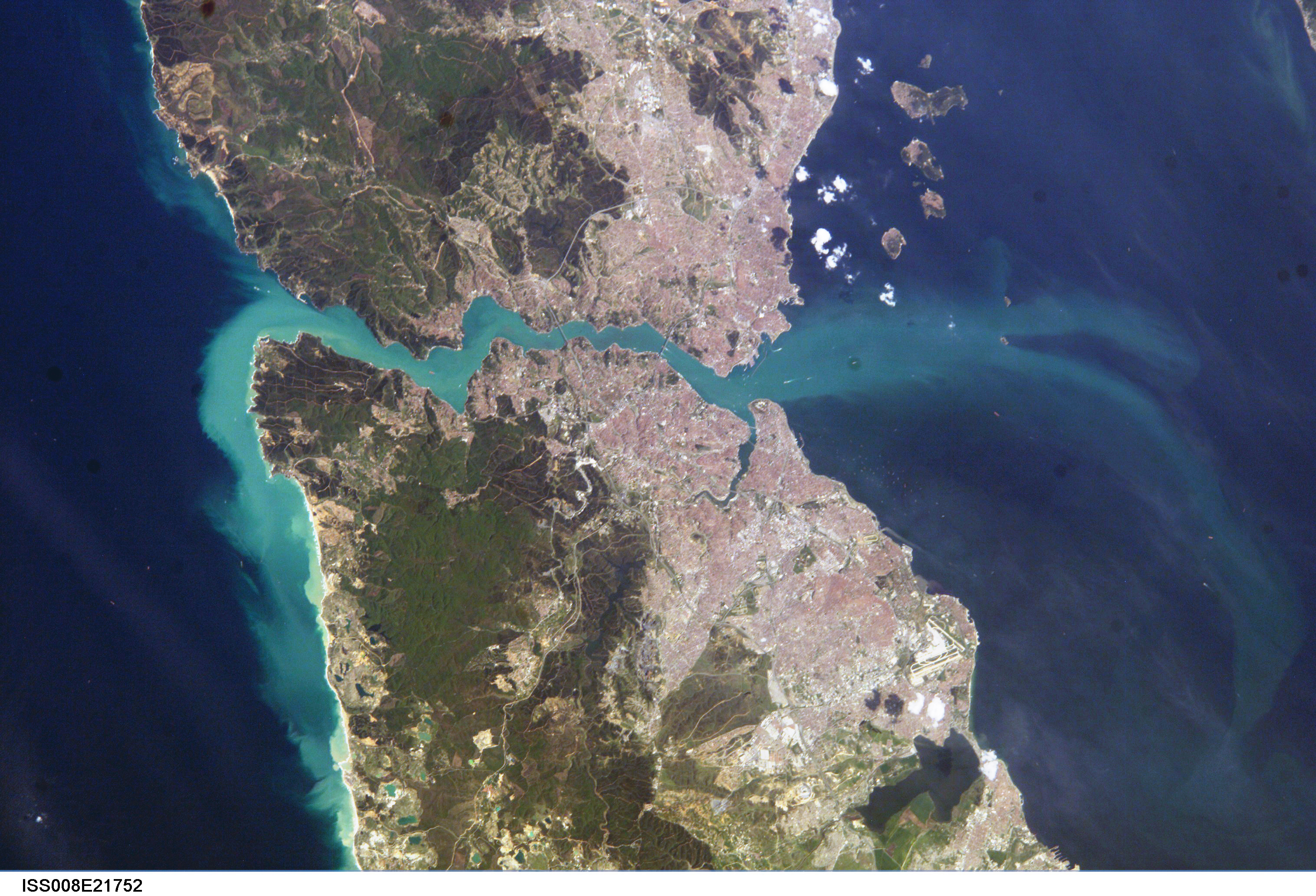
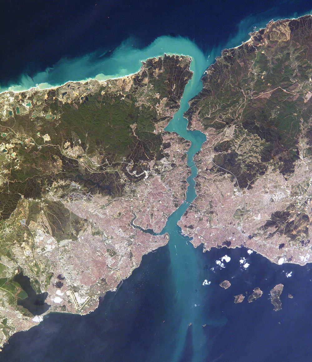
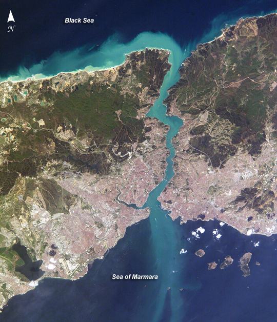
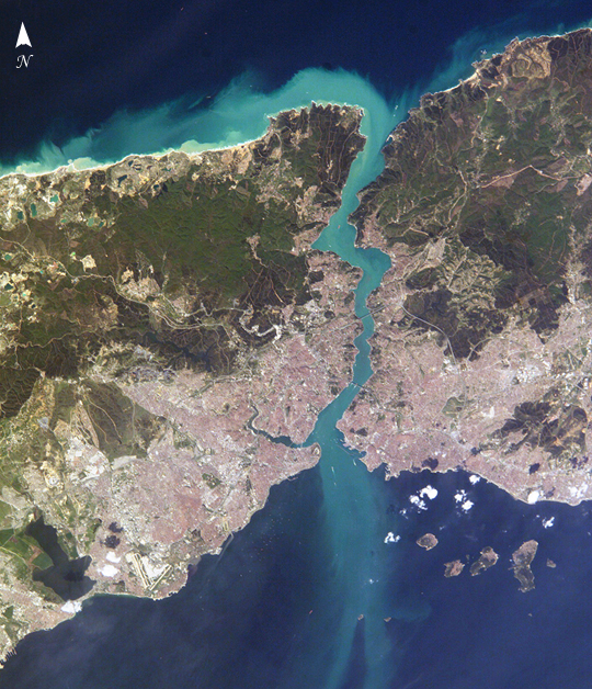
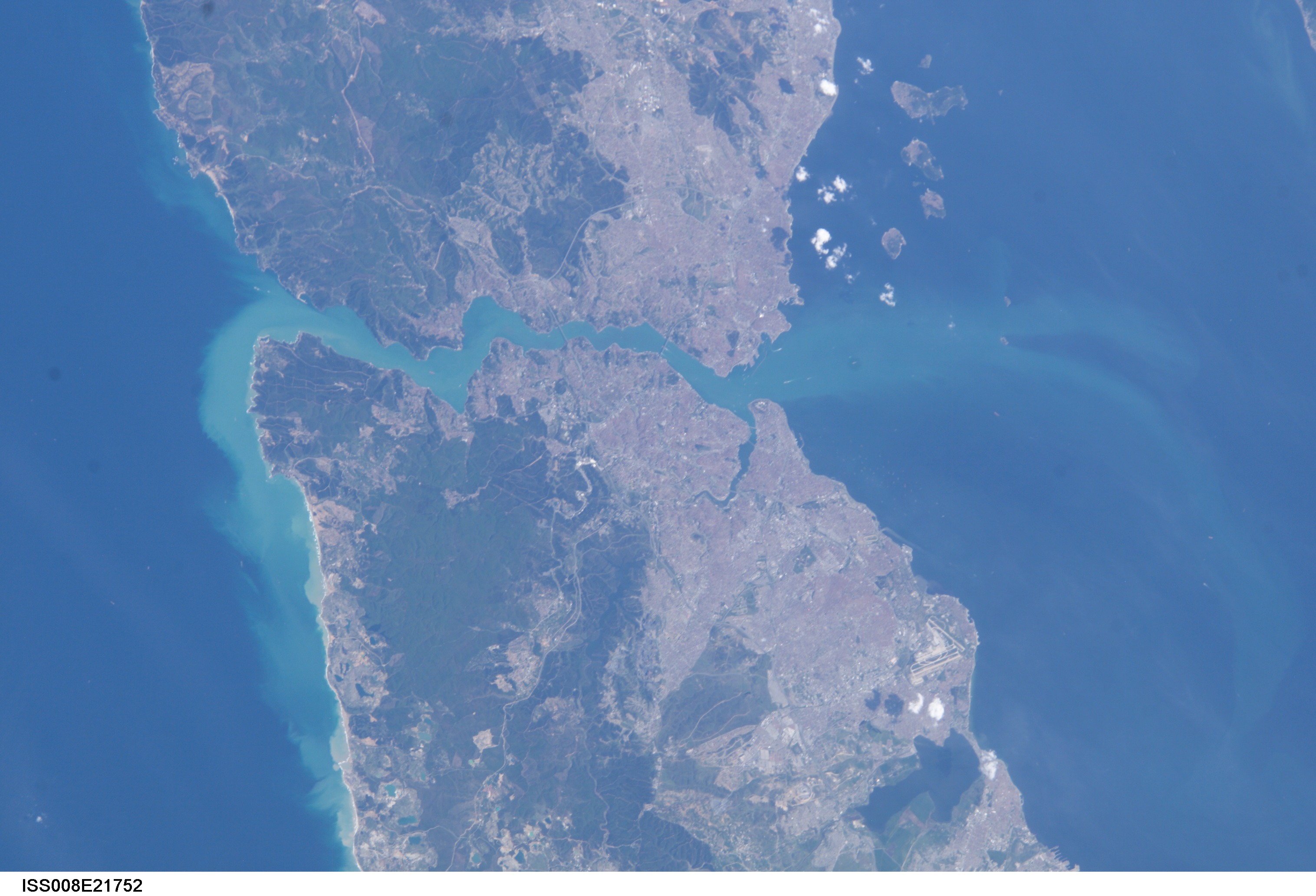
Image Caption: Istanbul, Turkey: The Crossroads of Europe and Asia:
This metropolis of 15 million people occupies both sides of the entrance to the narrow, 20-mile long Bosporus Strait connecting the Mediterranean and Sea of Marmara (south) to the Black Sea (north). From its founding as Byzantium by the Greeks in 600 B.C., this strategically located city has been a focus of maritime trade and commerce as well as an outpost and threshold for cultural exchange and conflict between Europe and Asia. The modern city's layout and architecture show the influences of both the Roman-Byzantine era when it became Constantinople, the world's first Christian capital, as well as that of the conquering Ottoman Turks, from 1453, when it became the seat of the world's largest Muslim Empire. Today Istanbul is Turkey's economic capital and home to nearly half the country's wealth.
This digital camera image was taken by the crew of the International Space Station on April 16, 2004. When this image was taken, strong currents carried turbid coastal waters from the Black Sea through the Strait and into the Sea of Marmara. The rugged uplands to the north of the city are forested and contain vital reservoirs. Note Ataturk airport southwest of the city near the bottom of the image, the picturesque Prince Islands in the Sea of Marmara, and the sinuous waterway and harbor on the western shore known as the Golden Horn.
