ISS008-E-15491
| NASA Photo ID | ISS008-E-15491 |
| Focal Length | 400mm |
| Date taken | 2004.02.12 |
| Time taken | 19:02:23 GMT |
Resolutions offered for this image:
3032 x 2004 pixels 1000 x 661 pixels 1000 x 663 pixels 540 x 539 pixels 540 x 814 pixels 3032 x 2064 pixels 639 x 435 pixels
3032 x 2004 pixels 1000 x 661 pixels 1000 x 663 pixels 540 x 539 pixels 540 x 814 pixels 3032 x 2064 pixels 639 x 435 pixels
Cloud masks available for this image:
Spacecraft nadir point: 49.0° N, 118.8° W
Photo center point: 49.0° N, 122.0° W
Photo center point by machine learning:
Photo center point: 49.0° N, 122.0° W
Photo center point by machine learning:
Nadir to Photo Center: West
Spacecraft Altitude: 194 nautical miles (359km)
Camera: | Kodak DCS760c Electronic Still Camera |
Focal Length: | 400mm |
Camera Tilt: | 45 degrees |
Format: | 3060E: 3060 x 2036 pixel CCD, RGBG array |
Film Exposure: | |
| Additional Information | |
| Width | Height | Annotated | Cropped | Purpose | Links |
|---|---|---|---|---|---|
| 3032 pixels | 2004 pixels | No | No | Earth From Space collection | Download Image |
| 1000 pixels | 661 pixels | No | Yes | NASA's Earth Observatory web site | Download Image |
| 1000 pixels | 663 pixels | No | NASA's Earth Observatory web site | Download Image | |
| 540 pixels | 539 pixels | Yes | Yes | NASA's Earth Observatory web site | Download Image |
| 540 pixels | 814 pixels | Yes | Yes | NASA's Earth Observatory web site | Download Image |
| 3032 pixels | 2064 pixels | No | No | Download Image | |
| 639 pixels | 435 pixels | No | No | Download Image |
Download Packaged File
Download a Google Earth KML for this Image
View photo footprint information
Download a GeoTIFF for this photo
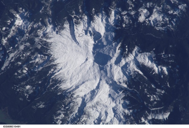
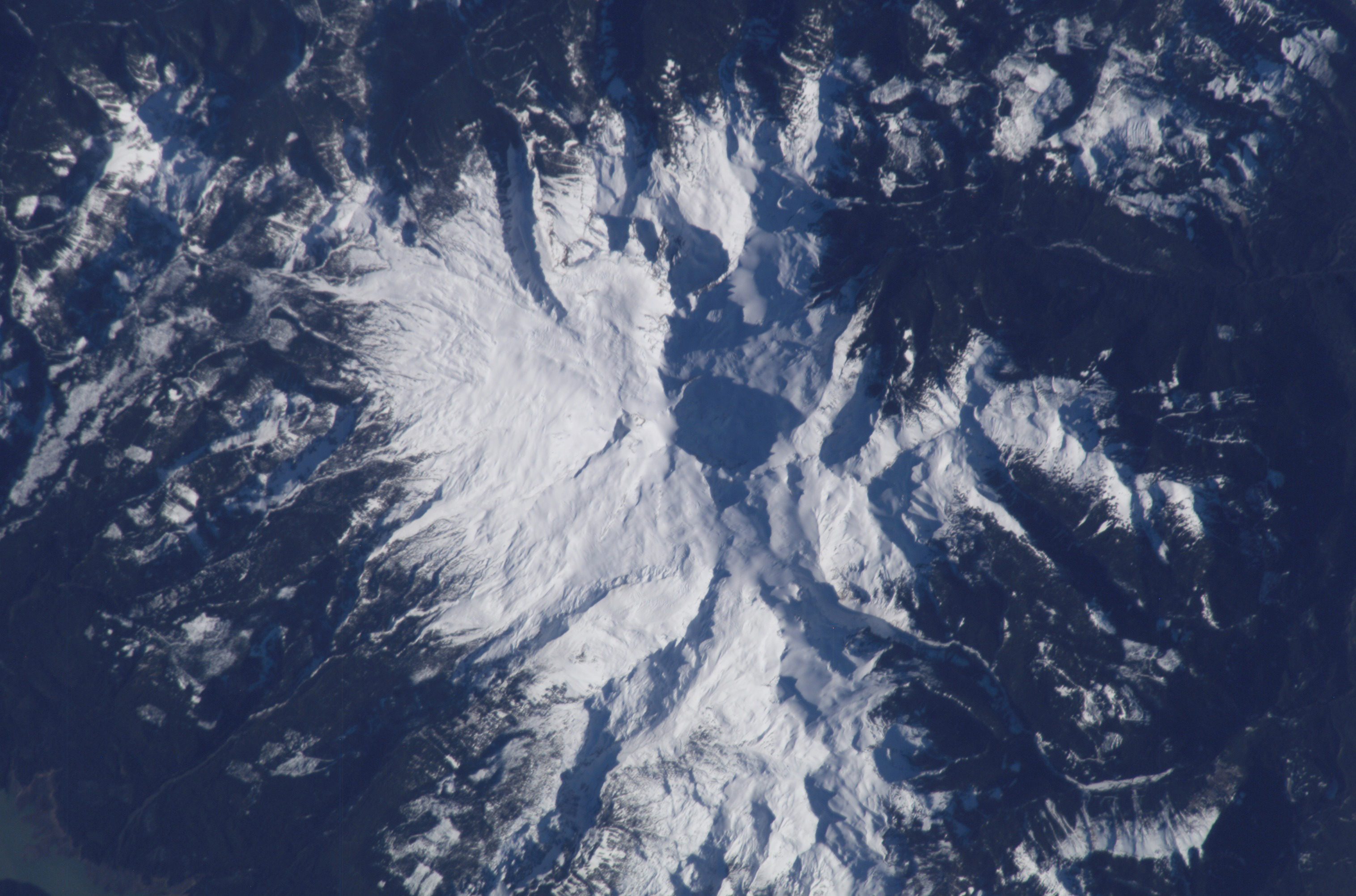
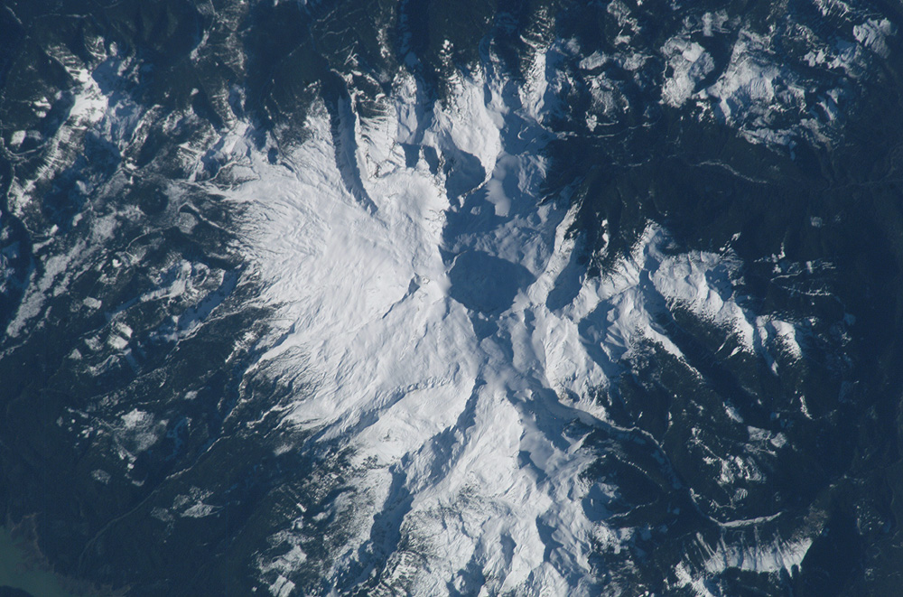
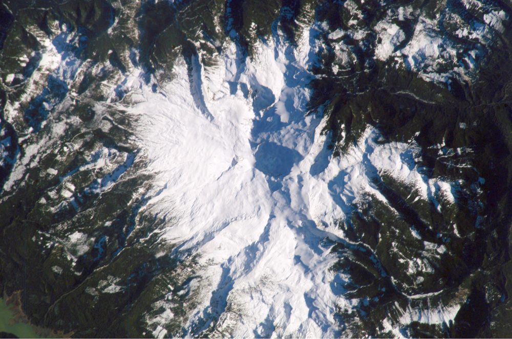
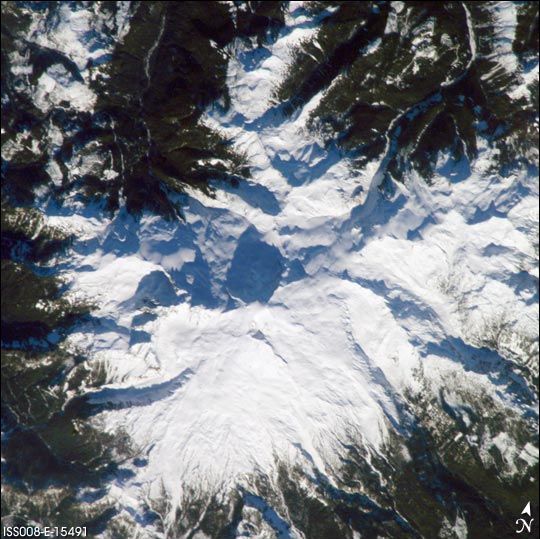
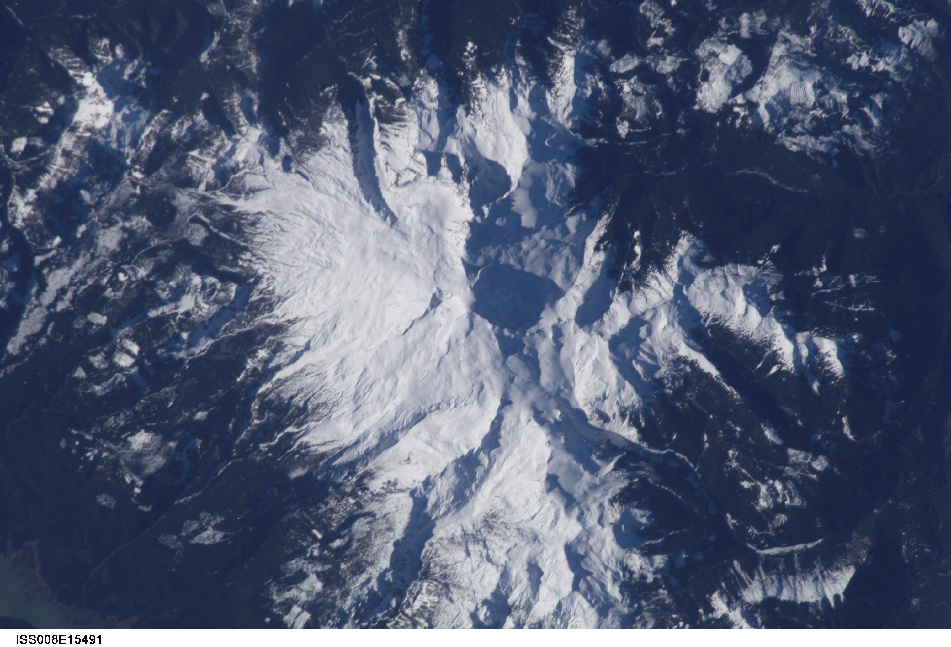
Image Caption: Mount Baker, Washington--a Hazardous Beauty:
The Cascade Range is an arc of volcanoes that extends from southwestern British Columbia to northern California. One of the six major composite volcanoes (formed by alternating layers of extruded lava and compacted ash) is Mount Baker in northern Washington. Close to the Canadian border, Mount Baker is about 85 miles north-northeast of Seattle and 65 miles southeast of Vancouver, British Columbia. This beautiful, snow-capped peak dominates the skyline from Bellingham, Washington to Vancouver, and offers multiple recreational opportunities to visitors and locals alike.
The life-threatening and destructive hazards of composite volcanoes include their tephra (ejected ash and rocks), lava flows, lahars (a mudslide composed of volcanic ash and debris saturated with water, often from glacial melt), and debris avalanches. Modern Mount Baker itself is a relatively young volcano (10,000-30,000 years old), but no eruptions have been observed since the mid-1800s. However, a steam plume is often observed from Sherman Crater at the summit (10,778 feet), occasionally alarming local residents. A marked increase in plume activity accompanied by unusual snowmelt led to the temporary closure of Baker Lake by the National Park Service in 1975.
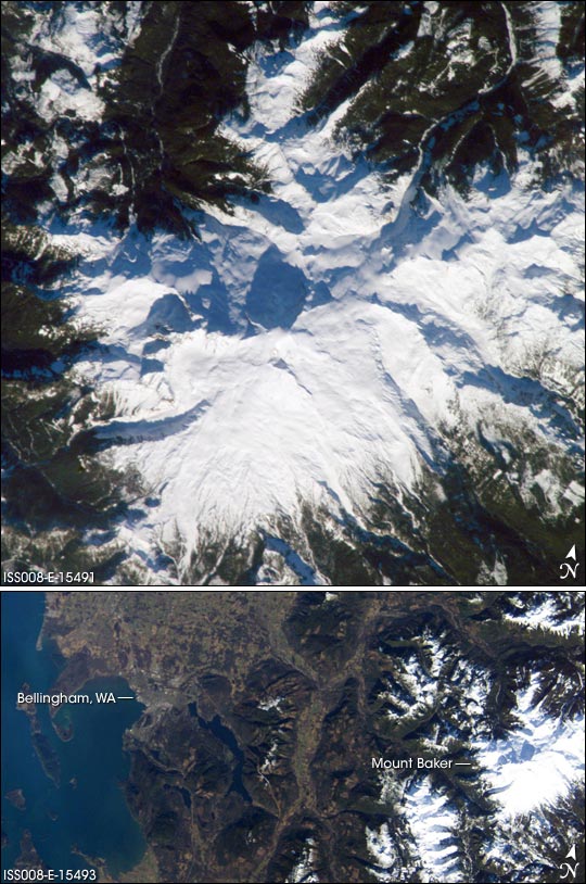
This two photograph was taken from the International Space Station. This view provides details of the rough terrain near the summit and on the upper flanks, while ISS008-E-15493 provides a regional picture of Mount Baker, showing its proximity to Bellingham.
The Cascade Range is an arc of volcanoes that extends from southwestern British Columbia to northern California. One of the six major composite volcanoes (formed by alternating layers of extruded lava and compacted ash) is Mount Baker in northern Washington. Close to the Canadian border, Mount Baker is about 85 miles north-northeast of Seattle and 65 miles southeast of Vancouver, British Columbia. This beautiful, snow-capped peak dominates the skyline from Bellingham, Washington to Vancouver, and offers multiple recreational opportunities to visitors and locals alike.
The life-threatening and destructive hazards of composite volcanoes include their tephra (ejected ash and rocks), lava flows, lahars (a mudslide composed of volcanic ash and debris saturated with water, often from glacial melt), and debris avalanches. Modern Mount Baker itself is a relatively young volcano (10,000-30,000 years old), but no eruptions have been observed since the mid-1800s. However, a steam plume is often observed from Sherman Crater at the summit (10,778 feet), occasionally alarming local residents. A marked increase in plume activity accompanied by unusual snowmelt led to the temporary closure of Baker Lake by the National Park Service in 1975.
This two photograph was taken from the International Space Station. This view provides details of the rough terrain near the summit and on the upper flanks, while ISS008-E-15493 provides a regional picture of Mount Baker, showing its proximity to Bellingham.
