ISS007-E-7878
| NASA Photo ID | ISS007-E-7878 |
| Focal Length | 50mm |
| Date taken | 2003.06.22 |
| Time taken | 13:32:45 GMT |
Resolutions offered for this image:
1024 x 668 pixels 540 x 352 pixels 540 x 405 pixels 3032 x 2064 pixels 6144 x 4068 pixels 639 x 435 pixels
1024 x 668 pixels 540 x 352 pixels 540 x 405 pixels 3032 x 2064 pixels 6144 x 4068 pixels 639 x 435 pixels


Cloud masks available for this image:
Spacecraft nadir point: 19.2° N, 43.8° E
Photo center point: 17.5° N, 40.5° E
Photo center point by machine learning:
Photo center point: 17.5° N, 40.5° E
Photo center point by machine learning:
Nadir to Photo Center: Southwest
Spacecraft Altitude: 210 nautical miles (389km)
Country or Geographic Name: | SAUDI ARABIA |
Features: | THUNDERSTORM, DUST, RED SEA |
| Features Found Using Machine Learning: | |
Cloud Cover Percentage: | 50 (26-50)% |
Sun Elevation Angle: | 28° |
Sun Azimuth: | 287° |
Camera: | Kodak DCS760c Electronic Still Camera |
Focal Length: | 50mm |
Camera Tilt: | 47 degrees |
Format: | 3060E: 3060 x 2036 pixel CCD, RGBG array |
Film Exposure: | |
| Additional Information | |
| Width | Height | Annotated | Cropped | Purpose | Links |
|---|---|---|---|---|---|
| 1024 pixels | 668 pixels | Photographic Highlights | Download Image | ||
| 540 pixels | 352 pixels | Photographic Highlights | Download Image | ||
| 540 pixels | 405 pixels | Yes | Yes | NASA's Earth Observatory web site | Download Image |
| 3032 pixels | 2064 pixels | No | No | Download Image | |
| 6144 pixels | 4068 pixels | No | No | Presentation | Download Image |
| 639 pixels | 435 pixels | No | No | Download Image |
Download Packaged File
Download a Google Earth KML for this Image
View photo footprint information
Download a GeoTIFF for this photo
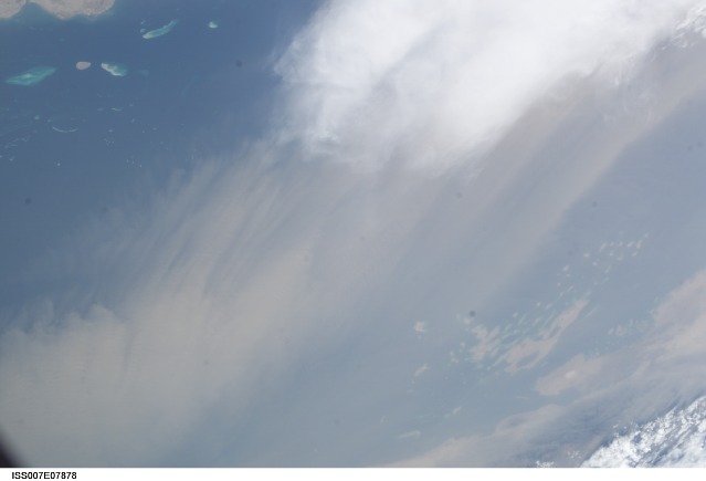
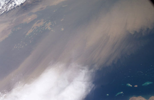
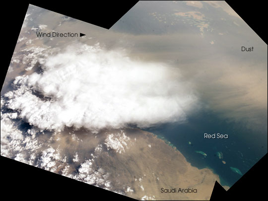
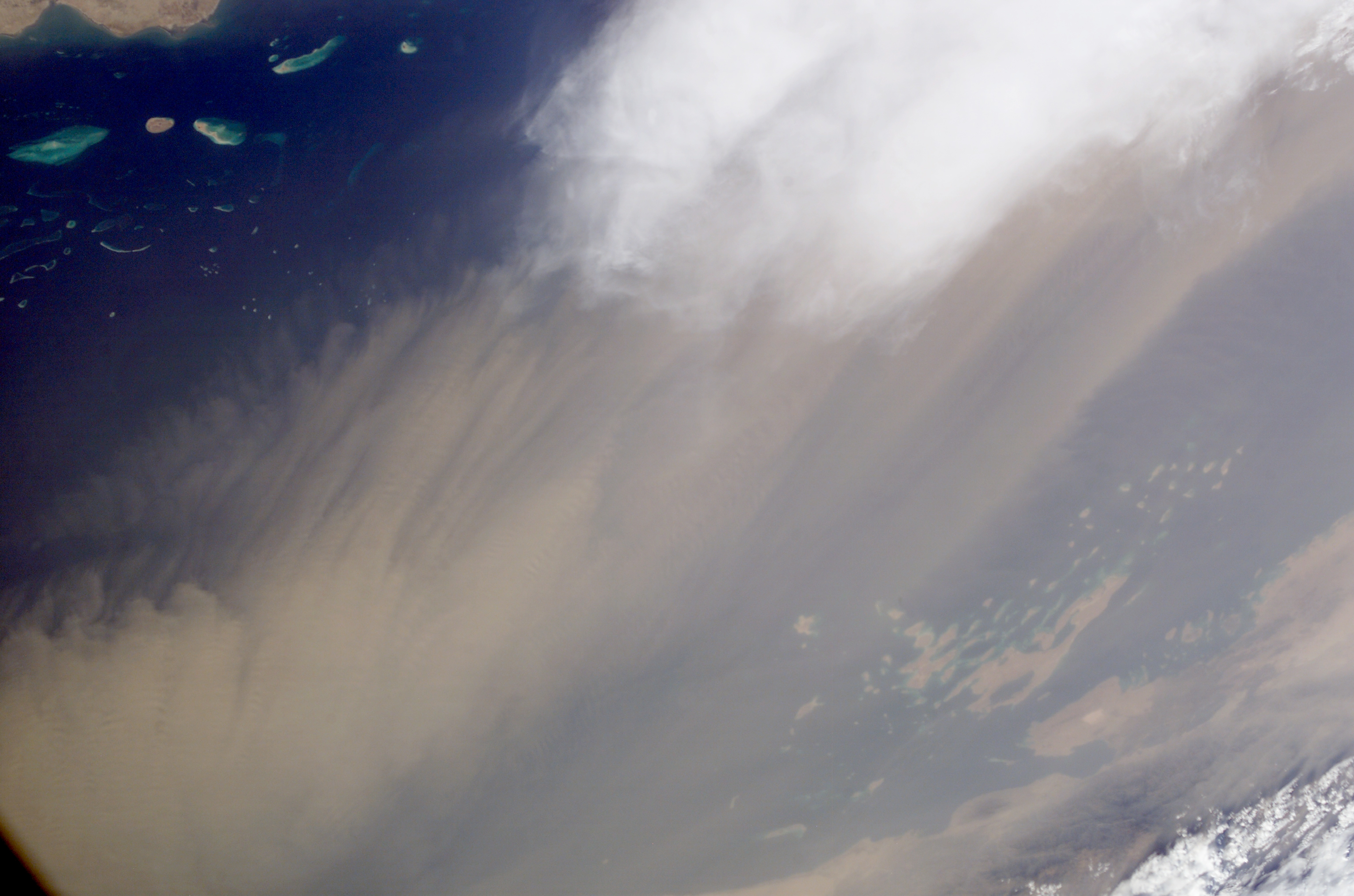
Image Caption: Which came first, the clouds or the dust? Both clouds and dust can be important factors influencing regional climate, and they are frequently observed together.
In this view taken from the International Space Station, two images were merged to create a mosaic of a dust storm and thunderstorm over the Red Sea. By interpreting the mosaic, we make a guess about which came first.
Saudi Arabia's southernmost coast facing the Red Sea appears in the foreground, and the African side of the Red Sea in Eritrea appears at the top of this view, slightly obscured under a light screen of dust. Wind directions on the day this view was taken (June 22, 2003) are difficult to interpret. Southeasterly flow from the Arabian Sea, related to monsoonal wind fields, seems to be dominant, and probably explains the more distant dust at the top of the view. As the southeasterly winds ascend over the hills that flank that Red Sea (center left), a local thunderstorm has developed. Downdrafts from the dying storm probably generated at least some of the dust seen out over the Red Sea.
It is common to see dust related to thunderstorms in this way. At a broader scale, however, the opposite is more often true: regional dust in the atmosphere tends to reduce cloud development and thus rainfall. The southern Arabian Peninsula is a center of dust generation in global terms and dust clouds are often imaged over the Red Sea by astronauts. Dust is transported in both directions across the Sea, from Arabian and from Saharan sources. Astronaut observations of dust and clouds provide useful information about their interactions.
