ISS007-E-16030

| NASA Photo ID | ISS007-E-16030 |
| Focal Length | 16mm |
| Date taken | 2003.10.01 |
| Time taken | 22:28:54 GMT |
Cloud masks available for this image:
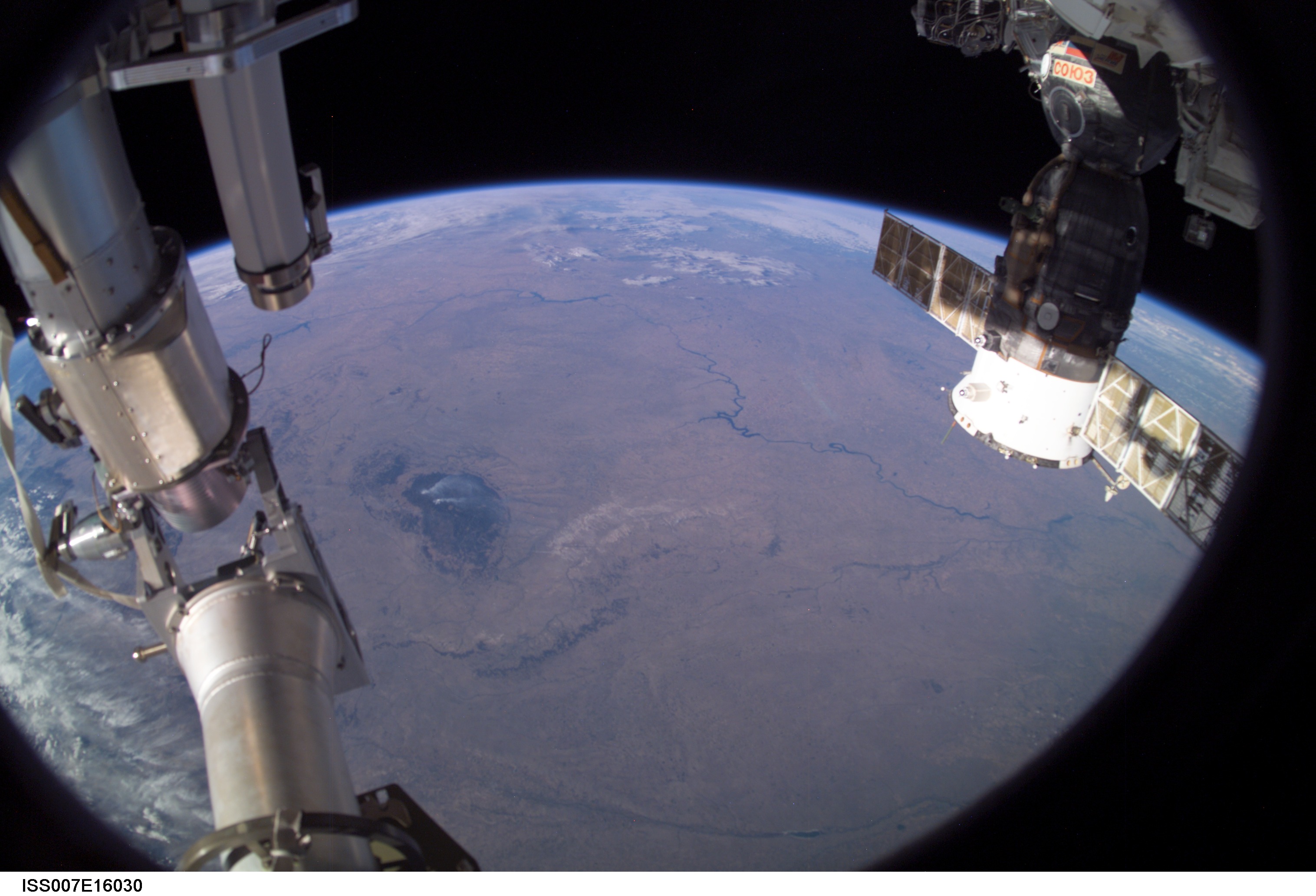
Spacecraft nadir point: 43.0° N, 97.9° W
Photo center point: 44.5° N, 102.0° W
Photo center point by machine learning:
Photo center point: 44.5° N, 102.0° W
Photo center point by machine learning:
Nadir to Photo Center: West
Spacecraft Altitude: 202 nautical miles (374km)
Country or Geographic Name: | USA-SOUTH DAKOTA |
Features: | PAN-GREAT PLAINS, BLACK HILLS |
| Features Found Using Machine Learning: | PAN- |
Cloud Cover Percentage: | 50 (26-50)% |
Sun Elevation Angle: | 18° |
Sun Azimuth: | 248° |
Camera: | Kodak DCS760c Electronic Still Camera |
Focal Length: | 16mm |
Camera Tilt: | 52 degrees |
Format: | 3060E: 3060 x 2036 pixel CCD, RGBG array |
Film Exposure: | |
| Additional Information | |
| Width | Height | Annotated | Cropped | Purpose | Links |
|---|---|---|---|---|---|
| 3032 pixels | 2064 pixels | No | No | Download Image | |
| 639 pixels | 435 pixels | No | No | Download Image |
Download Packaged File
Download a Google Earth KML for this Image
View photo footprint information
Download a GeoTIFF for this photo
Image Caption: ISS007-E-16030 (1 October 2003) --- This Earth horizon view, featuring the Great Plains and the Black Hills of South Dakota, was photographed by an Expedition 7 crewmember onboard the International Space Station (ISS). A Soyuz spacecraft, docked to the Station, is visible at right.
