ISS007-E-15222
| NASA Photo ID | ISS007-E-15222 |
| Focal Length | 400mm |
| Date taken | 2003.09.22 |
| Time taken | 20:11:34 GMT |
Resolutions offered for this image:
463 x 540 pixels 659 x 768 pixels 3032 x 2064 pixels 540 x 540 pixels 1000 x 1164 pixels 3032 x 2064 pixels 6144 x 4068 pixels 639 x 435 pixels
463 x 540 pixels 659 x 768 pixels 3032 x 2064 pixels 540 x 540 pixels 1000 x 1164 pixels 3032 x 2064 pixels 6144 x 4068 pixels 639 x 435 pixels
Cloud masks available for this image:
Spacecraft nadir point: 18.2° S, 70.9° W
Photo center point: 17.5° S, 70.5° W
Photo center point by machine learning:
Photo center point: 17.5° S, 70.5° W
Photo center point by machine learning:
Nadir to Photo Center: Northeast
Spacecraft Altitude: 206 nautical miles (382km)
Country or Geographic Name: | PERU |
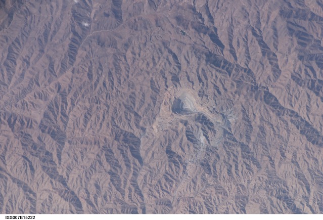
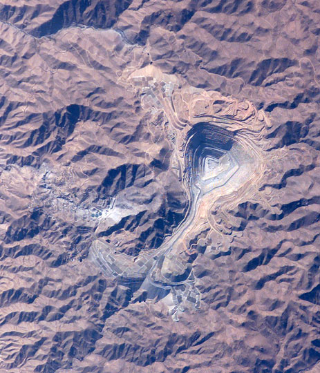
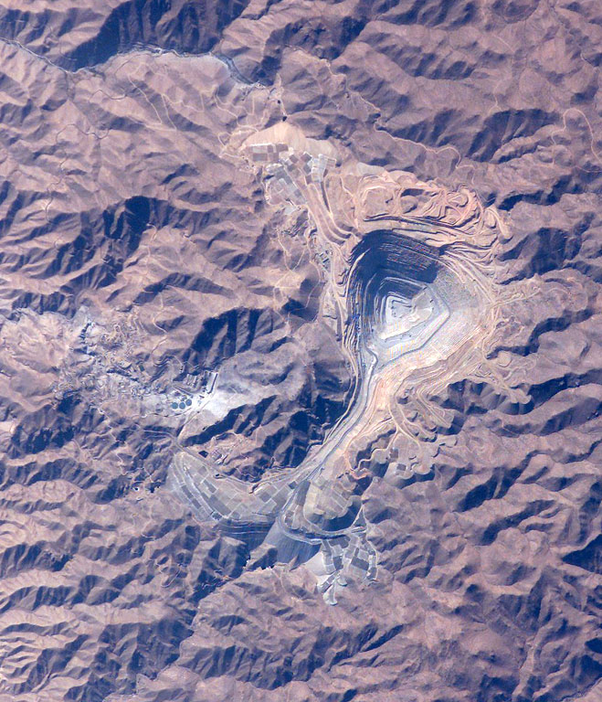
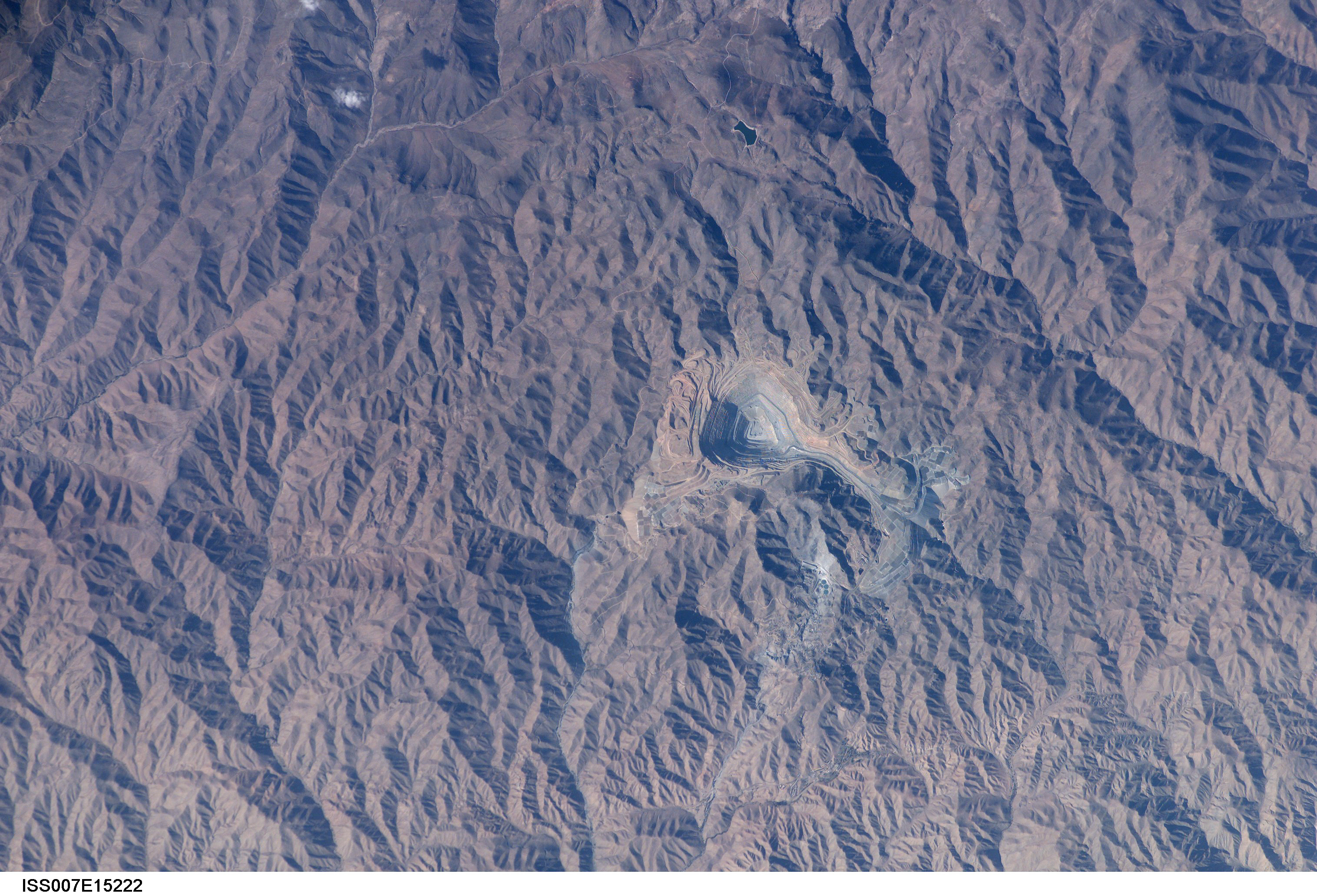
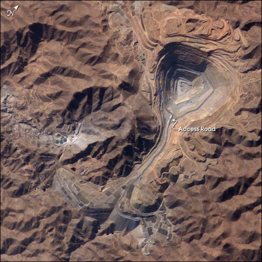
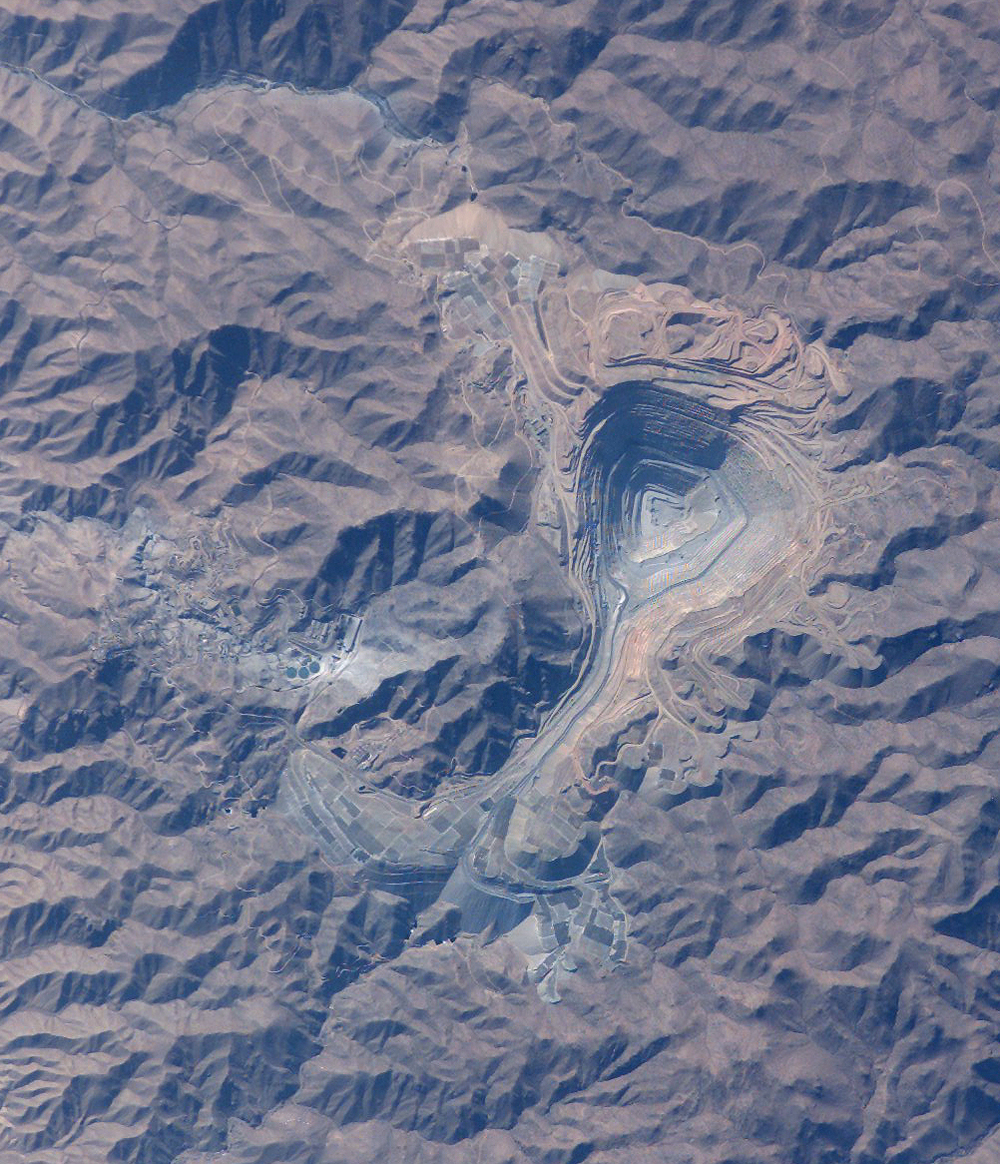
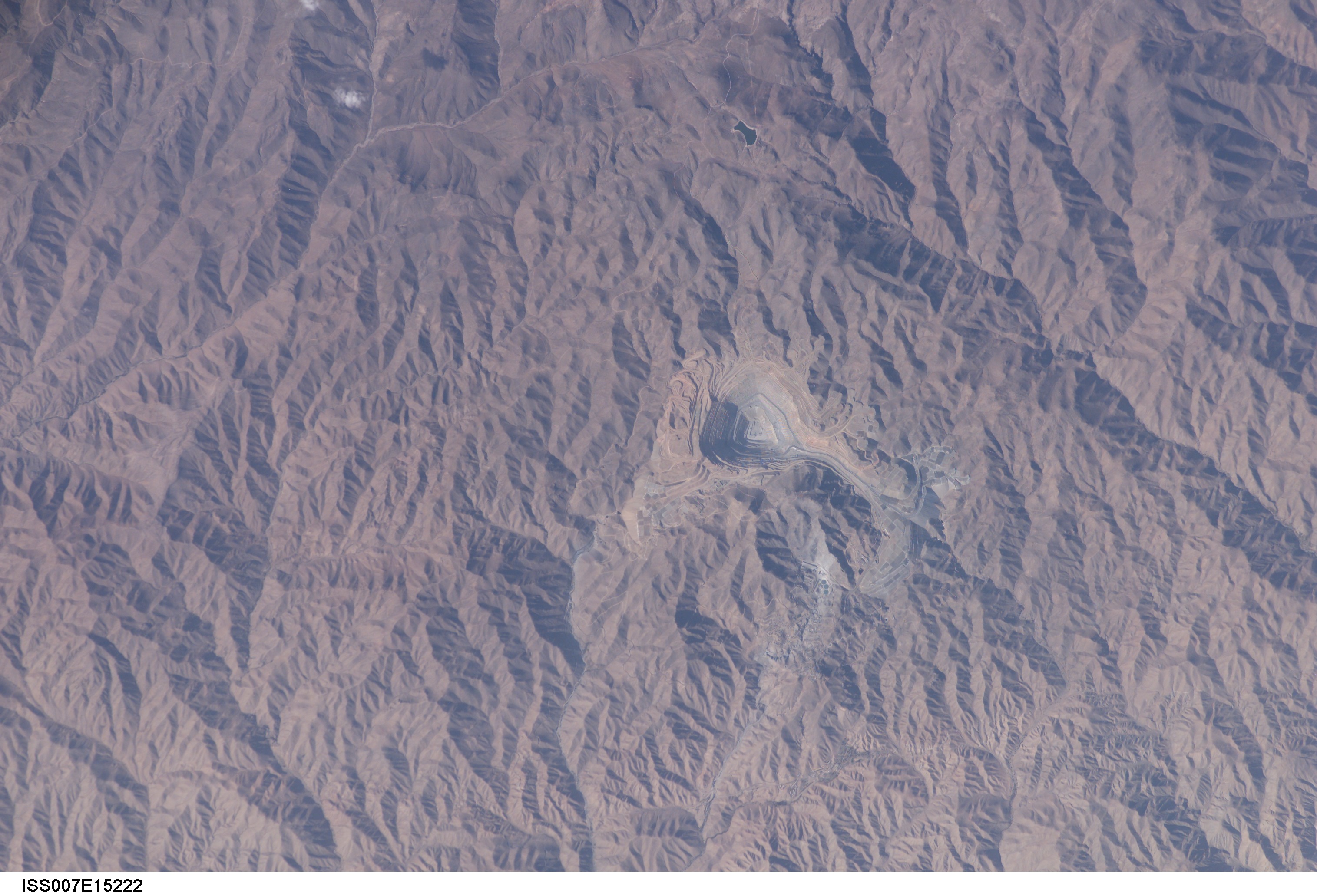
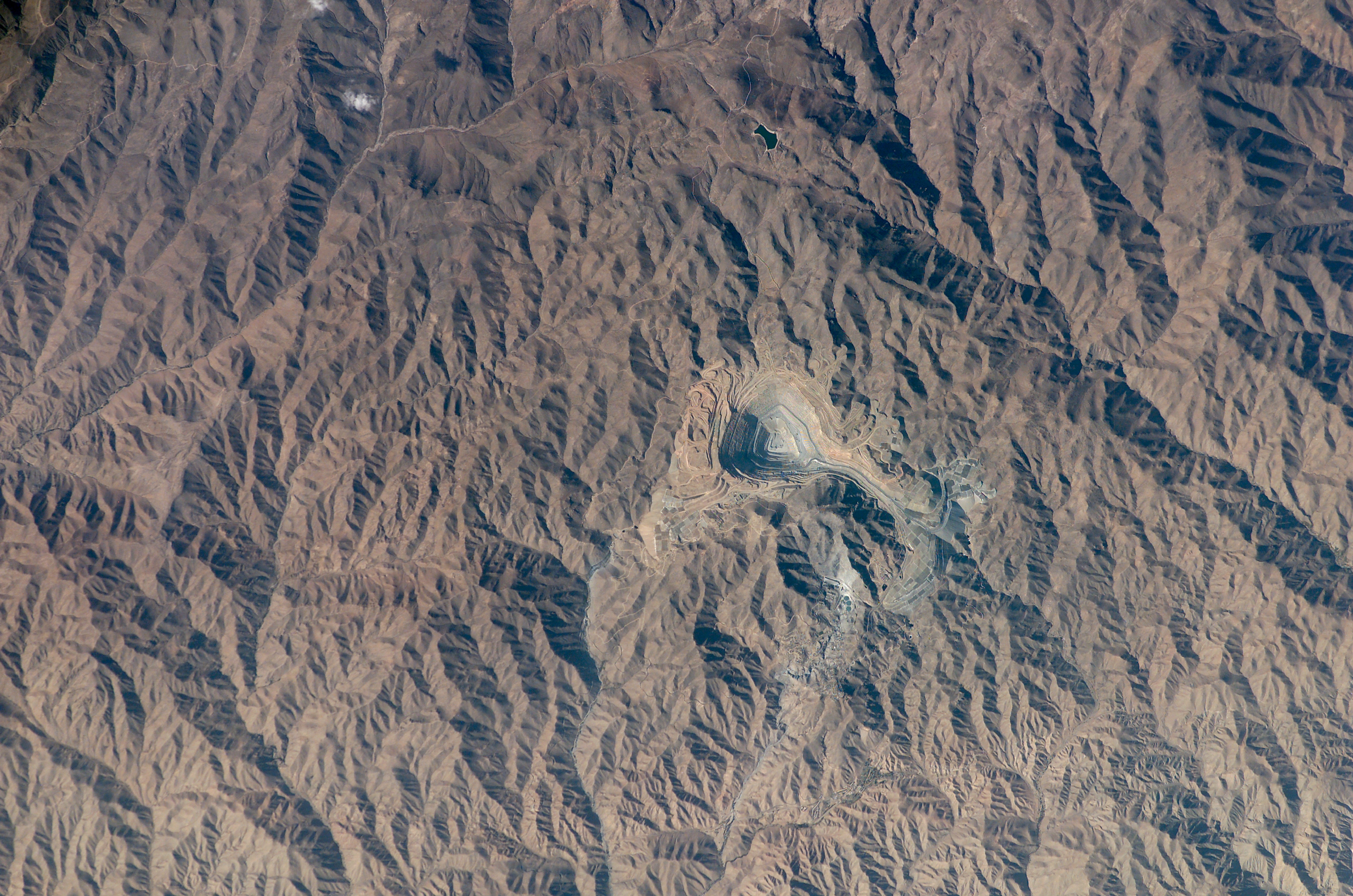
Features: | TOQUEPALA OPEN PIT MINE |
| Features Found Using Machine Learning: | |
Cloud Cover Percentage: | 10 (1-10)% |
Sun Elevation Angle: | 34° |
Sun Azimuth: | 283° |
Camera: | Kodak DCS760c Electronic Still Camera |
Focal Length: | 400mm |
Camera Tilt: | 13 degrees |
Format: | 3060E: 3060 x 2036 pixel CCD, RGBG array |
Film Exposure: | |
| Additional Information | |
| Width | Height | Annotated | Cropped | Purpose | Links |
|---|---|---|---|---|---|
| 463 pixels | 540 pixels | Photographic Highlights | Download Image | ||
| 659 pixels | 768 pixels | Photographic Highlights | Download Image | ||
| 3032 pixels | 2064 pixels | No | No | Earth From Space collection | Download Image |
| 540 pixels | 540 pixels | Yes | Yes | Earth From Space collection | Download Image |
| 1000 pixels | 1164 pixels | No | Yes | NASA's Earth Observatory web site | Download Image |
| 3032 pixels | 2064 pixels | No | No | Download Image | |
| 6144 pixels | 4068 pixels | No | No | Presentation | Download Image |
| 639 pixels | 435 pixels | No | No | Download Image |
Download Packaged File
Download a Google Earth KML for this Image
View photo footprint information
Download a GeoTIFF for this photo
Image Caption: Toquepala Copper Mine, Southern Peru: The rugged, mineral-rich Andes support some of the world's biggest mines (gold, silver, copper, and more). This image looks down the bull's-eye of Peru's Toquepala copper mine, a steep sided and stepped open-pit mine. Mid-afternoon sunlight on the arid slopes of the central Andes mountains provides an accent to the mine contours. At the surface the open pit is 6.5 km across and it descends more than 3000 m into the earth. A dark line on the wall of the pit is the main access road to the bottom. Spoil dumps of material mined from the pit are arranged in tiers along the northwest lip of the pit. Numerous angular leaching fields appear lower right, and the railroad to the coast is a line that exits the image center left. The railroad was built to export Toquepala's copper and connects the coastal port of Ilo, 95 km to the southwest.
