ISS007-E-14419

| NASA Photo ID | ISS007-E-14419 |
| Focal Length | 50mm |
| Date taken | 2003.09.04 |
| Time taken | 15:26:19 GMT |
Resolutions offered for this image:
540 x 356 pixels 997 x 658 pixels 540 x 357 pixels 1000 x 661 pixels 3032 x 2004 pixels 3032 x 2064 pixels 6144 x 4068 pixels 639 x 435 pixels
540 x 356 pixels 997 x 658 pixels 540 x 357 pixels 1000 x 661 pixels 3032 x 2004 pixels 3032 x 2064 pixels 6144 x 4068 pixels 639 x 435 pixels


Cloud masks available for this image:
Spacecraft nadir point: 19.0° N, 70.5° W
Photo center point: 25.0° N, 64.0° W
Photo center point by machine learning:
Photo center point: 25.0° N, 64.0° W
Photo center point by machine learning:
Nadir to Photo Center: Northeast
Spacecraft Altitude: 203 nautical miles (376km)
Country or Geographic Name: | ATLANTIC OCEAN |
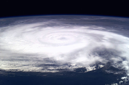
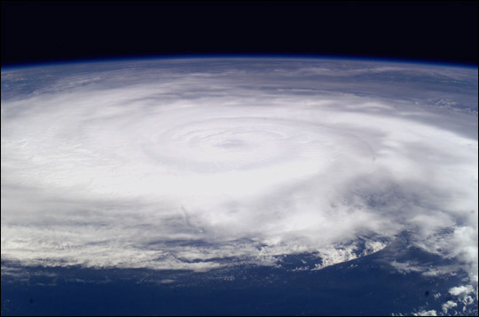
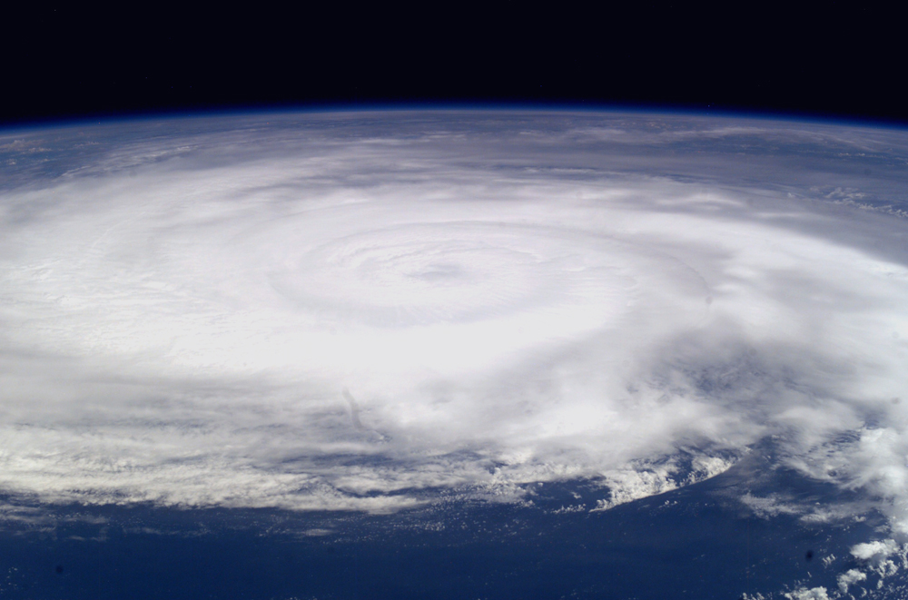
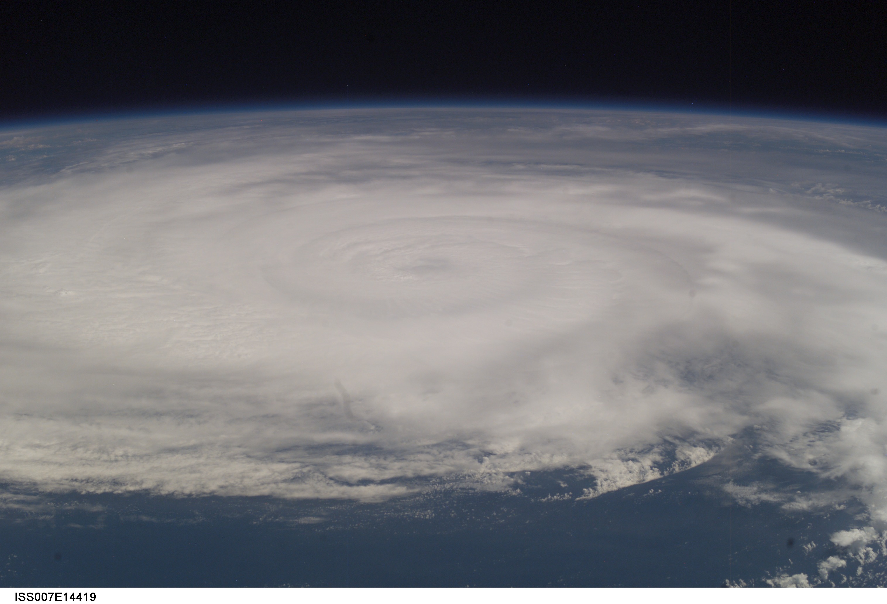
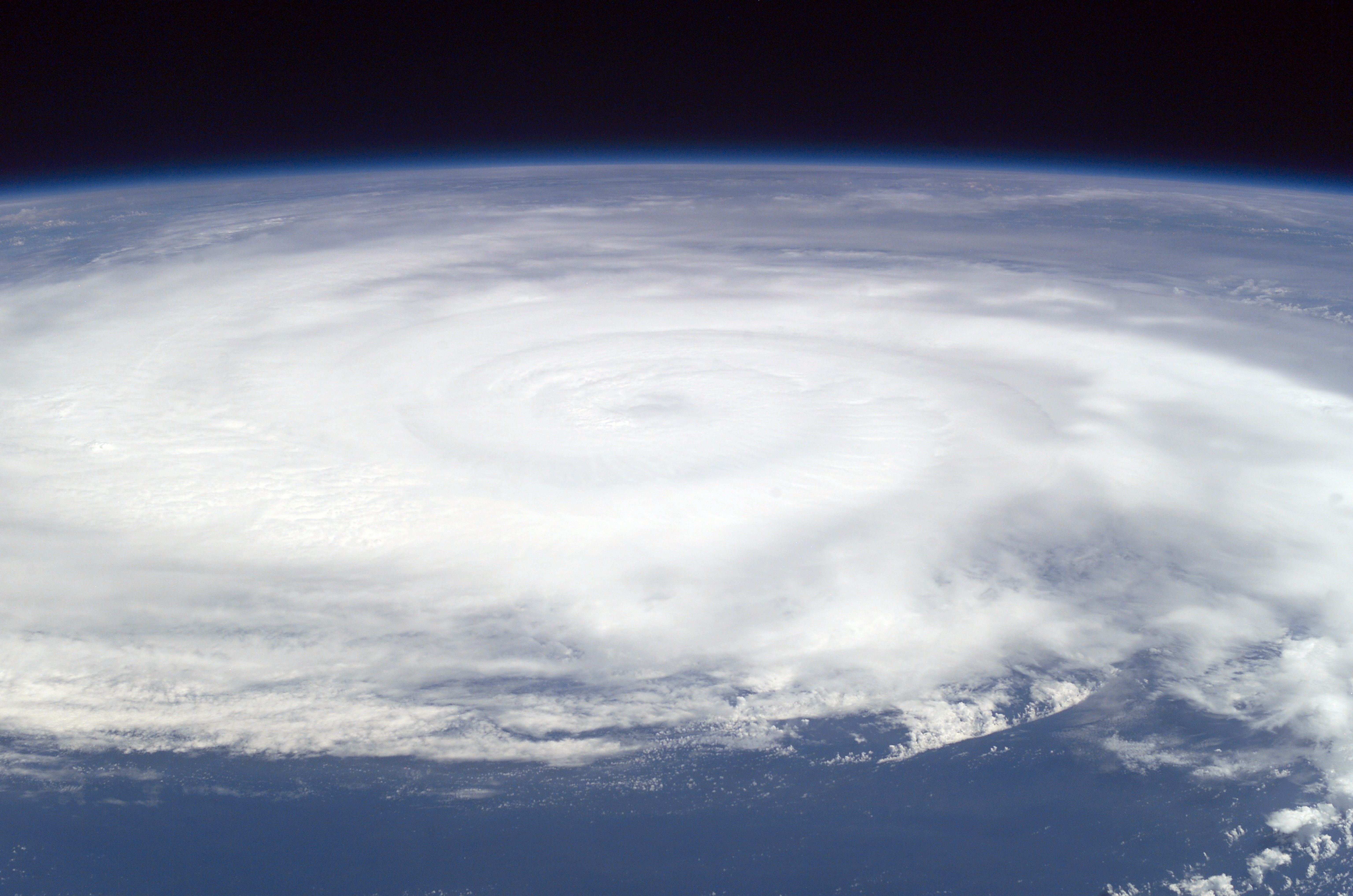
Features: | PAN-HURRICANE FABIAN |
| Features Found Using Machine Learning: | |
Cloud Cover Percentage: | 75 (51-75)% |
Sun Elevation Angle: | 68° |
Sun Azimuth: | 120° |
Camera: | Kodak DCS760c Electronic Still Camera |
Focal Length: | 50mm |
Camera Tilt: | High Oblique |
Format: | 3060E: 3060 x 2036 pixel CCD, RGBG array |
Film Exposure: | |
| Additional Information | |
| Width | Height | Annotated | Cropped | Purpose | Links |
|---|---|---|---|---|---|
| 540 pixels | 356 pixels | Photographic Highlights | Download Image | ||
| 997 pixels | 658 pixels | Photographic Highlights | Download Image | ||
| 540 pixels | 357 pixels | No | No | Earth From Space collection | Download Image |
| 1000 pixels | 661 pixels | No | No | NASA's Earth Observatory web site | Download Image |
| 3032 pixels | 2004 pixels | No | No | NASA's Earth Observatory web site | Download Image |
| 3032 pixels | 2064 pixels | No | No | Download Image | |
| 6144 pixels | 4068 pixels | No | No | Presentation | Download Image |
| 639 pixels | 435 pixels | No | No | Download Image |
Download Packaged File
Download a Google Earth KML for this Image
View photo footprint information
Download a GeoTIFF for this photo
Image Caption: Hurricane Fabian: Astronauts onboard the International Space Station photographed Hurricane Fabian on September 4, 2003 as it churned its way towards Bermuda. At the time the photo was taken, Fabian had maximum sustained winds of 120 mph and was moving to the north-northwest at 12 mph.
