ISS006-E-36913
| NASA Photo ID | ISS006-E-36913 |
| Focal Length | 85mm |
| Date taken | 2003.03.10 |
| Time taken | 09:15:07 GMT |
Resolutions offered for this image:
1024 x 720 pixels 540 x 380 pixels 540 x 540 pixels 1000 x 1000 pixels 3032 x 2064 pixels 639 x 435 pixels
1024 x 720 pixels 540 x 380 pixels 540 x 540 pixels 1000 x 1000 pixels 3032 x 2064 pixels 639 x 435 pixels

Cloud masks available for this image:
Spacecraft nadir point: 35.3° N, 116.1° W
Photo center point: 34.0° N, 118.0° W
Photo center point by machine learning:
Photo center point: 34.0° N, 118.0° W
Photo center point by machine learning:
Nadir to Photo Center: Southwest
Spacecraft Altitude: 209 nautical miles (387km)
Country or Geographic Name: | USA-CALIFORNIA |
Features: | LOS ANGELES AT NIGHT |
| Features Found Using Machine Learning: | |
Cloud Cover Percentage: | 10 (1-10)% |
Sun Elevation Angle: | -54° |
Sun Azimuth: | 36° |
Camera: | Kodak DCS760c Electronic Still Camera |
Focal Length: | 85mm |
Camera Tilt: | 33 degrees |
Format: | 3060E: 3060 x 2036 pixel CCD, RGBG array |
Film Exposure: | |
| Additional Information | |
| Width | Height | Annotated | Cropped | Purpose | Links |
|---|---|---|---|---|---|
| 1024 pixels | 720 pixels | Photographic Highlights | Download Image | ||
| 540 pixels | 380 pixels | Photographic Highlights | Download Image | ||
| 540 pixels | 540 pixels | Yes | Yes | Earth From Space collection | Download Image |
| 1000 pixels | 1000 pixels | No | No | NASA's Earth Observatory web site | Download Image |
| 3032 pixels | 2064 pixels | No | No | Download Image | |
| 639 pixels | 435 pixels | No | No | Download Image |
Download Packaged File
Download a Google Earth KML for this Image
View photo footprint information
Download a GeoTIFF for this photo
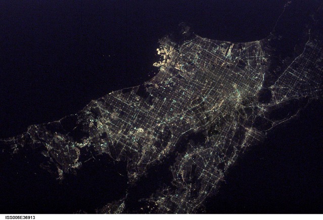
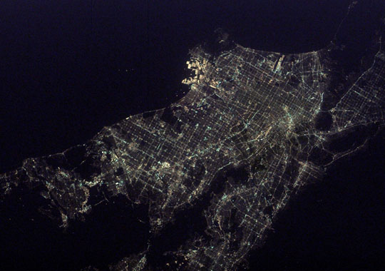
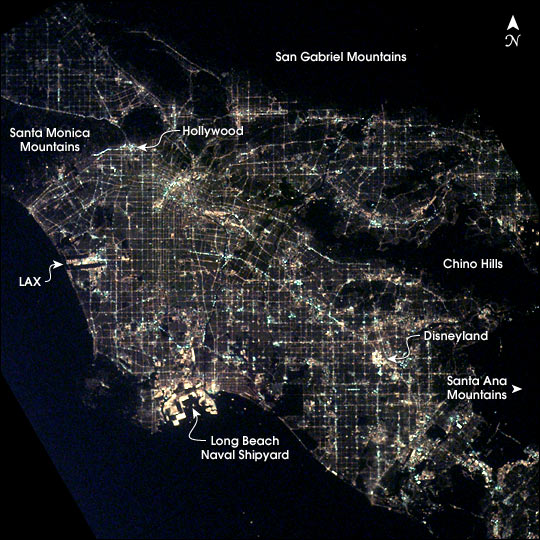
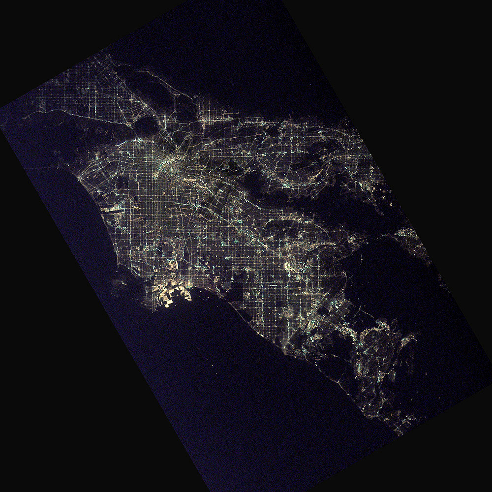
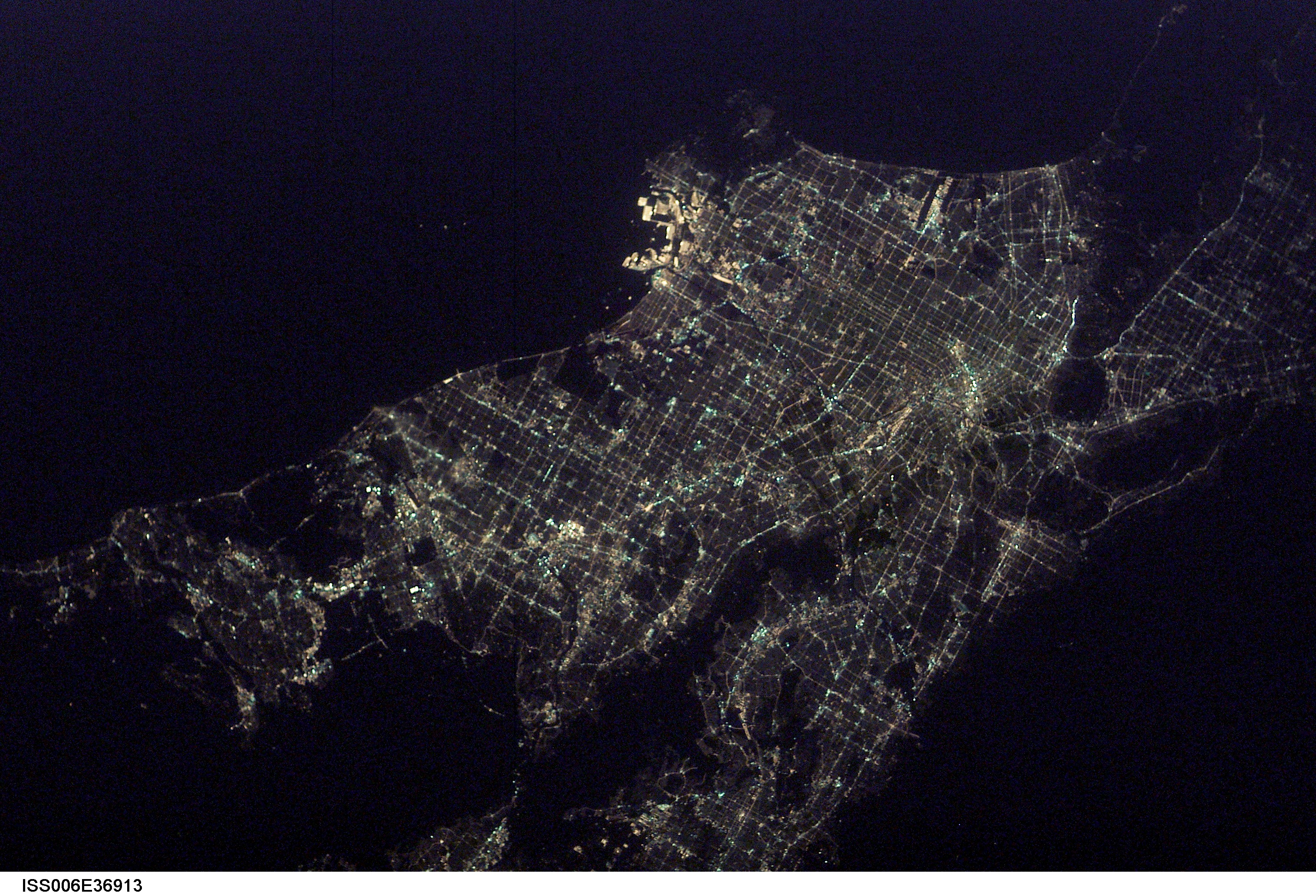
Image Caption: After sunset the borders of "The City of Angels" are defined as much by its dark terrain features as by its well-lit grid of streets and freeways. Over 13 million people inhabit the coastal basin bounded roughly by the Santa Monica and San Gabriel Mountains to the north and the Chino Hills and Santa Ana Mountains to the east and southeast.
The crew of the International Space Station took this unique image shortly after 1 a.m. local time on March 10, 2003. Both the glitter and sprawl of America's second largest city as well as a number of its renowned landmarks are highly visible. In the north, Hollywood is nestled against the south side of the Santa Monica Mountains. On the coast, Los Angeles International Airport (LAX) and the port facilities at Long Beach Naval Shipyards are bright spots. Finally, even at this time of night, the bright lights of Disneyland in Anaheim are a standout feature.
The crew of the International Space Station took this unique image shortly after 1 a.m. local time on March 10, 2003. Both the glitter and sprawl of America's second largest city as well as a number of its renowned landmarks are highly visible. In the north, Hollywood is nestled against the south side of the Santa Monica Mountains. On the coast, Los Angeles International Airport (LAX) and the port facilities at Long Beach Naval Shipyards are bright spots. Finally, even at this time of night, the bright lights of Disneyland in Anaheim are a standout feature.
