ISS005-E-18039
| NASA Photo ID | ISS005-E-18039 |
| Focal Length | 800mm |
| Date taken | 2002.10.22 |
| Time taken | 13:42:32 GMT |
Resolutions offered for this image:
1024 x 768 pixels 540 x 405 pixels 540 x 451 pixels 1000 x 702 pixels 3032 x 2064 pixels 639 x 435 pixels
1024 x 768 pixels 540 x 405 pixels 540 x 451 pixels 1000 x 702 pixels 3032 x 2064 pixels 639 x 435 pixels


Cloud masks available for this image:
Spacecraft nadir point: 24.8° N, 81.9° W
Photo center point: 24.5° N, 82.0° W
Photo center point by machine learning:
Photo center point: 24.5° N, 82.0° W
Photo center point by machine learning:
Nadir to Photo Center: South
Spacecraft Altitude: 207 nautical miles (383km)
Country or Geographic Name: | USA-FLORIDA |
Features: | KEY WEST |
| Features Found Using Machine Learning: | |
Cloud Cover Percentage: | 10 (1-10)% |
Sun Elevation Angle: | 28° |
Sun Azimuth: | 119° |
Camera: | Kodak DCS760c Electronic Still Camera |
Focal Length: | 800mm |
Camera Tilt: | 5 degrees |
Format: | 3060E: 3060 x 2036 pixel CCD, RGBG array |
Film Exposure: | |
| Additional Information | |
| Width | Height | Annotated | Cropped | Purpose | Links |
|---|---|---|---|---|---|
| 1024 pixels | 768 pixels | Photographic Highlights | Download Image | ||
| 540 pixels | 405 pixels | Photographic Highlights | Download Image | ||
| 540 pixels | 451 pixels | Yes | Yes | Earth From Space collection | Download Image |
| 1000 pixels | 702 pixels | No | Yes | NASA's Earth Observatory web site | Download Image |
| 3032 pixels | 2064 pixels | No | No | Download Image | |
| 639 pixels | 435 pixels | No | No | Download Image |
Download Packaged File
Download a Google Earth KML for this Image
View photo footprint information
Download a GeoTIFF for this photo
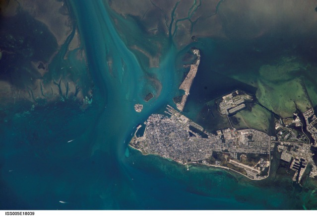
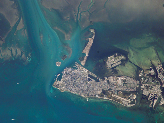
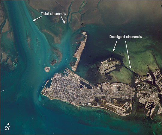
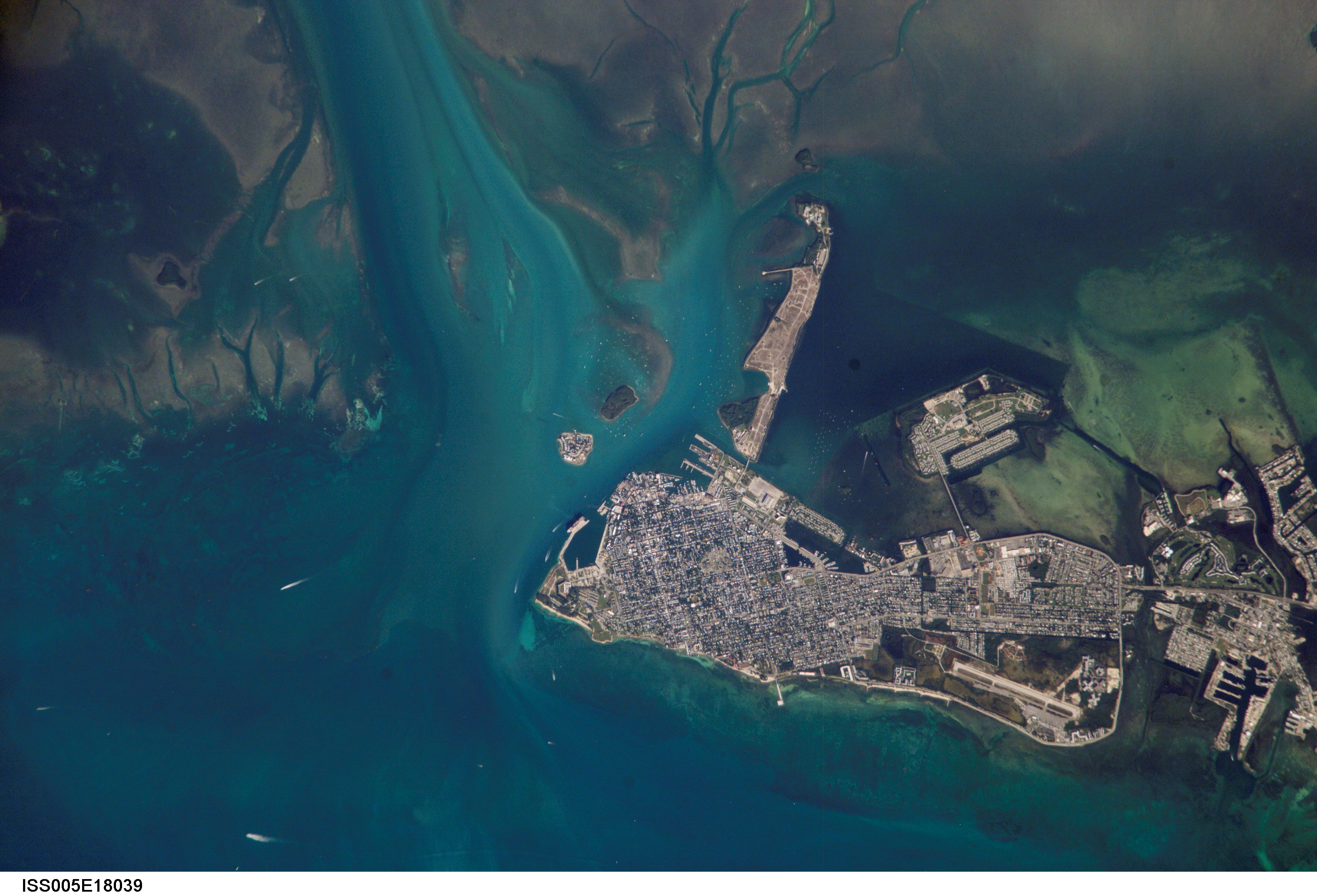
Image Caption: Turquoise blue waters, coral reefs and sandy beaches were apparently on the minds of International Space Station astronauts last week. As they passed over the Florida Keys, they acquired a sequence of images from Key West eastward along the outer keys. The detail of the images showcases the clarity of the Caribbean waters, and allows for mapping of both land use and shallow marine features. This image of Key West shows the intensive built-up area of the town, the offshore sand flats and grassbeds surrounding Key West, the patterns of natural tidal channels and artificially dredged channels that allow boat access to the local marinas.
