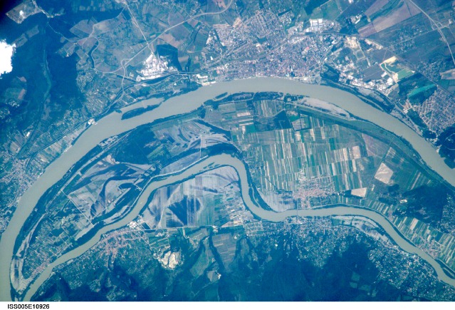
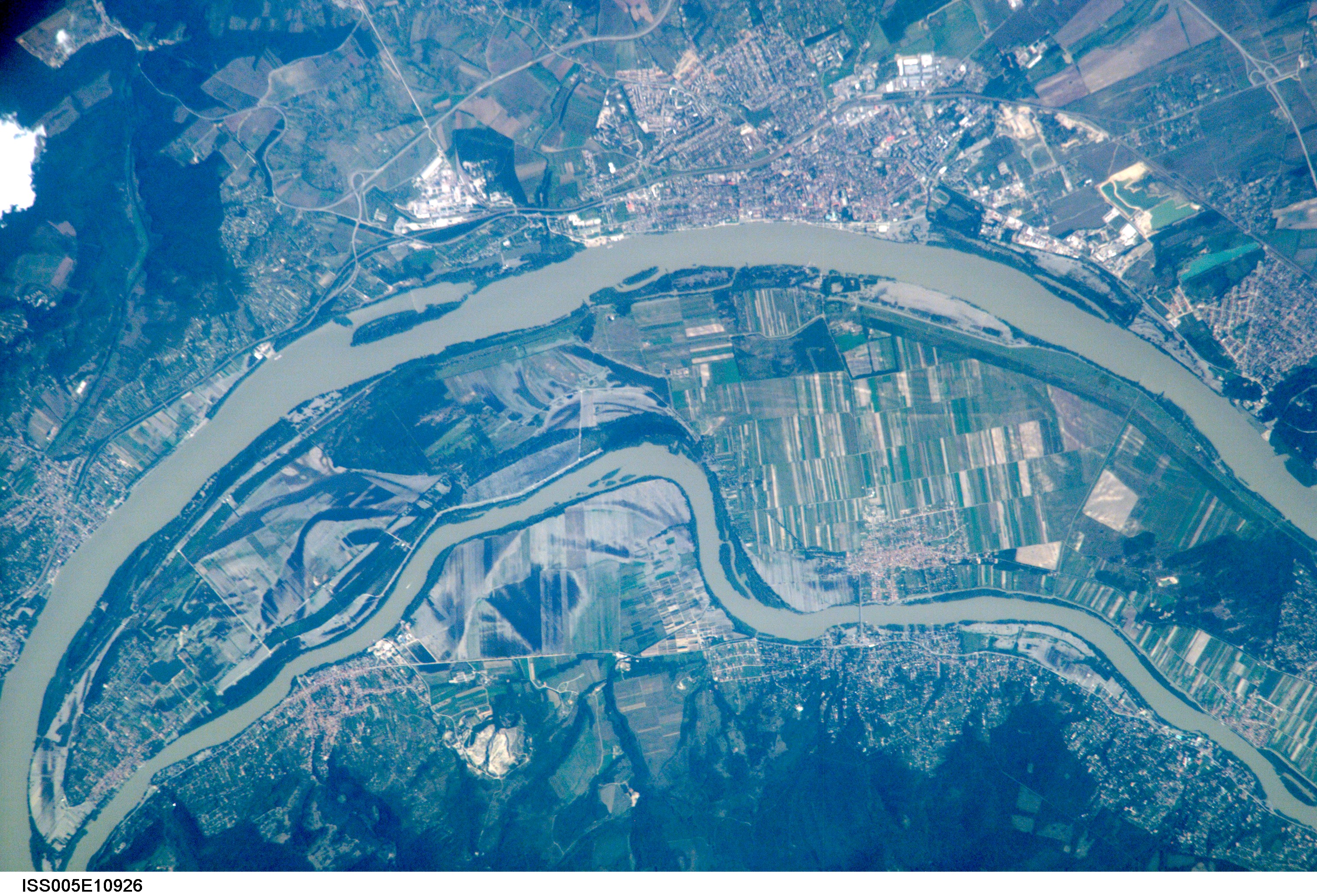
ISS005-E-10926
| NASA Photo ID | ISS005-E-10926 |
| Focal Length | 800mm |
| Date taken | 2002.08.23 |
| Time taken | 09:47:25 GMT |
Resolutions offered for this image:
473 x 540 pixels 541 x 617 pixels 540 x 329 pixels 3032 x 2064 pixels 3032 x 2064 pixels 639 x 435 pixels 639 x 435 pixels
473 x 540 pixels 541 x 617 pixels 540 x 329 pixels 3032 x 2064 pixels 3032 x 2064 pixels 639 x 435 pixels 639 x 435 pixels

Cloud masks available for this image:
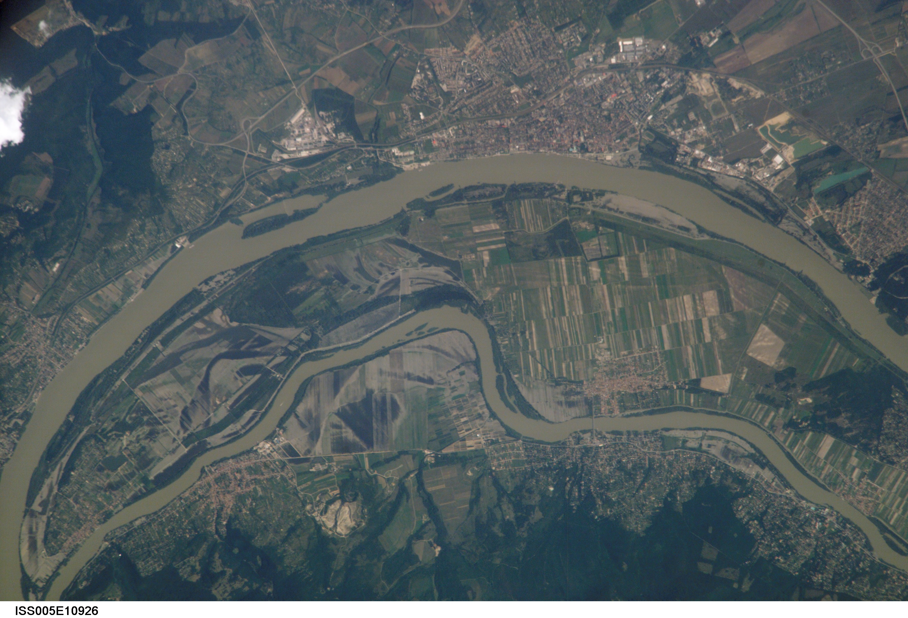
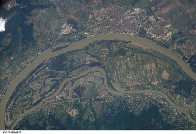
Spacecraft nadir point: 48.4° N, 19.7° E
Photo center point: 48.0° N, 19.0° E
Photo center point by machine learning:
Photo center point: 48.0° N, 19.0° E
Photo center point by machine learning:
Nadir to Photo Center: Southwest
Spacecraft Altitude: 209 nautical miles (387km)
Country or Geographic Name: | HUNGARY |
Features: | DANUBE RIVER, CITY OF VAC |
| Features Found Using Machine Learning: | |
Cloud Cover Percentage: | 10 (1-10)% |
Sun Elevation Angle: | 51° |
Sun Azimuth: | 157° |
Camera: | Kodak DCS760c Electronic Still Camera |
Focal Length: | 800mm |
Camera Tilt: | 13 degrees |
Format: | 3060E: 3060 x 2036 pixel CCD, RGBG array |
Film Exposure: | |
| Additional Information | |
| Width | Height | Annotated | Cropped | Purpose | Links |
|---|---|---|---|---|---|
| 473 pixels | 540 pixels | Photographic Highlights | Download Image | ||
| 541 pixels | 617 pixels | Photographic Highlights | Download Image | ||
| 540 pixels | 329 pixels | Yes | Yes | NASA's Earth Observatory web site | Download Image |
| 3032 pixels | 2064 pixels | No | No | Download Image | |
| 3032 pixels | 2064 pixels | No | No | Download Image | |
| 639 pixels | 435 pixels | No | No | Download Image | |
| 639 pixels | 435 pixels | No | No | Download Image |
Download Packaged File
Download a Google Earth KML for this Image
View photo footprint information
Download a GeoTIFF for this photo
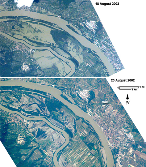
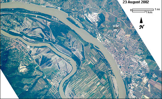
Image Caption: This image shows some of the devastating European flooding were captured by astronauts onboard the International Space Station. The photograph shows flooding around the Danube Bend area just north of Budapest near the city of Vac, Hungary. The flood peaked in Budapest on August 19 at about 8.5 m (28 ft), exceeding the previous 1965 flood record. The image shows the waters inundating farmland in the flood palain and then receding, when in comparison to ISS005-E-10000.
