ISS004-E-7999
| NASA Photo ID | ISS004-E-7999 |
| Focal Length | 400mm |
| Date taken | 2002.02.17 |
| Time taken | 16:41:04 GMT |
Resolutions offered for this image:
620 x 768 pixels 436 x 540 pixels 540 x 604 pixels 3032 x 2064 pixels 3032 x 2064 pixels 639 x 435 pixels 400 x 272 pixels
620 x 768 pixels 436 x 540 pixels 540 x 604 pixels 3032 x 2064 pixels 3032 x 2064 pixels 639 x 435 pixels 400 x 272 pixels


Cloud masks available for this image:
Spacecraft nadir point: 20.9° N, 86.7° W
Photo center point: 15.0° N, 91.5° W
Photo center point by machine learning:
Photo center point: 15.0° N, 91.5° W
Photo center point by machine learning:
Nadir to Photo Center: Southwest
Spacecraft Altitude: 205 nautical miles (380km)
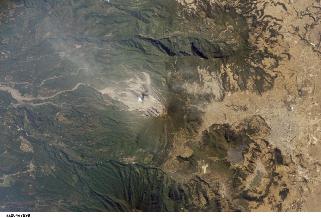
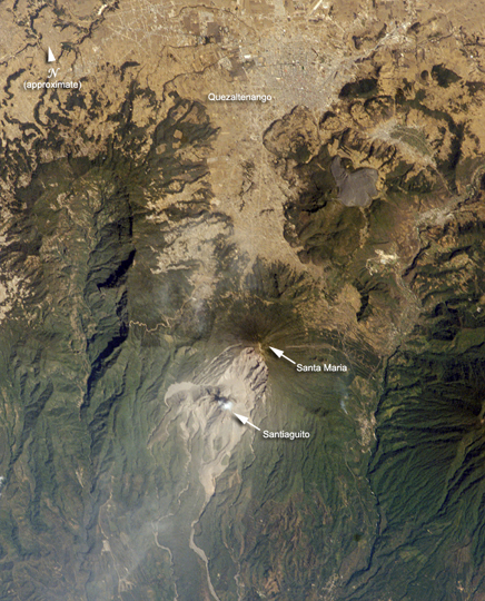
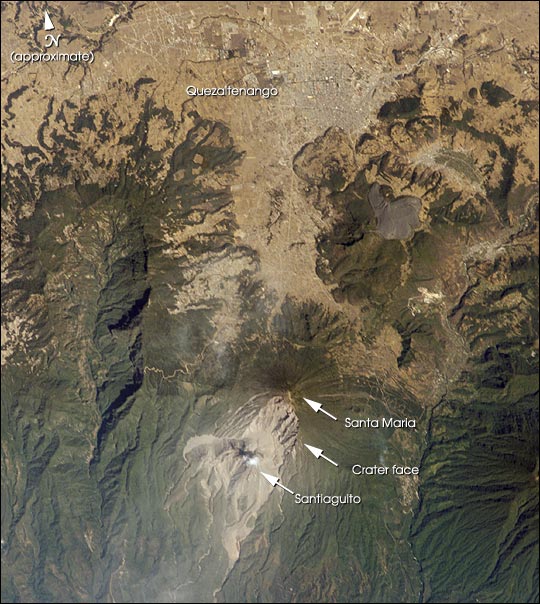
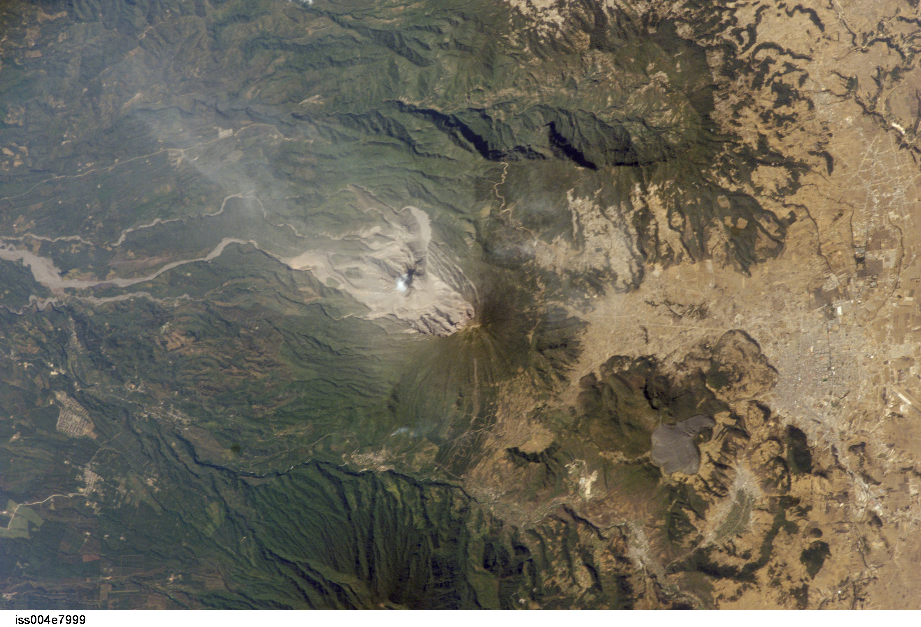
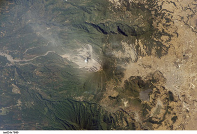
Country or Geographic Name: | GUATEMALA |
Features: | SANTA MARIA VOLCANO, SMOKE |
| Features Found Using Machine Learning: | |
Cloud Cover Percentage: | 10 (1-10)% |
Sun Elevation Angle: | 52° |
Sun Azimuth: | 147° |
Camera: | Kodak DCS760c Electronic Still Camera |
Focal Length: | 400mm |
Camera Tilt: | High Oblique |
Format: | 3060E: 3060 x 2036 pixel CCD, RGBG array |
Film Exposure: | |
| Additional Information | |
| Width | Height | Annotated | Cropped | Purpose | Links |
|---|---|---|---|---|---|
| 620 pixels | 768 pixels | Photographic Highlights | Download Image | ||
| 436 pixels | 540 pixels | Photographic Highlights | Download Image | ||
| 540 pixels | 604 pixels | Yes | Yes | Earth From Space collection | Download Image |
| 3032 pixels | 2064 pixels | No | No | Download Image | |
| 3032 pixels | 2064 pixels | No | No | Download Image | |
| 639 pixels | 435 pixels | No | No | Download Image | |
| 400 pixels | 272 pixels | No | No | Photographic Highlights | Download Image |
Download Packaged File
Download a Google Earth KML for this Image
View photo footprint information
Download a GeoTIFF for this photo
Image Caption: The eruption of Santa Maria volcano in 1902 was one of the largest eruptions of the 20th century, forming a large crater on the mountain's southwest flank. Since 1922, a lava-dome complex, Santiaguito, has been forming in the 1902 crater. Growth of the dome has produced pyroclastic flows as recently as the 2001--they can be identified in this image. The city of Quezaltenango (approximately 90,000 people in 1989) sits below the 3772 m summit. The volcano is considered dangerous because of the possibility of a dome collapse such as one that occurred in 1929, which killed about 5000 people. A second hazard results from the flow of volcanic debris into rivers south of Santiaguito, which can lead to catastrophic flooding and mud flows.
