ISS004-E-6383
| NASA Photo ID | ISS004-E-6383 |
| Focal Length | 800mm |
| Date taken | 2002.01.17 |
| Time taken | 17:20:31 GMT |

Cloud masks available for this image:
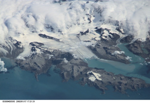
Spacecraft nadir point: 51.5° S, 25.9° W
Photo center point: 54.5° S, 36.5° W
Photo center point by machine learning:
Photo center point: 54.5° S, 36.5° W
Photo center point by machine learning:
Nadir to Photo Center: West
Spacecraft Altitude: 214 nautical miles (396km)
Country or Geographic Name: | SOUTH GEORGIA IS. |
Features: | GLACIERS, CUMBERLAND BAY |
| Features Found Using Machine Learning: | |
Cloud Cover Percentage: | 10 (1-10)% |
Sun Elevation Angle: | 40° |
Sun Azimuth: | 288° |
Camera: | Kodak DCS460 Electronic Still Camera |
Focal Length: | 800mm |
Camera Tilt: | High Oblique |
Format: | 3060E: 3060 x 2036 pixel CCD, RGBG array |
Film Exposure: | |
| Additional Information | |
| Width | Height | Annotated | Cropped | Purpose | Links |
|---|---|---|---|---|---|
| 3060 pixels | 2100 pixels | No | No | Download Image | |
| 640 pixels | 439 pixels | No | No | Download Image |
Download Packaged File
Download a Google Earth KML for this Image
View photo footprint information
Download a GeoTIFF for this photo
Image Caption: none
