ISS004-E-12080

| NASA Photo ID | ISS004-E-12080 |
| Focal Length | 35mm |
| Date taken | 2002.05.18 |
| Time taken | 10:21:14 GMT |
Resolutions offered for this image:
540 x 647 pixels 451 x 540 pixels 540 x 649 pixels 660 x 1000 pixels 3032 x 2064 pixels 639 x 435 pixels
540 x 647 pixels 451 x 540 pixels 540 x 649 pixels 660 x 1000 pixels 3032 x 2064 pixels 639 x 435 pixels
Cloud masks available for this image:
Spacecraft nadir point: 5.3° N, 12.9° W
Photo center point: 14.0° N, 16.5° W
Photo center point by machine learning:
Photo center point: 14.0° N, 16.5° W
Photo center point by machine learning:
Nadir to Photo Center: North
Spacecraft Altitude: 210 nautical miles (389km)
Camera: | Kodak DCS760c Electronic Still Camera |
Focal Length: | 35mm |
Camera Tilt: | High Oblique |
Format: | 3060E: 3060 x 2036 pixel CCD, RGBG array |
Film Exposure: | |
| Additional Information | |
| Width | Height | Annotated | Cropped | Purpose | Links |
|---|---|---|---|---|---|
| 540 pixels | 647 pixels | Photographic Highlights | Download Image | ||
| 451 pixels | 540 pixels | Photographic Highlights | Download Image | ||
| 540 pixels | 649 pixels | Yes | Yes | Earth From Space collection | Download Image |
| 660 pixels | 1000 pixels | No | Yes | NASA's Earth Observatory web site | Download Image |
| 3032 pixels | 2064 pixels | No | No | Download Image | |
| 639 pixels | 435 pixels | No | No | Download Image |
Download Packaged File
Download a Google Earth KML for this Image
View photo footprint information
Download a GeoTIFF for this photo
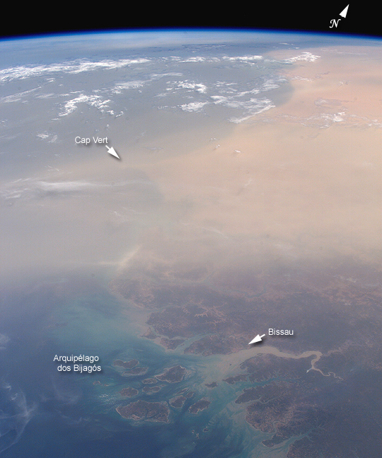
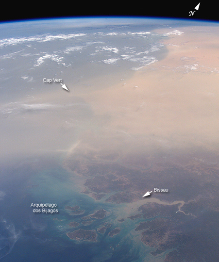
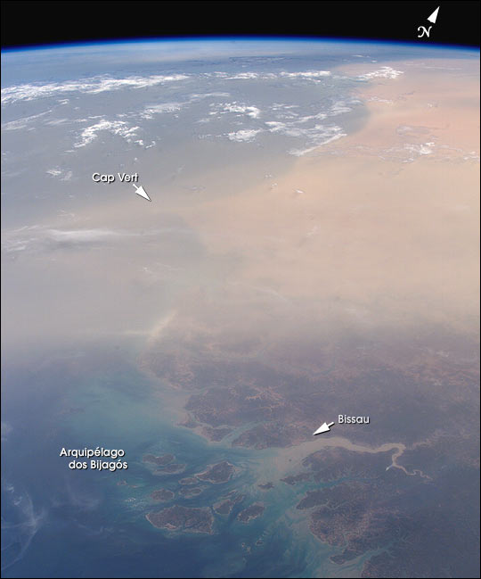
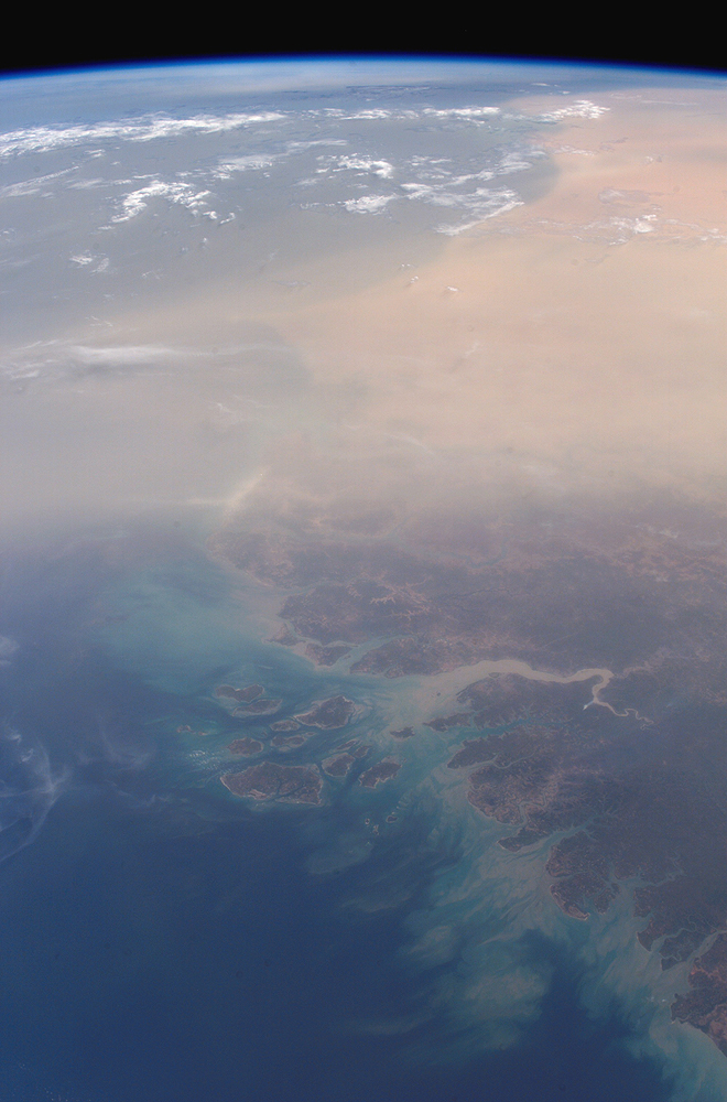
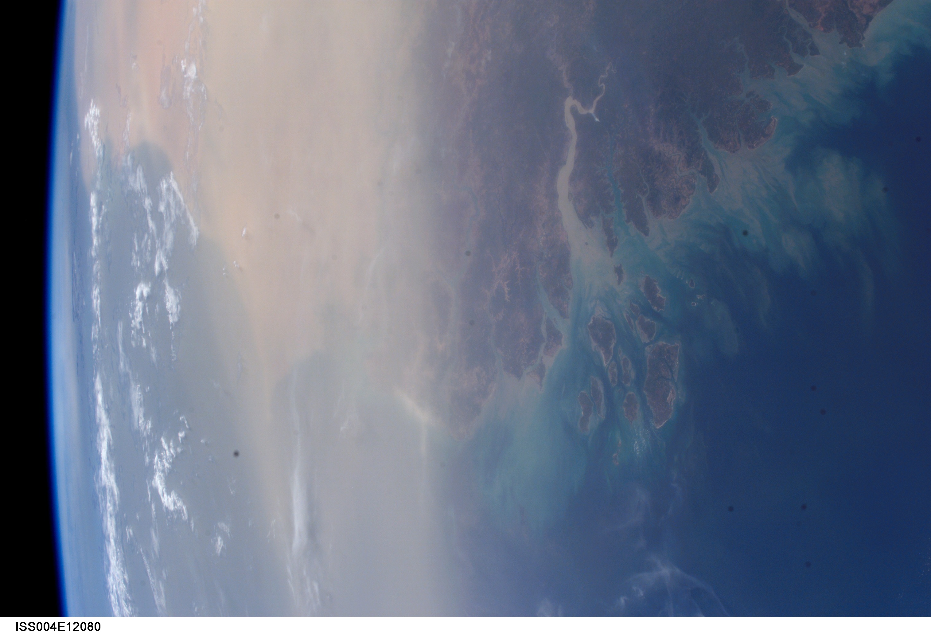
Image Caption: Airborne African dust regularly reaches northeastern South America and the Caribbean. Westward dust transport from the Sahara across the central Atlantic has been a common occurrence this spring, with major events visible in both satellite images and photographs. Cap Vert, the westernmost point of Senegal, is dimly visible beneath the dust mass (center); the Arquipelago dos Bijagos in Guinea Bissau lies opposite the mouth of the sediment-laden Rio Corubal.
This photo (ISS004-E-12080) was taken by the crew of the International Space Station on May 18, 2002, using a digital camera with a 35-mm lens.
This photo (ISS004-E-12080) was taken by the crew of the International Space Station on May 18, 2002, using a digital camera with a 35-mm lens.
