ISS004-E-12039

| NASA Photo ID | ISS004-E-12039 |
| Focal Length | 70mm |
| Date taken | 2002.05.17 |
| Time taken | 15:49:32 GMT |
Resolutions offered for this image:
1024 x 780 pixels 540 x 411 pixels 1000 x 681 pixels 3032 x 2064 pixels 639 x 435 pixels
1024 x 780 pixels 540 x 411 pixels 1000 x 681 pixels 3032 x 2064 pixels 639 x 435 pixels

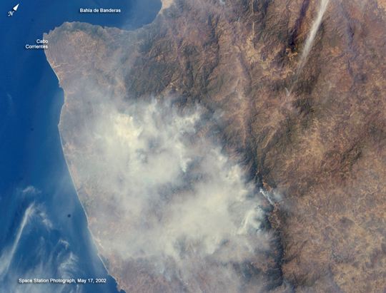

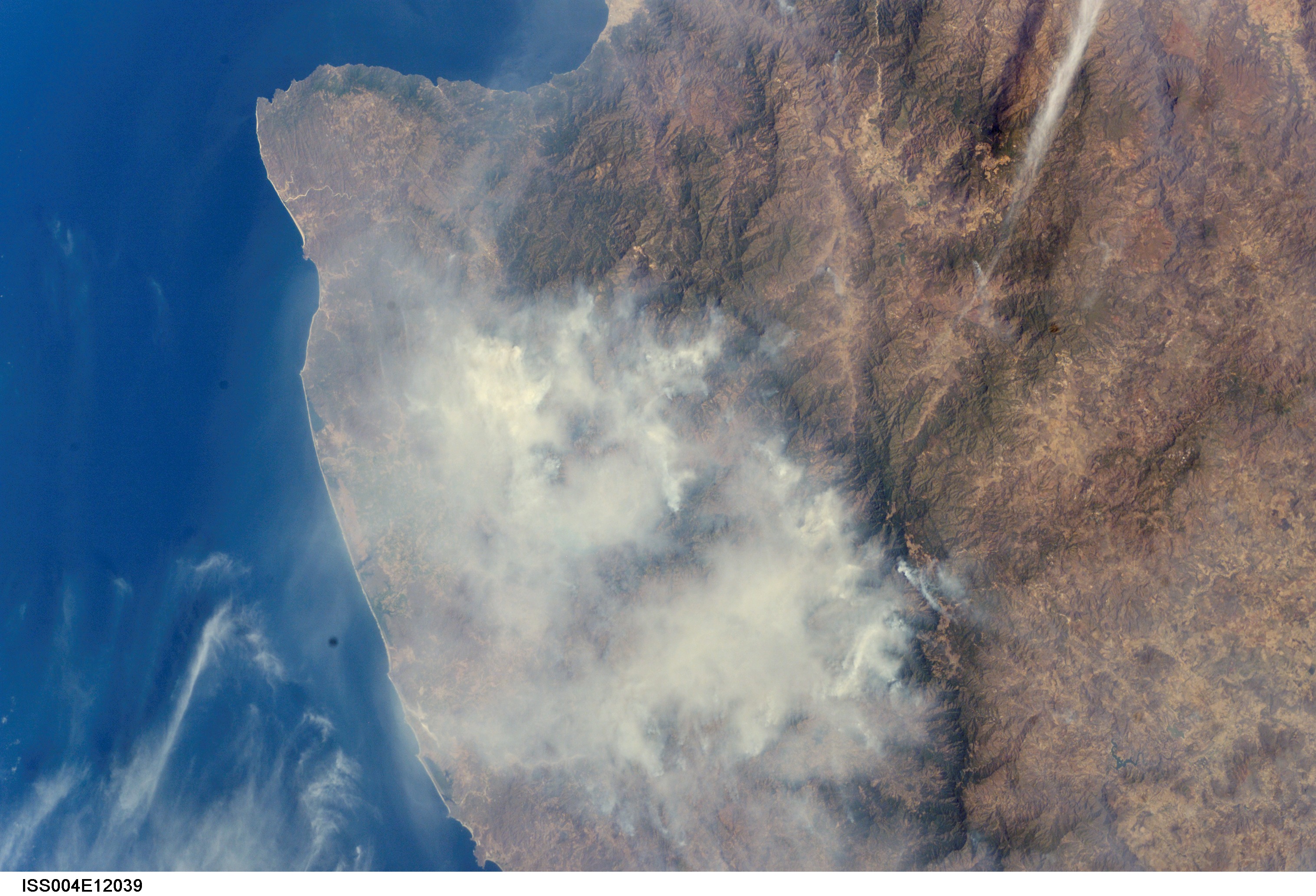


Spacecraft nadir point: 19.0° N, 101.9° W
Photo center point: 20.5° N, 105.5° W
Photo center point by machine learning:
Photo center point: 20.5° N, 105.5° W
Photo center point by machine learning:
Nadir to Photo Center: West
Spacecraft Altitude: 208 nautical miles (385km)
Country or Geographic Name: | MEXICO |
Features: | COAST, CAPE CORRIENTES |
| Features Found Using Machine Learning: | |
Cloud Cover Percentage: | 10 (1-10)% |
Sun Elevation Angle: | 49° |
Sun Azimuth: | 82° |
Camera: | Kodak DCS760c Electronic Still Camera |
Focal Length: | 70mm |
Camera Tilt: | 48 degrees |
Format: | 3060E: 3060 x 2036 pixel CCD, RGBG array |
Film Exposure: | |
| Additional Information | |
| Width | Height | Annotated | Cropped | Purpose | Links |
|---|---|---|---|---|---|
| 1024 pixels | 780 pixels | Photographic Highlights | Download Image | ||
| 540 pixels | 411 pixels | Photographic Highlights | Download Image | ||
| 1000 pixels | 681 pixels | No | No | NASA's Earth Observatory web site | Download Image |
| 3032 pixels | 2064 pixels | No | No | Download Image | |
| 639 pixels | 435 pixels | No | No | Download Image |
Download Packaged File
Download a Google Earth KML for this Image
View photo footprint information
Download a GeoTIFF for this photo
Image Caption: none
