ISS002-E-5325
| NASA Photo ID | ISS002-E-5325 |
| Focal Length | 800mm |
| Date taken | 2001.04.13 |
| Time taken | 22:20:48 GMT |
Resolutions offered for this image:
3060 x 2092 pixels 1200 x 820 pixels 1024 x 700 pixels 540 x 369 pixels 3060 x 2092 pixels 540 x 540 pixels 3060 x 2092 pixels 3060 x 2092 pixels 640 x 437 pixels 400 x 273 pixels
3060 x 2092 pixels 1200 x 820 pixels 1024 x 700 pixels 540 x 369 pixels 3060 x 2092 pixels 540 x 540 pixels 3060 x 2092 pixels 3060 x 2092 pixels 640 x 437 pixels 400 x 273 pixels


Cloud masks available for this image:
Spacecraft nadir point: 42.0° N, 79.6° W
Photo center point: 43.0° N, 79.0° W
Photo center point by machine learning:
Photo center point: 43.0° N, 79.0° W
Photo center point by machine learning:
Nadir to Photo Center: Northeast
Spacecraft Altitude: 209 nautical miles (387km)
Country or Geographic Name: | USA-NEW YORK |
Features: | NIAGARA FALLS |
| Features Found Using Machine Learning: | |
Cloud Cover Percentage: | 10 (1-10)% |
Sun Elevation Angle: | 17° |
Sun Azimuth: | 267° |
Camera: | Kodak DCS460 Electronic Still Camera |
Focal Length: | 800mm |
Camera Tilt: | 19 degrees |
Format: | 3060E: 3060 x 2036 pixel CCD, RGBG array |
Film Exposure: | |
| Additional Information | |
| Width | Height | Annotated | Cropped | Purpose | Links |
|---|---|---|---|---|---|
| 3060 pixels | 2092 pixels | No | No | Cities collection | Download Image |
| 1200 pixels | 820 pixels | No | No | Cities collection | Download Image |
| 1024 pixels | 700 pixels | Photographic Highlights | Download Image | ||
| 540 pixels | 369 pixels | Photographic Highlights | Download Image | ||
| 3060 pixels | 2092 pixels | No | No | Earth From Space collection | Download Image |
| 540 pixels | 540 pixels | Yes | Yes | Earth From Space collection | Download Image |
| 3060 pixels | 2092 pixels | No | No | NASA's Earth Observatory web site | Download Image |
| 3060 pixels | 2092 pixels | No | No | Download Image | |
| 640 pixels | 437 pixels | No | No | Download Image | |
| 400 pixels | 273 pixels | No | No | Photographic Highlights | Download Image |
Download Packaged File
Download a Google Earth KML for this Image
View photo footprint information
Download a GeoTIFF for this photo
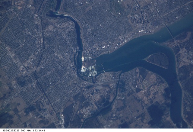
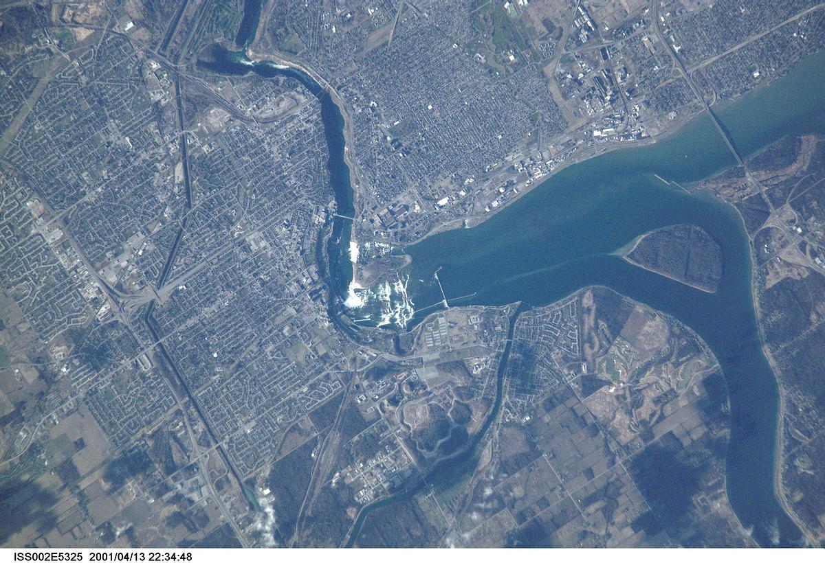
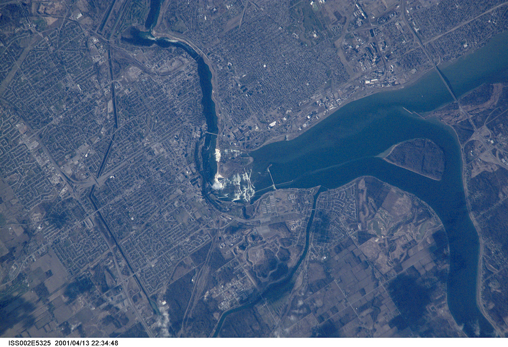
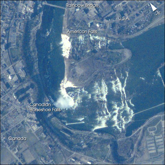
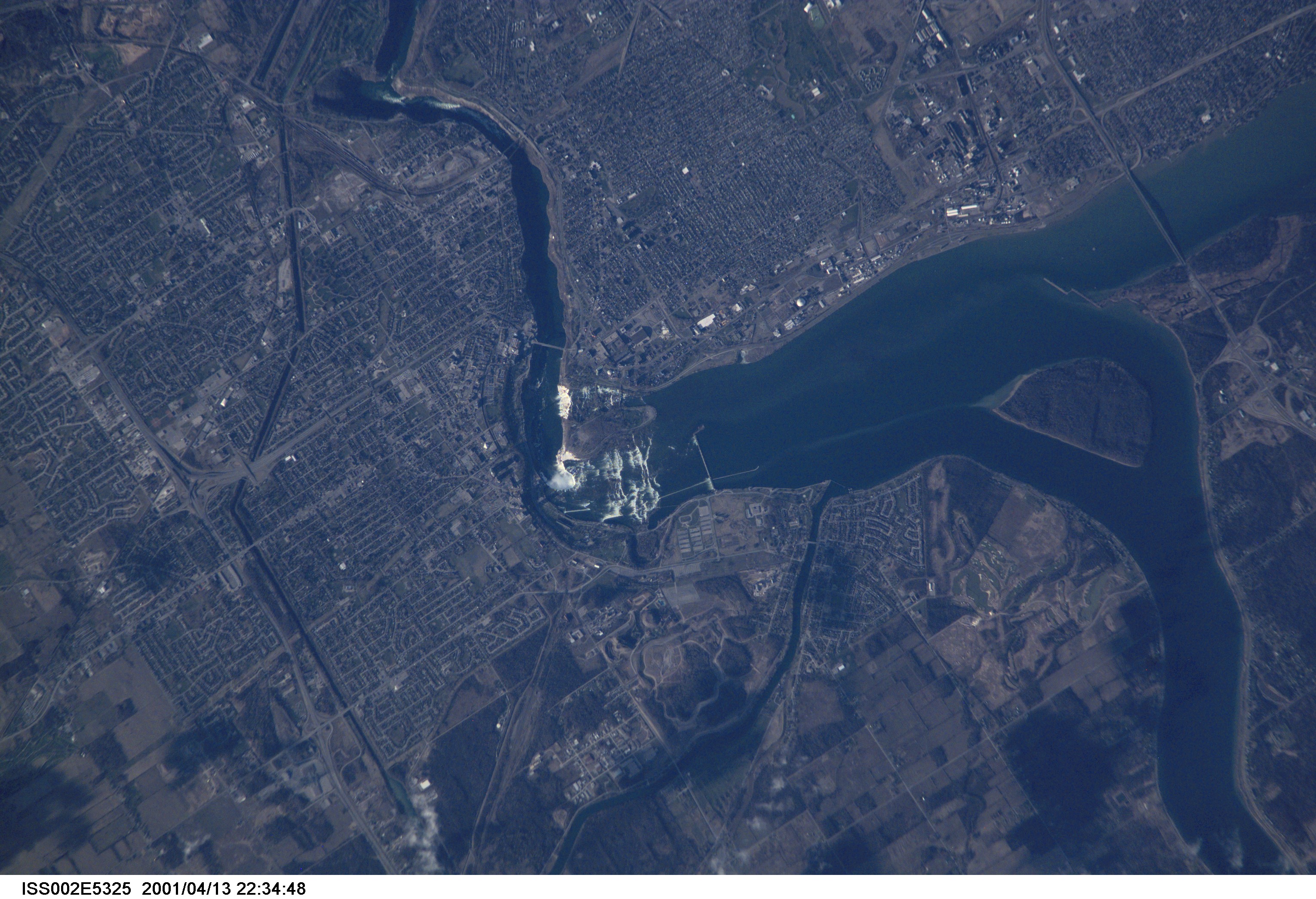
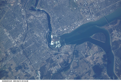
Image Caption: Mark Twain once said of Niagara Falls: "Although it was wonderful to see all that water tumbling down, it would be even more wonderful to see all that water tumbling up."
Viewing the tumbling waters of the Niagara River from the microgravity environment of the International Space Station, astronauts recently acquired this image. They were at an orbit of 207 nautical miles (383 km) above the Falls, and used a digital camera with an 800 mm lens. In taking these kinds of detailed images, Space Station crewmembers have compensated for the relative motion of the Earth, thus achieving spatial resolutions of less than 6 m and surpassing the previous records for spatial resolution from human spaceflight. Details of the city of Niagara Falls are easy to see; for spatial reference, the American falls is 328 m wide (1075 ft), and the Horseshoe Falls is 675 m wide (2200 ft).
The Niagara River forms the U.S.-Canadian Border and allows Lake Erie to drain northwest into Lake Ontario. Lake Ontario is about 100 m lower than Lake Erie; the Falls and the rapids account for most of the elevation difference. The energy derived from water falling over the falls, with average total flows of 750,000 U.S. gallons (2.8 million liters) per second, fuel multiple power plants on the river. Power Plants downstream from the plant generate 4.4 million kilowatts of power for both Ontario and New York.
