ISS001-E-6504

| NASA Photo ID | ISS001-E-6504 |
| Focal Length | 800mm |
| Date taken | 2001.03.__ |
| Time taken | GMT |
Resolutions offered for this image:
540 x 359 pixels 540 x 885 pixels 3060 x 2036 pixels 640 x 425 pixels 400 x 266 pixels
540 x 359 pixels 540 x 885 pixels 3060 x 2036 pixels 640 x 425 pixels 400 x 266 pixels

Cloud masks available for this image:
Spacecraft nadir point:
Photo center point: 56.0° N, 160.5° E
Photo center point by machine learning:
Photo center point: 56.0° N, 160.5° E
Photo center point by machine learning:
Nadir to Photo Center:
Spacecraft Altitude: nautical miles (0km)
Country or Geographic Name: | RUSSIAN FEDERATION |
Features: | OBLIQUE VIEW, VOLCANOES |
| Features Found Using Machine Learning: | |
Cloud Cover Percentage: | 10 (1-10)% |
Sun Elevation Angle: | ° |
Sun Azimuth: | ° |
Camera: | Kodak DCS460 Electronic Still Camera |
Focal Length: | 800mm |
Camera Tilt: | High Oblique |
Format: | 3060E: 3060 x 2036 pixel CCD, RGBG array |
Film Exposure: | |
| Additional Information | |
| Width | Height | Annotated | Cropped | Purpose | Links |
|---|---|---|---|---|---|
| 540 pixels | 359 pixels | Yes | Yes | NASA's Earth Observatory web site | Download Image |
| 540 pixels | 885 pixels | Yes | No | NASA's Earth Observatory web site | Download Image |
| 3060 pixels | 2036 pixels | No | No | Download Image | |
| 640 pixels | 425 pixels | No | No | Download Image | |
| 400 pixels | 266 pixels | No | No | Photographic Highlights | Download Image |
Download Packaged File
Download a Google Earth KML for this Image
View photo footprint information
Download a GeoTIFF for this photo
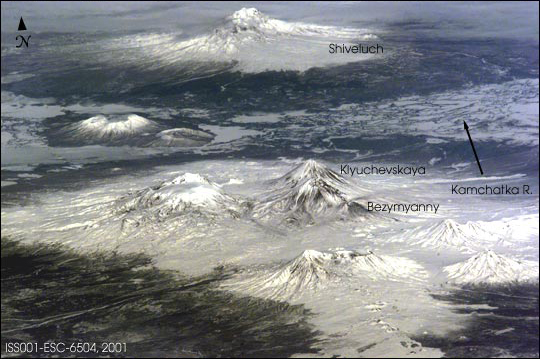
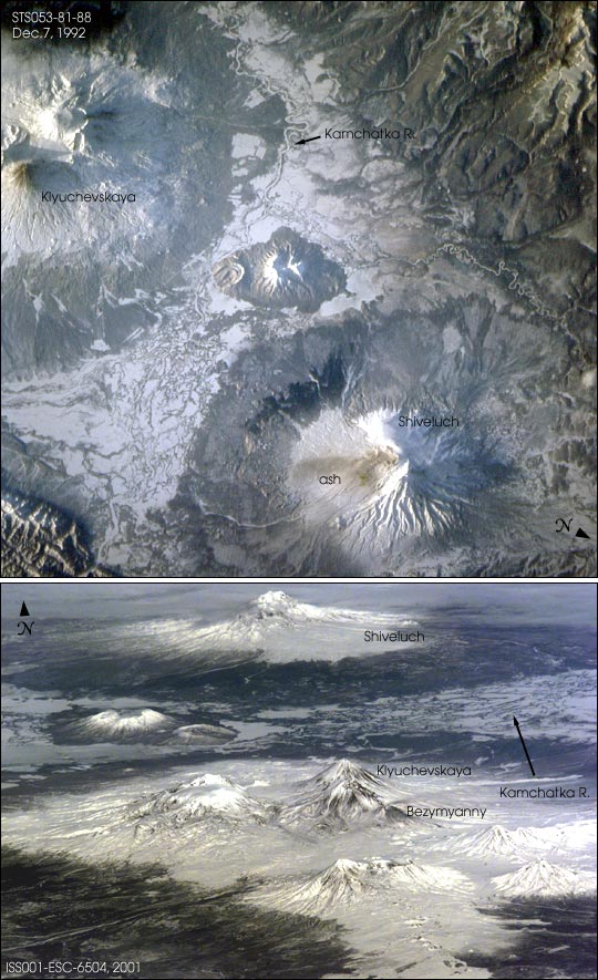
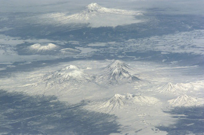
Image Caption: Shiveluch volcano anchors the northern end of a volcanic chain of more than 100
volcanoes covering the Kamchatkan Peninsula. It is one of the most active
volcanoes along the Pacific Rim, most recently from February 22 to March 1,2002.
Astronauts took both of these very different images of Shiveluch
and other Kamchatkan volcanoes. The first image was taken nearly 10 years ago,
and looks straight down from orbit onto Shiveluch's irregular outline. The
Kamchatka River wanders between Shiveluch to the north and Kamchatka's most
active volcano, Klyuchevskaya (also recently active, on February 27, 2002). Low
sun and snow cover highlight the volcano morphology--the south and southeastern
flank of Shiveluch were blown off in an earlier major eruption. Today the
crater is partly covered by a smooth-looking apron of debris. In this image, a
thin dusting of ash on the surface of the snow indicates that Shiveluch had
"burped" just prior to being photographed by astronauts.
More recently, astronauts aboard the International Space Station Alpha looked
north toward Shiveluch's scarred southern slope to get a different perspective
of the impressive cluster of volcanoes in the Klyuchevskaya group and Shiveluch.
The oblique views were acquired because these volcanoes (at 56.6 degrees
latitude) lie north of the station's orbital track, which reaches a maximum
latitude of 51.6 degrees. Space Station crewmembers will continue to observe
these and other volcanoes for signs of eruptions.
