ISS001-E-5317

| NASA Photo ID | ISS001-E-5317 |
| Focal Length | mm |
| Date taken | 2001.01.23 |
| Time taken | GMT |
Resolutions offered for this image:
540 x 540 pixels 909 x 1122 pixels 400 x 400 pixels 540 x 667 pixels 1530 x 1018 pixels 961 x 639 pixels 225 x 149 pixels 1530 x 1018 pixels
540 x 540 pixels 909 x 1122 pixels 400 x 400 pixels 540 x 667 pixels 1530 x 1018 pixels 961 x 639 pixels 225 x 149 pixels 1530 x 1018 pixels


Cloud masks available for this image:
Spacecraft nadir point:
Photo center point: 18.0° N, 88.0° W
Photo center point by machine learning:
Photo center point: 18.0° N, 88.0° W
Photo center point by machine learning:
Nadir to Photo Center:
Spacecraft Altitude: nautical miles (0km)
Country or Geographic Name: | BELIZE |
Features: | CHETUMAL BAY |
| Features Found Using Machine Learning: | |
Cloud Cover Percentage: | 10 (1-10)% |
Sun Elevation Angle: | ° |
Sun Azimuth: | ° |
Camera: | Kodak DCS460 Electronic Still Camera |
Focal Length: | mm |
Camera Tilt: | |
Format: | 3060E: 3060 x 2036 pixel CCD, RGBG array |
Film Exposure: | |
| Additional Information | |
| Width | Height | Annotated | Cropped | Purpose | Links |
|---|---|---|---|---|---|
| 540 pixels | 540 pixels | Yes | Yes | Earth From Space collection | Download Image |
| 909 pixels | 1122 pixels | Yes | Yes | Publisher Request | Download Image |
| 400 pixels | 400 pixels | Yes | Yes | Photographic Highlights | Download Image |
| 540 pixels | 667 pixels | Yes | Yes | Publisher Request | Download Image |
| 1530 pixels | 1018 pixels | No | No | Download Image | |
| 961 pixels | 639 pixels | No | No | Download Image | |
| 225 pixels | 149 pixels | No | No | Download Image | |
| 1530 pixels | 1018 pixels | No | No | Coral Reef Atlas Publication | Download Image |
Download Packaged File
Download a Google Earth KML for this Image
View photo footprint information
Download a GeoTIFF for this photo
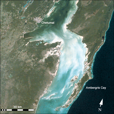
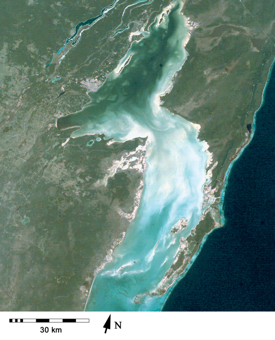
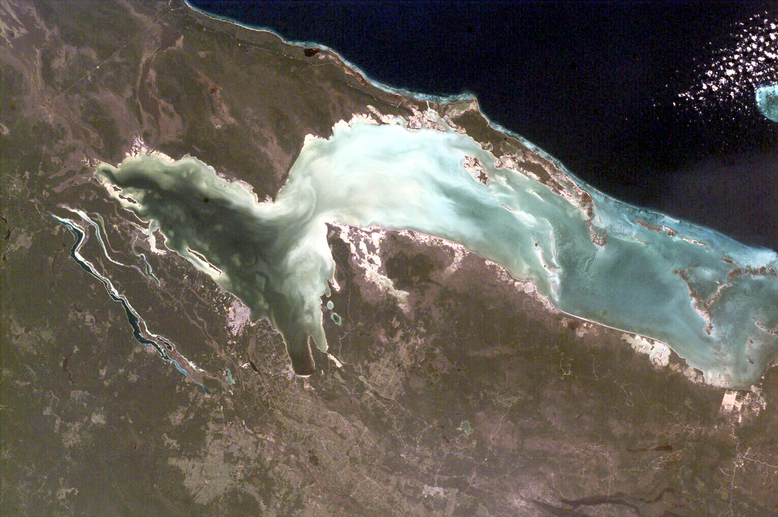
Image Caption: ISS001-E-5317 Chetumal Bay, Ambergris Cay
Chetumal Bay lies on the Border between Mexico and Belize. To the east of the bay, Ambergris Cay connects the Belize Barrier Reef to the Yucatan Peninsula. The north of the island is Bacalar Chico Marine Reserve. Here, the barrier reef comes very close to the east side of the island. In 1998, reefs in Belize were hit by two major events that led to heavy coral mortality: El Nino-related
coral bleaching and Hurricane Mitch.
Astronaut photographs of coral reefs are being used to provide perspective on coral reef geography, coastal development, and related land habitats. Numerous photographs taken by astronauts were included in the recently published World Atlas of Coral Reefs . Coral reef images acquired by astronauts can also be used as mapping data in more
detailed remote sensing applications.
Images of coral reef areas are being acquired by astronauts on Space Station Alpha as part of the Crew Earth Observations Project. Coral reefs are one of the areas selected as a scientific theme for this project (see also the recent Earth Observatory article, Mapping the Decline of Coral Reefs).
