ISS001-E-5117

| NASA Photo ID | ISS001-E-5117 |
| Focal Length | 400mm |
| Date taken | 2000.12.__ |
| Time taken | GMT |
Cloud masks available for this image:
Spacecraft nadir point:
Photo center point: 30.0° N, 95.5° W
Photo center point by machine learning:
Photo center point: 30.0° N, 95.5° W
Photo center point by machine learning:
Nadir to Photo Center:
Spacecraft Altitude: nautical miles (0km)
Country or Geographic Name: | USA-TEXAS |
Features: | GEORGE BUSH AIRPORT |
| Features Found Using Machine Learning: | PAN- |
Cloud Cover Percentage: | 10 (1-10)% |
Sun Elevation Angle: | ° |
Sun Azimuth: | ° |
Camera: | Kodak DCS460 Electronic Still Camera |
Focal Length: | 400mm |
Camera Tilt: | |
Format: | 3060E: 3060 x 2036 pixel CCD, RGBG array |
Film Exposure: | |
| Additional Information | |
| Width | Height | Annotated | Cropped | Purpose | Links |
|---|---|---|---|---|---|
| 3060 pixels | 2092 pixels | No | No | Download Image | |
| 640 pixels | 437 pixels | No | No | Download Image |
Download Packaged File
Download a Google Earth KML for this Image
View photo footprint information
Download a GeoTIFF for this photo
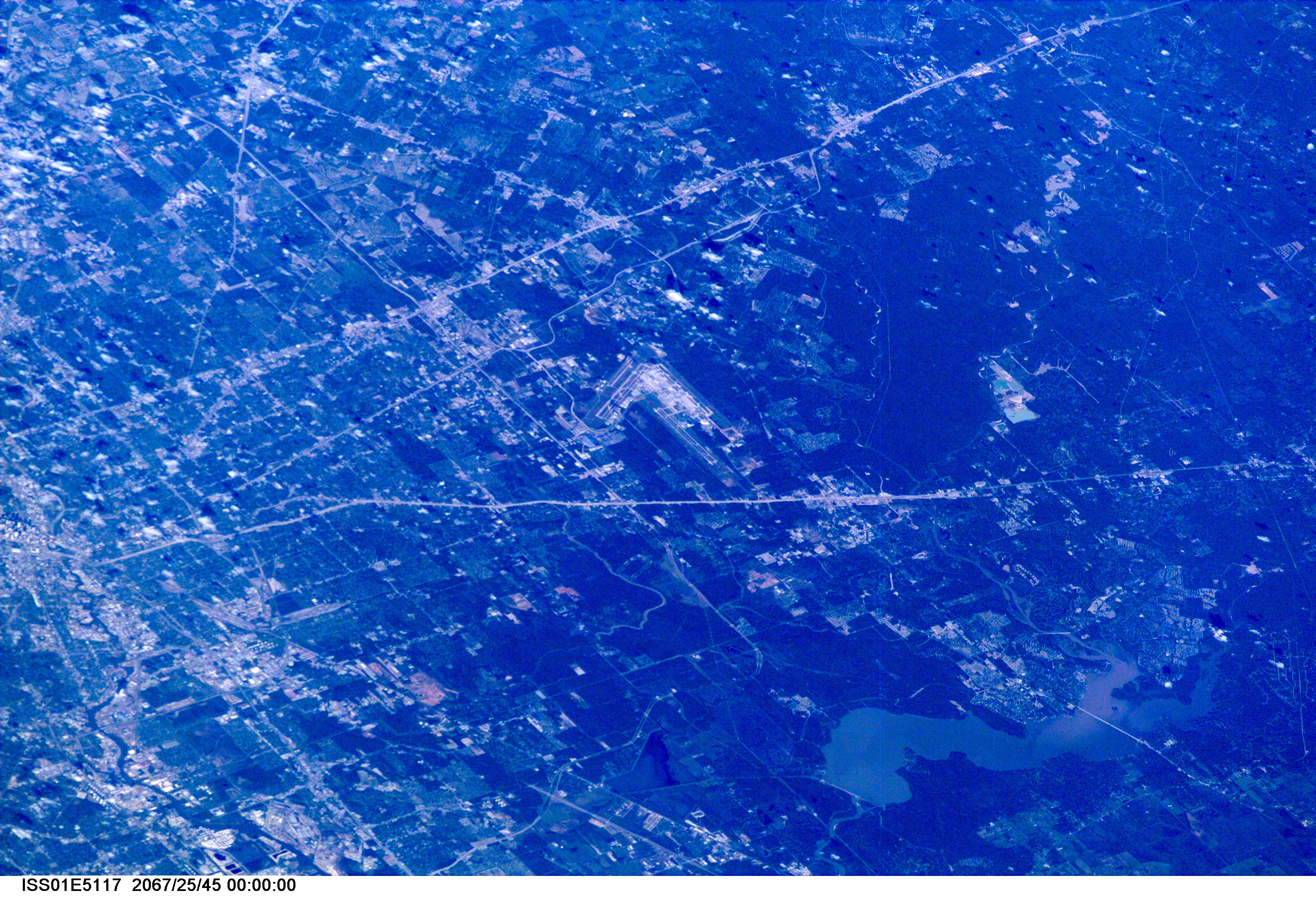
Image Caption: ISS01-E-5117 (December 2000) --- This westerly-looking view over north Harris County featuring Lake Houston and the Bush Intercontinental Airport was photographed with a digital still camera from the Earth-orbiting International Space Station (ISS). Parts of the 610 Loop, Interstate Highway 45, U.S. Highway 59 and the Sam Houston Toll Way can be easily delineated in the view. Part of the downtown area is just below center at left edge of the frame.
