ISS001-E-5078

| NASA Photo ID | ISS001-E-5078 |
| Focal Length | 400mm |
| Date taken | 2000.12.__ |
| Time taken | GMT |
Cloud masks available for this image:
Spacecraft nadir point:
Photo center point: 29.5° N, 95.0° W
Photo center point by machine learning:
Photo center point: 29.5° N, 95.0° W
Photo center point by machine learning:
Nadir to Photo Center:
Spacecraft Altitude: nautical miles (0km)
Country or Geographic Name: | USA-TEXAS |
Features: | HOUSTON, TEXAS CITY |
| Features Found Using Machine Learning: | PAN- |
Cloud Cover Percentage: | 10 (1-10)% |
Sun Elevation Angle: | ° |
Sun Azimuth: | ° |
Camera: | Kodak DCS460 Electronic Still Camera |
Focal Length: | 400mm |
Camera Tilt: | |
Format: | 3060E: 3060 x 2036 pixel CCD, RGBG array |
Film Exposure: | |
| Additional Information | |
| Width | Height | Annotated | Cropped | Purpose | Links |
|---|---|---|---|---|---|
| 3060 pixels | 2092 pixels | No | No | Download Image | |
| 640 pixels | 437 pixels | No | No | Download Image |
Download Packaged File
Download a Google Earth KML for this Image
View photo footprint information
Download a GeoTIFF for this photo
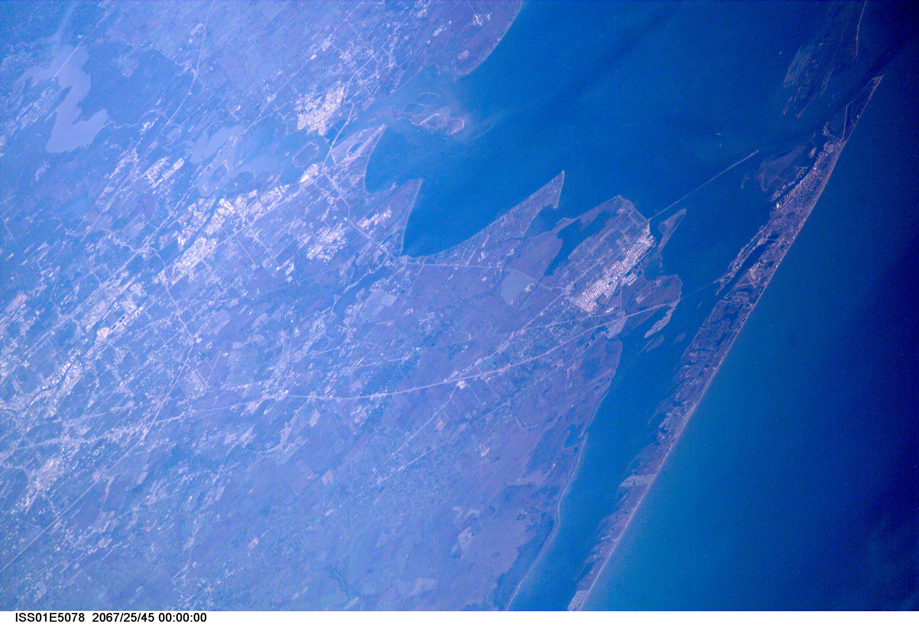
Image Caption: ISS01-E-5078 (December 2000) --- A northwesterly-looking view from over the Gulf of Mexico reveals much of Galveston and Harris Counties, as photographed with a digital still camera from the Earth-orbiting International Space Station (ISS). Galveston Island and Galveston Bay take up most of the right side of the frame, with parts of southern Harris County and even part of
north Harris County, including Lake Houston, are visible on the left side of the frame. The Texas City Dike is in the upper right quadrant of the image.
north Harris County, including Lake Houston, are visible on the left side of the frame. The Texas City Dike is in the upper right quadrant of the image.
