AST-27-2396
| NASA Photo ID | AST-27-2396 |
| Focal Length | 50mm |
| Date taken | 1975.07.__ |
| Time taken | GMT |
Cloud masks available for this image:
Spacecraft nadir point:
Photo center point:
Photo center point by machine learning:
Photo center point:
Photo center point by machine learning:
Nadir to Photo Center:
Spacecraft Altitude: nautical miles (0km)
Country or Geographic Name: | OCEAN |
Features: | CLOUDS |
| Features Found Using Machine Learning: | |
Cloud Cover Percentage: | 50 (26-50)% |
Sun Elevation Angle: | ° |
Sun Azimuth: | ° |
Camera: | Hasselblad |
Focal Length: | 50mm |
Camera Tilt: | Low Oblique |
Format: | QX807: SO368 film (fine-grain Ektachrome) with yellow dye layer equivalent to Wratten 2A |
Film Exposure: | Normal |
| Additional Information | |
| Width | Height | Annotated | Cropped | Purpose | Links |
|---|---|---|---|---|---|
| 5700 pixels | 5800 pixels | No | No | Download Image | |
| 500 pixels | 509 pixels | No | No | Download Image |
Download Packaged File
Download a Google Earth KML for this Image
View photo footprint information
Download a GeoTIFF for this photo
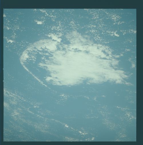
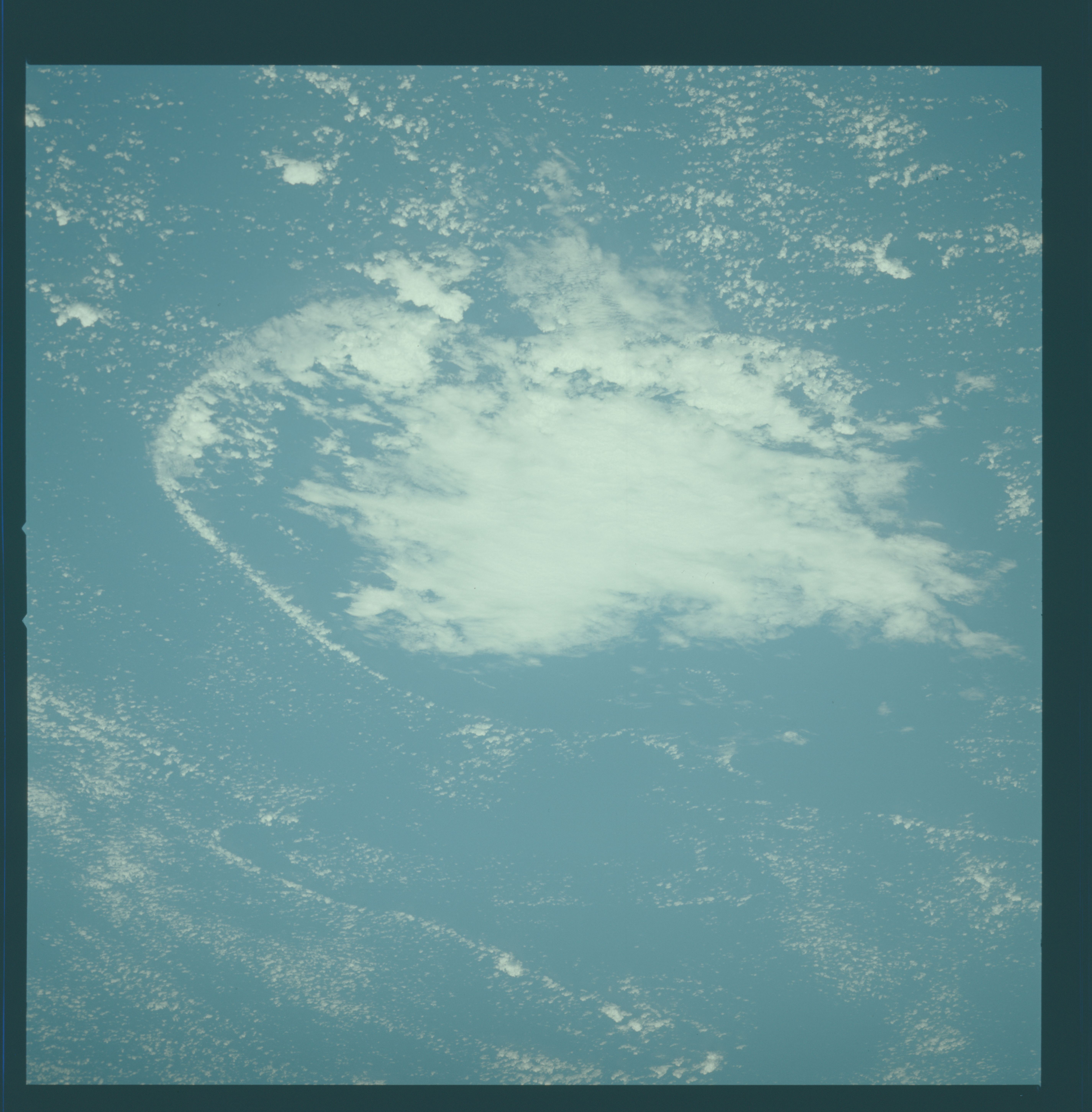
Image Caption: Thunderstorm and associated arc cloud
The deflated, disorganized shape of the major storm cloud and lack of convective activity indicates that the storm is dissipating. The dissipating phase is dominated by the downdraft of evaporatively cooled air sinking fast to the surface and then spreading horizontally outwards. The arc cloud is associated with the edge of the down draft. Here the cool air from the outflow is seen meeting the moist lower-level air, forcing the moist air to rise and thus renewing the cycle of convestion. The 50 mm lens allowed the entire storm structure to be captured on a single frame. (From Black, 1979.)
The deflated, disorganized shape of the major storm cloud and lack of convective activity indicates that the storm is dissipating. The dissipating phase is dominated by the downdraft of evaporatively cooled air sinking fast to the surface and then spreading horizontally outwards. The arc cloud is associated with the edge of the down draft. Here the cool air from the outflow is seen meeting the moist lower-level air, forcing the moist air to rise and thus renewing the cycle of convestion. The 50 mm lens allowed the entire storm structure to be captured on a single frame. (From Black, 1979.)
